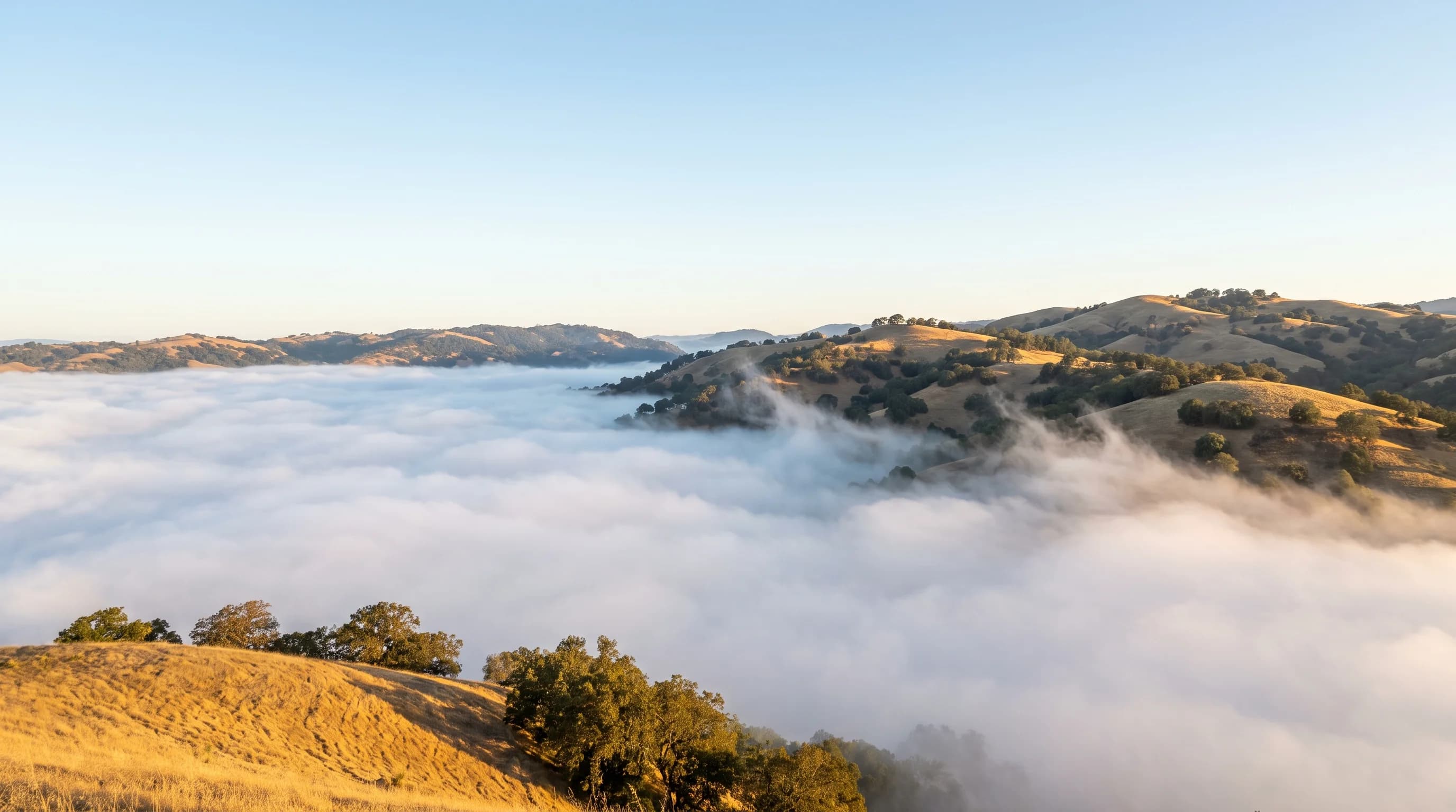
Fog is a cloud sitting on the ground. It forms when the air near the surface cools to its dew point, the temperature at which it can no longer hold all of its water vapor, or when enough moisture is added to reach the same point. The extra water condenses into droplets so small they float, and the droplets scatter light until you can no longer see down the street. Meteorologists call it fog once visibility drops below about 1 kilometer, roughly six-tenths of a mile. Thinner, lighter haze made of the same droplets is called mist.
So when you look outside and wonder why it is so foggy today, the real question is what cooled the air, or what added the moisture, overnight or over the last few hours. Most foggy days come down to a handful of setups, and once you know which one you are in, you can usually tell how long the fog will last. If you are in the San Francisco Bay Area, jump to today’s Bay Area fog.
The Most Common Reasons It’s Foggy Today
- Last night was clear and calm. With no clouds to hold heat in, the ground radiates its warmth to space, cools the air just above it to the dew point, and fog forms by dawn. This is the classic foggy morning.
- Moist air moved over something colder. Air that drifts across a cold ocean current, a cold lake, or snow-covered ground cools from below. Coastal fog that rolls in during the afternoon usually forms this way.
- It rained recently. Wet ground and puddles add moisture to the lowest layer of air. A rainy day followed by a clear, calm night is one of the most reliable fog setups anywhere.
- A temperature inversion is trapping the air. When warmer air sits on top of cooler air, the moisture near the ground has nowhere to go. Inversions can hold fog in place for hours or even days.
- The wind is light. A gentle breeze helps fog form and spread, but a strong wind mixes the moist surface air with drier air above and breaks it up.
The Main Types of Fog and When You’ll See Them
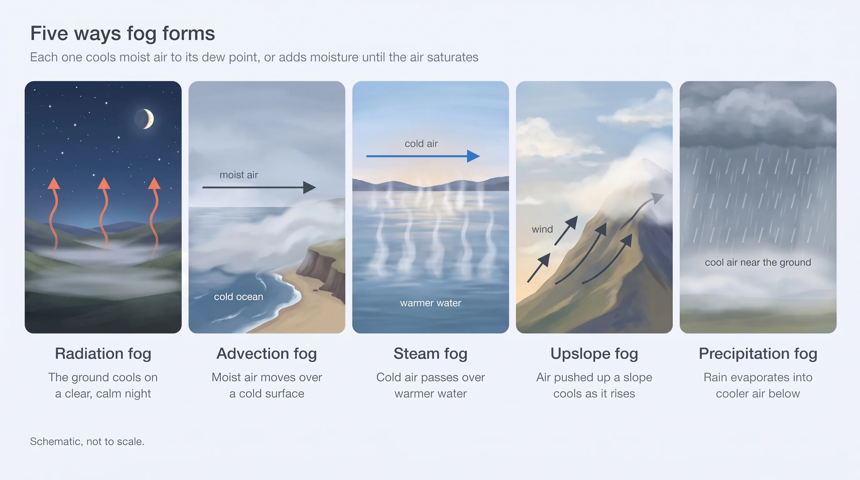
Fog looks the same from the sidewalk, but it forms in several different ways. The type tells you a lot about when it arrives and when it leaves.
| Type | How it forms | Where and when | How it ends |
|---|---|---|---|
| Radiation fog | The ground cools on a clear, calm night and chills the air above it | Valleys and low spots, fall and winter, thickest around sunrise | Usually burns off as the sun warms the ground |
| Advection fog | Moist air moves over a colder surface, such as a cold ocean | Coastlines, often rolling in by afternoon or evening | Can last all day; ends when the wind or air mass changes |
| Steam fog | Cold air passes over warmer water, which evaporates into it | Lakes, rivers, and bays on cold mornings | Fades as the air warms |
| Upslope fog | Moist air is pushed up a slope and cools as it rises | Hillsides and mountain foothills | Ends when the wind direction changes |
| Precipitation fog | Rain falling through cooler air adds moisture until it saturates | Around slow-moving rain and fronts | Clears when the rain moves on and drier air arrives |
Why Is It So Foggy This Morning?
Fog is most common around sunrise because that is when the air near the ground is coldest. All night, the ground has been losing heat, and the coolest, dampest air has been settling into low places. By dawn the air is as close to its dew point as it will get all day.
After sunrise, the sun heats the ground, the ground warms the air, and the droplets start to evaporate. Fog often lifts first into a low gray layer of cloud before it breaks up completely, which is why a foggy morning so often turns into a sunny afternoon. It doesn’t always work that way. Fog that is very thick, a weak winter sun, or a strong inversion overhead can keep it in place all day.
When Will the Fog Lift Today?
There is no single answer, but the type of fog gives you a good guess. Radiation fog on a clear morning usually thins by mid to late morning, once the sun has had a few hours to work, and sooner on a warm day. Thick winter fog in a valley can hang on into the afternoon, and under a strong, stubborn inversion it sometimes doesn’t clear at all. Coastal advection fog follows the wind rather than the sun: it can pull back offshore by late morning and return by evening, or sit over the coast all day.
The most useful thing to watch is the trend. If visibility is improving and the sky overhead is starting to brighten, the fog is thinning. If the wind is calm and the sky is still uniformly gray at midday, expect it to last.
Is It Fog, Mist, Smoke, or Haze?
Not everything that makes the air look thick is fog. Fog and mist are water droplets, so they feel cool and damp and leave surfaces wet; the difference is only how far you can see. Haze and wildfire smoke are dry particles. They make the sky look milky, yellow, or brown, they don’t feel damp, and smoke often smells. If it looks foggy but the air feels dry or smells of smoke, check the air quality before spending time outside. More on fog vs. mist, haze vs. fog, and reading the AQI.
Why Is It So Foggy in the Bay Area?
The San Francisco Bay Area gets two kinds of fog in two different seasons, and which one you are seeing depends on the month and on where you are standing.
Summer: The Marine Layer
From late spring through summer, Bay Area fog is advection fog from the marine layer. A cold ocean current runs along the coast, and the air over it is cool and saturated. When the inland valleys heat up, they pull that ocean air toward them, and the easiest path is through the gap at the Golden Gate. The result is the famous pattern of a gray coast and a sunny inland: Ocean Beach, the Sunset, and the Golden Gate under low cloud while Oakland, Walnut Creek, and San Jose are bright and warm. Fog season peaks in July, which is San Francisco’s foggiest month, and locals have nicknamed the whole phenomenon Karl the Fog.
Summer fog usually rolls in during the afternoon or evening, is thickest overnight, and pulls back late in the morning, first from the inland side and last from the coast. On the strongest days it never fully clears from the western neighborhoods. That is also why San Francisco is foggier than Oakland.
Winter: Valley and Tule Fog
From late fall through winter, the fog story moves inland. On clear, calm nights after a storm, radiation fog forms in the low places: the Central Valley, the Delta, and Bay Area valleys such as Livermore, Napa, and Petaluma. In the Central Valley it is called tule fog, and it can be dense enough to drop visibility to near zero on highways. Under a strong high-pressure system it can sit in the valley for days, held down by a temperature inversion, while the hills above are sunny.
When visibility is expected to drop to a quarter mile or less, the National Weather Service issues a dense fog advisory. Winter fog is mostly a morning problem, so commutes and early flights are the most affected. More on Central Valley fog and why Bay Area mornings are foggy.
Checking Bay Area Fog Today
Because the Bay Area’s fog changes so sharply over a few miles, a single city forecast can be misleading. The live Bay Area fog map and forecast shows where the marine layer is now, how far inland it will reach, when it is expected to lift in each city, and any dense fog advisories in effect.