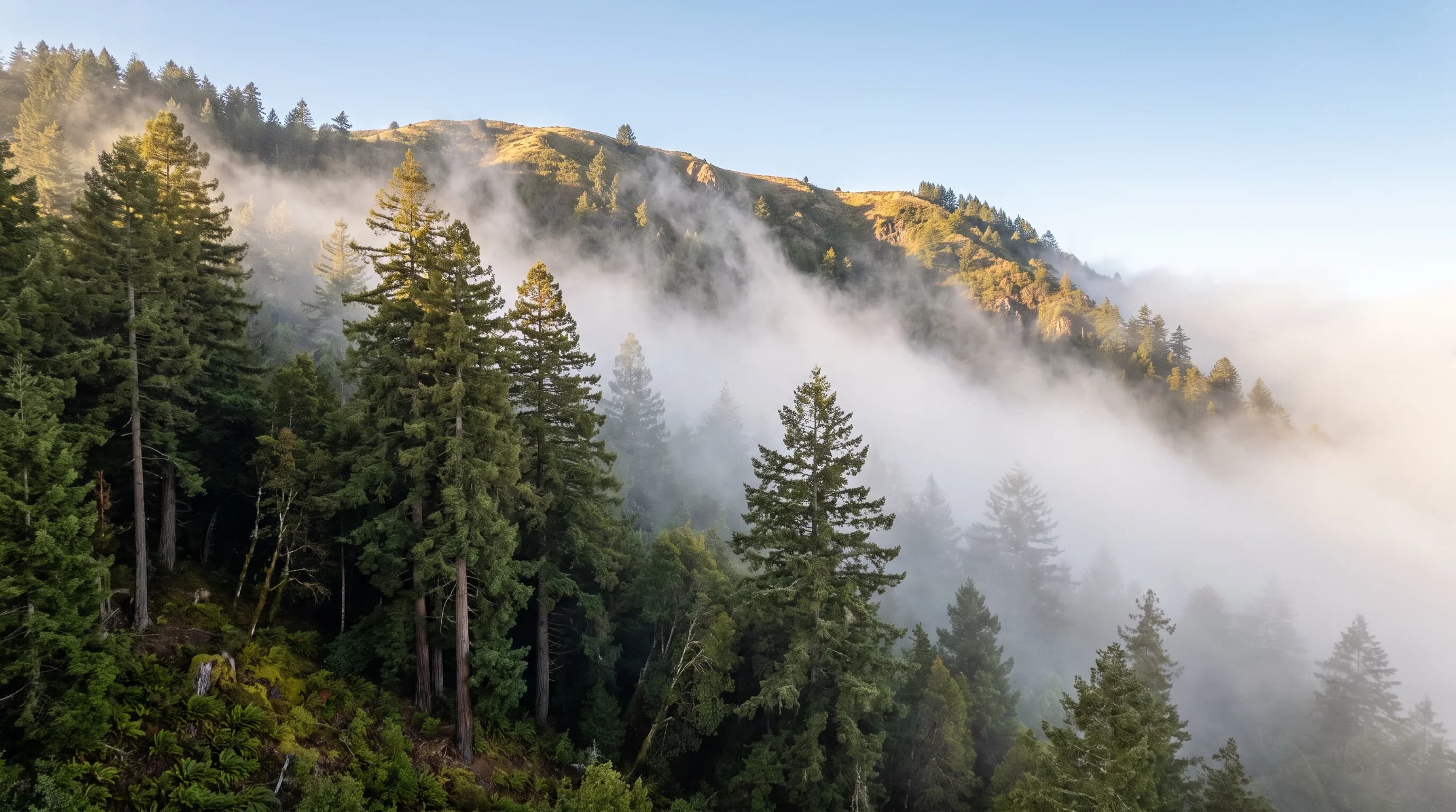
Upslope fog forms when moist, stable air is pushed up a slope and cools as it rises until it reaches its dew point. In the Bay Area, the onshore wind lifts marine air up the hills every summer: over one year of NOAA HRRR analysis, Oakland's Montclair hills logged 76% more fog hours than downtown Oakland.
That is why a street in the Oakland hills can sit in gray mist while downtown, a few miles away and 800 feet lower, stays sunny. The marine air covers both places. Only the hillside gets the fog, because only the hillside makes the air climb.
What Is Upslope Fog?
Upslope fog is fog made by terrain. The National Weather Service defines it as a fog that forms when moist, stable air is carried up a mountain slope. The everyday version is simpler: the wind pushes damp air uphill, the air cools on the way up, and the hillside ends up inside a cloud.
The rest of this page follows one idea. The same air sits over the flats and the hills, but the climb is what turns it into fog. Once you see that, you can predict which slopes will be socked in on a given day.
How Does Upslope Fog Form?
Upslope fog needs three things. First, wind has to push air toward rising ground, so the air has no choice but to climb. Second, the rising air expands and cools: unsaturated air cools about 5.5°F for every 1,000 feet it rises, according to the NWS. Third, the air has to be moist enough to reach its dew point on the way up, and stable enough that it stays in a layer instead of boiling up into showers.
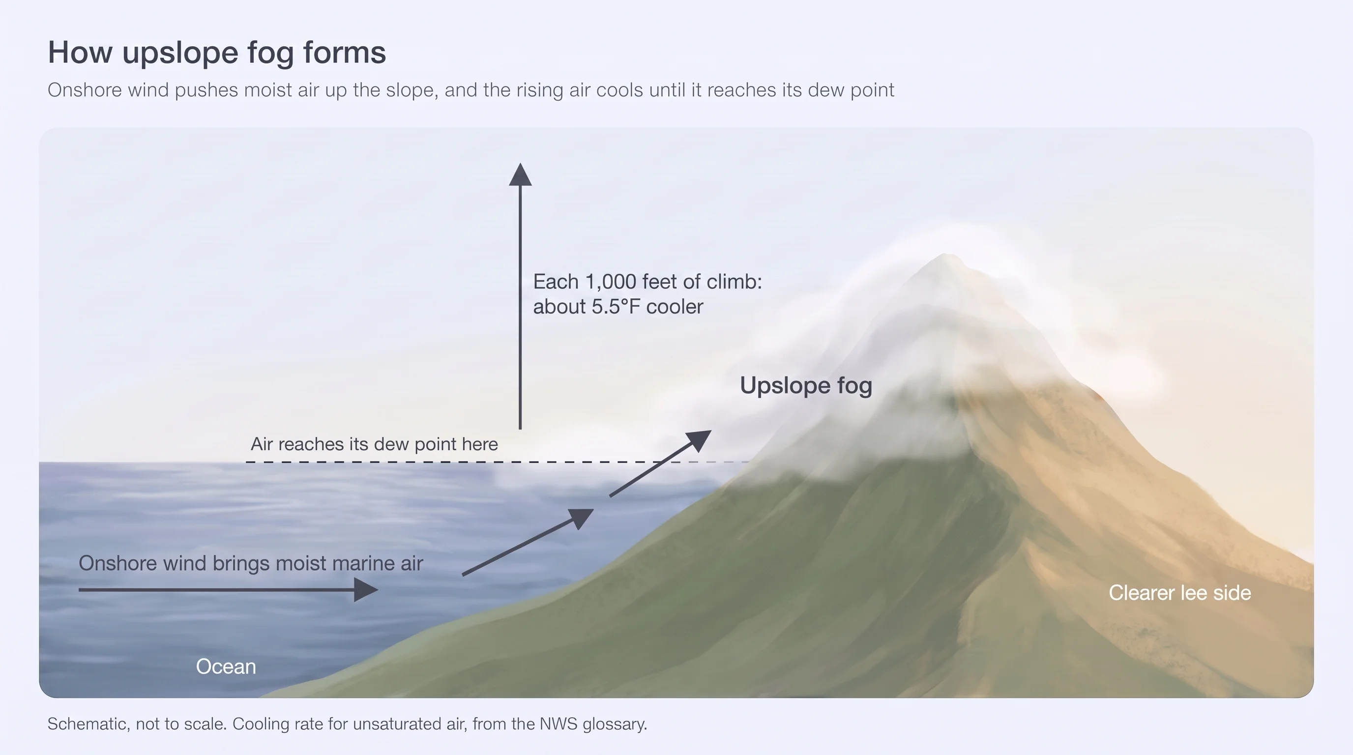
Upslope fog lasts as long as the wind keeps pushing. When the wind weakens, turns, or the air dries out, the fog stops forming and thins out. Unlike radiation fog, it does not need a clear night; it can form under cloudy skies and in the middle of the day.
In the Bay Area, the wind doing the pushing is the same onshore flow that brings the marine layer ashore, so the air arriving at the hills is already cool and nearly saturated. It doesn't have to climb far before it condenses.
Why Are the Bay Area Hills Foggier Than the Flats Below Them?
The Bay Area hills are foggier because they make marine air climb. In every area we checked, the hillside logged more fog hours than the flats below it: Oakland's Montclair hills about 76% more than downtown, Twin Peaks about 73% more than the Mission, and Skyline Ridge three times as many as Palo Alto.
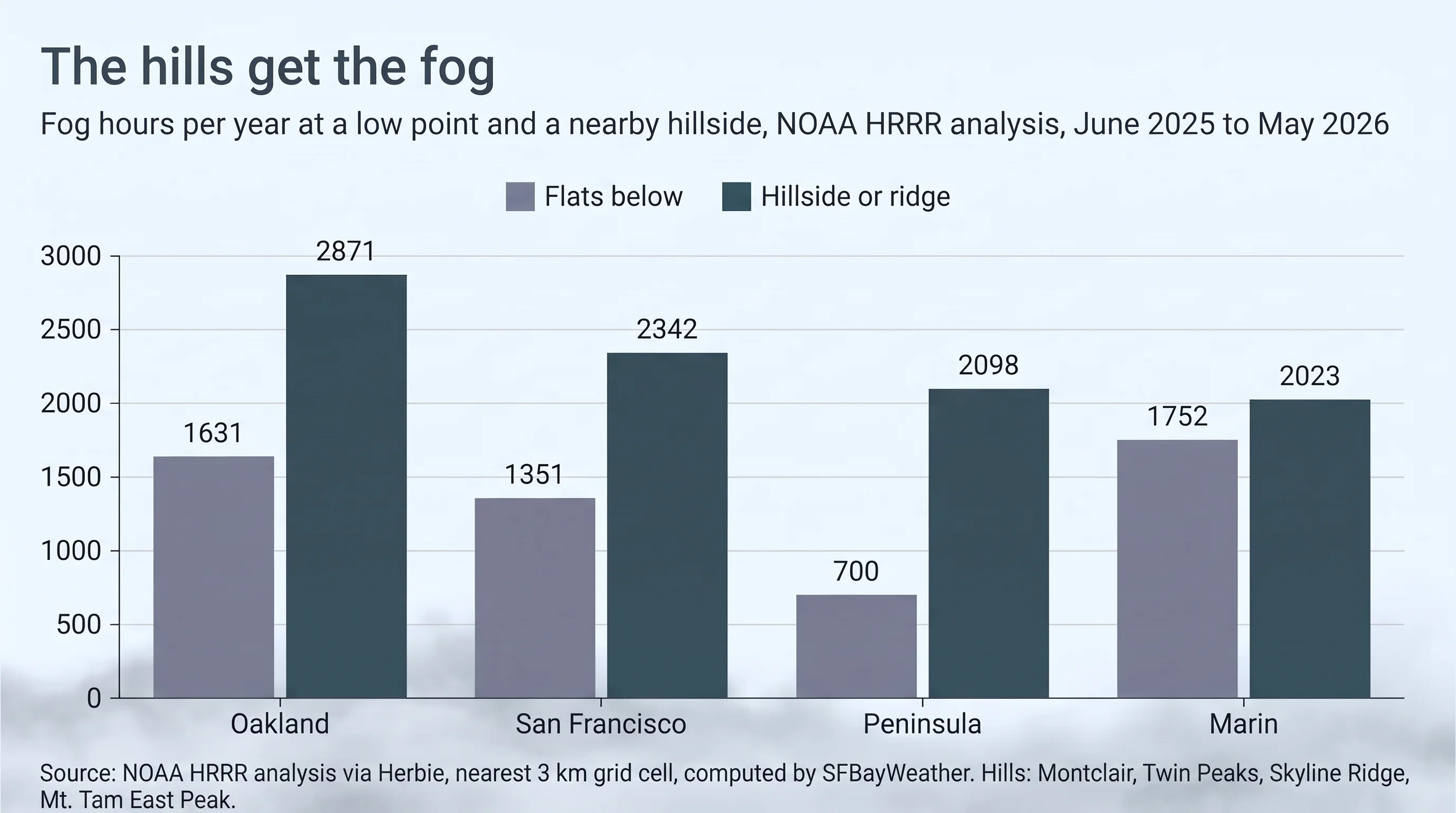
| Area | Flats | Fog hours | Hills | Fog hours | Coast |
|---|---|---|---|---|---|
| Oakland | Downtown, 42 ft | 1,631 | Montclair, 850 ft | 2,871 | n/a |
| San Francisco | Mission, 49 ft | 1,351 | Twin Peaks, 922 ft | 2,342 | 3,108 (Outer Sunset) |
| Peninsula | Palo Alto, 30 ft | 700 | Skyline Ridge, 2,300 ft | 2,098 | 3,373 (Half Moon Bay) |
| Marin | Mill Valley, 52 ft | 1,752 | Mt. Tam East Peak, 2,571 ft | 2,023 | 2,622 (Stinson Beach) |
The pattern runs in a clear order. The coast is foggiest because that is where the marine air comes ashore. The windward hills come next because they lift that air. The sheltered flats behind the hills are clearest. That is also part of why San Francisco is foggier than Oakland.
Not every extra hour on the hills is pure upslope fog. Some of it is a low cloud deck whose base already sits below the hilltops, so the hills simply poke into it. On the windward side, the lifting lowers that base further, and in practice the two work together.
Where Does Upslope Fog Hit Hardest in the Bay Area?
Upslope fog hits hardest on slopes that face the onshore wind. In the Bay Area, that means the Oakland and Berkeley hills, which face the Golden Gate across the bay; Twin Peaks and Mount Sutro in San Francisco; San Bruno Mountain above Daly City; the Santa Cruz Mountains along Skyline Boulevard; and the west face of Mount Tamalpais.
The other side of each ridge tells the rest of the story. Valleys and slopes in the lee, such as Orinda behind the Oakland hills, Woodside below Skyline, and the canyons of Mill Valley, often stay clearer, because the air sinks and warms as it comes down the far side.
When Does Climbing Get You Above the Fog?
Climbing gets you above the fog when a ridge rises higher than the top of the marine layer. The summit then sits in sunshine while the slopes below are socked in. That is why Mount Tamalpais's East Peak, at 2,571 feet, logged fewer fog hours than Stinson Beach at the foot of the mountain.
How high you need to go depends on how deep the marine layer is that day. For the heights that usually rise above it, and where to find them, see how elevation affects Bay Area fog.
Driving, Hiking and Flying in Upslope Fog
On the road, upslope fog can drop visibility to near zero within minutes on an onshore afternoon, especially on Skyline Boulevard, Grizzly Peak Boulevard and the roads over the coast ranges. Slow down, use low beams, and read driving in Bay Area fog before a foggy commute.
On the trail, ridge hikes can go from sun to cold, wind-driven fog quickly, and trails under redwoods stay wet from fog drip. Carry a windproof layer even on a warm inland day. For pilots, upslope fog is a classic hazard because it can hide rising terrain and hangs on as long as the upslope wind keeps blowing.
The thread through all of it is the wind. Watch which way it is blowing, not just the sky overhead: if it is pushing ocean air toward a slope, that slope will get the fog first.
Before heading up Skyline or Grizzly Peak on an onshore day, check the Bay Area fog map to see how far inland the marine layer reaches and how high it sits, and the Mount Tamalpais forecast to see whether the summit is above it. For the same lifting process in winter storms, see Bay Area orographic rain.