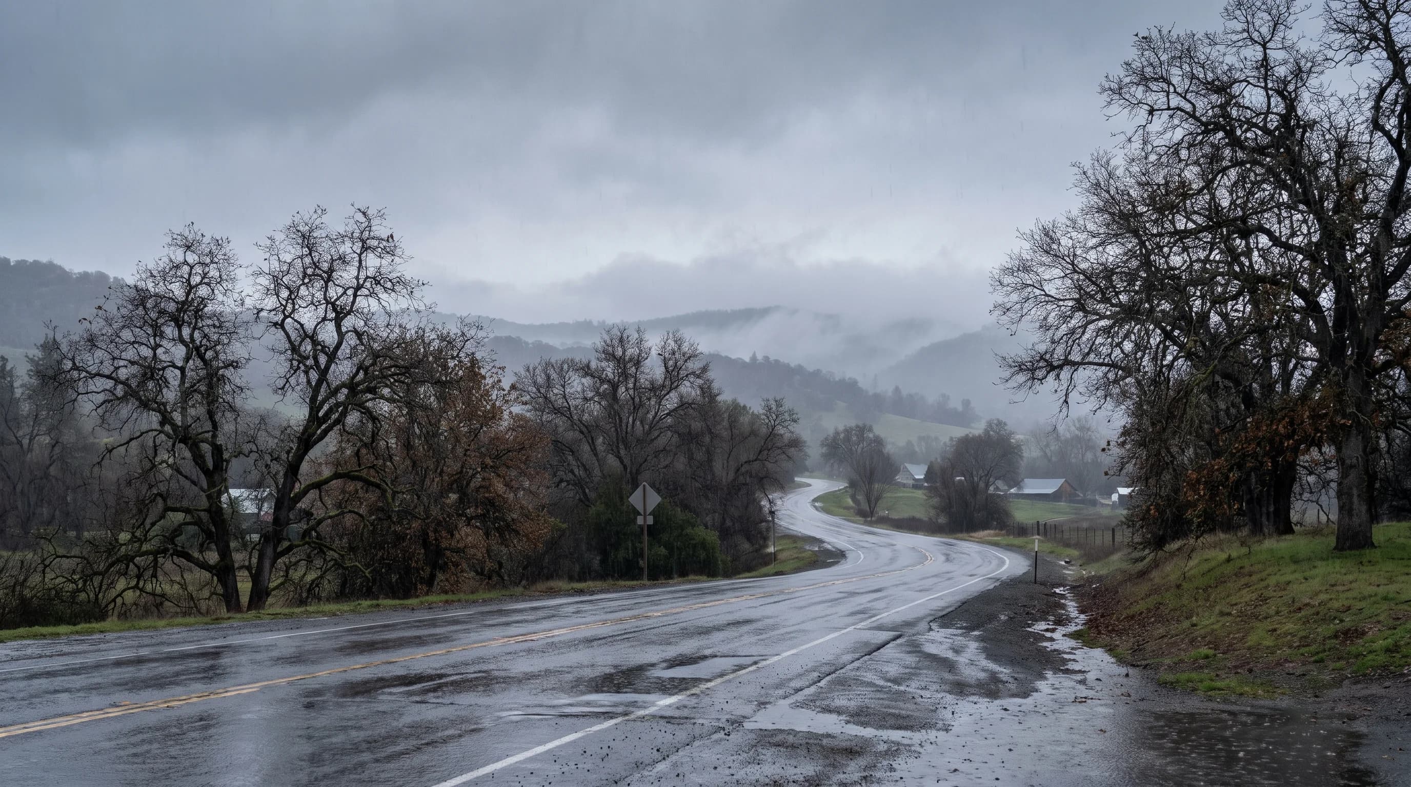
Precipitation fog forms when relatively warm rain falls through cooler air near the ground and evaporates into it until that air is saturated, most often ahead of a warm front. In the Bay Area it is rare: airports report fog in under 1% of rainy hours, 2015 to 2025. Rain mostly brings mist; dense fog comes after the storm.
That runs against intuition. Rain adds water to the air, so you might expect every rainy day to be a foggy one. Ten years of hourly airport reports say otherwise. Here, rain and fog mostly take turns.
What Is Precipitation Fog?
Precipitation fog is fog made by rain. Rain falling from warmer air above evaporates into the cooler air near the ground, adds moisture to it, and keeps adding until that layer can't hold any more. The extra water condenses into tiny droplets that hang in the air, and the layer becomes fog.
You will also see it called frontal fog or precipitation-induced fog, because it usually forms along a weather front. Whatever the name, the key is that the rain itself supplies the moisture. Ordinary fog on a clear night forms the other way around: the air cools down to meet the moisture already in it.
How Does Rain Create Fog?
The classic setup is a warm front. Warm, moist air slides up and over a wedge of cooler air that is sitting at the ground. Clouds form in the rising warm air and rain falls out of them, down through the cool layer below.
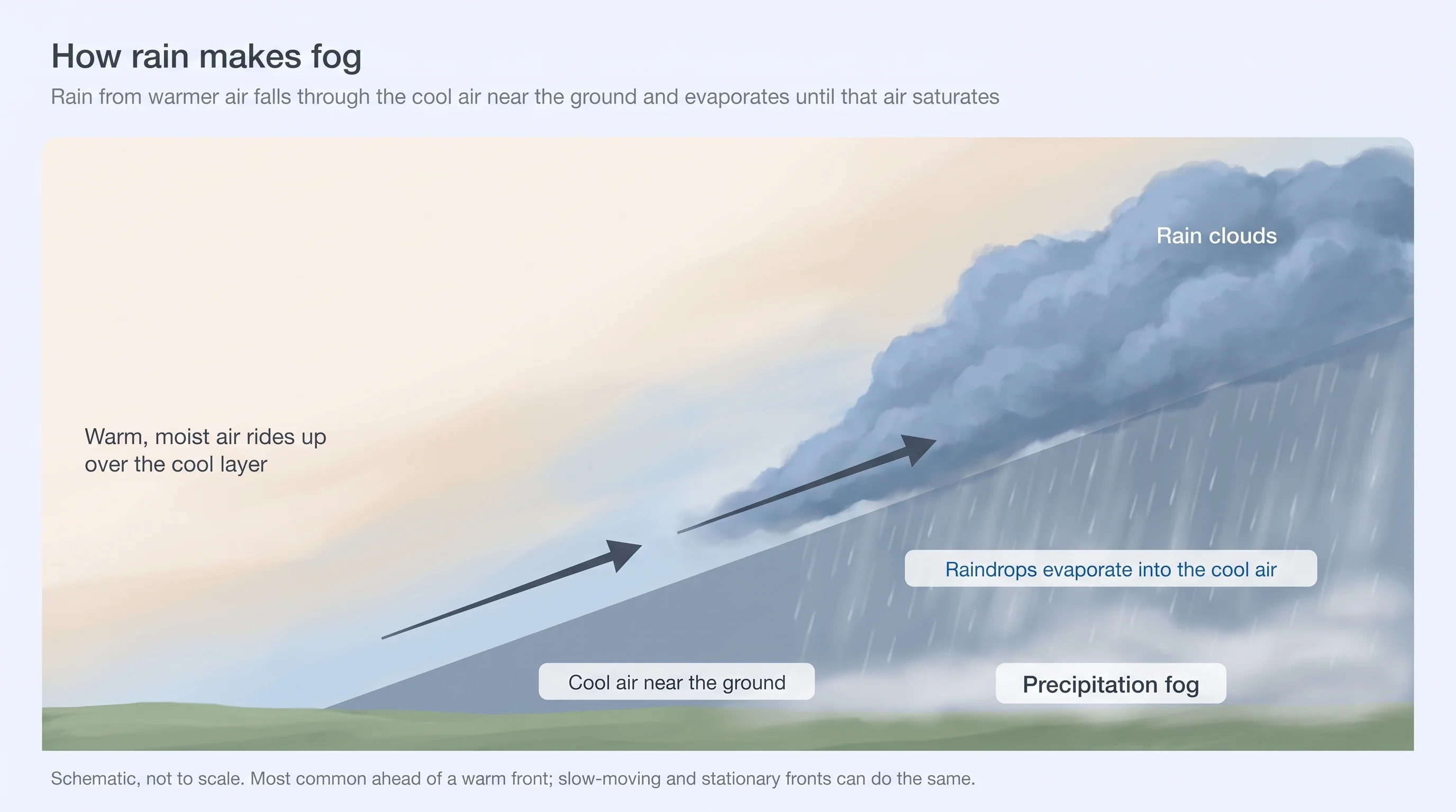
As the drops fall, some of their water evaporates into the cool air. That raises the cool layer's dew point, the temperature at which it would be saturated. If the rain keeps coming and the dew point climbs all the way up to the air temperature, the cool layer saturates and fog forms at the surface, often under a low, gray ceiling.
Two conditions make this work. The rain has to be warmer than the air it falls through, so it gives off moisture instead of taking it in. And the cool layer has to be close to saturated already, or the rain can't finish the job. Slow-moving cold fronts and stalled fronts can produce it too, but warm fronts are the usual cause.
Is Fog a Type of Precipitation?
No. Fog is not precipitation. Precipitation is water that falls to the ground, such as rain, drizzle, snow or hail. Fog droplets are so small they stay suspended in the air instead of falling. The National Weather Service describes fog as water droplets suspended in the air at the Earth's surface: in other words, a cloud at ground level.
Fog can still leave water behind. When fog blows through trees, droplets collect on needles and leaves and drip to the ground. In the coast ranges, that fog drip adds real moisture during the dry season, which you can read more about in Bay Area orographic rain. It just isn't counted as precipitation.
Why Does Bay Area Rain Bring Mist Instead of Fog?
Bay Area rain usually brings mist and low clouds, not dense fog. Across ten years of hourly reports, fog appeared in under 1% of rainy hours at five of six airports we checked. Mist was far more common: it was reported in about a third of rainy hours at SFO and Oakland, and in about 62% of them at Santa Rosa.
| Station | Rainy hours with fog | Rainy hours under 3 mi visibility | Rainy hours with mist | Fog hours within 48 h after rain |
|---|---|---|---|---|
| San Francisco (SFO) | 0.0% | 11.7% | 31.6% | 20.6% |
| Oakland (OAK) | 0.3% | 12.5% | 38.0% | 29.2% |
| San Jose (SJC) | 0.0% | 5.5% | 25.7% | 21.4% |
| Santa Rosa (STS) | 0.4% | 29.0% | 61.9% | 35.7% |
| Livermore (LVK) | 0.1% | 12.5% | 35.4% | 44.6% |
| Half Moon Bay (HAF) | 2.2% | 54.1% | 20.8% | 21.1% |
The likely reason is how our storms arrive. Bay Area storms usually come in with a good deal of wind, which keeps stirring the lowest air and makes it hard for a saturated layer to settle at the ground. The rain also often isn't much warmer than the air near the surface, so it moistens that air without pushing it all the way to saturation. The result is mist, spray and a low cloud deck rather than a wall of fog. For how the two differ, see fog vs. mist.
Half Moon Bay is the coastal exception. There, rain often arrives with marine cloud already sitting on the coast, and the two combine. More than half of its rainy hours had visibility under 3 miles. These are airport readings, so they describe the flats. On the hills, where the clouds touch the ground, fog in rain is more common; that is upslope fog, not rain-made fog.
Why Does Fog Often Follow a Storm?
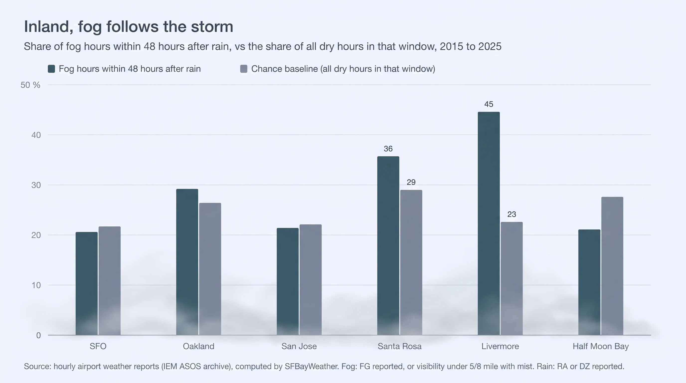
The dense fog doesn't skip the storm. It waits until the storm has passed. At Livermore, 45% of all fog hours came within 48 hours after rain, about twice the share of time that falls in that window. Santa Rosa and Oakland showed smaller boosts. The coastal airports showed none.
Here is the sequence. The storm soaks the ground and leaves the air near it moist. Then the front moves on, the sky clears and the wind drops. On that first clear, calm night, the wet ground loses heat quickly, the air above it cools to its dew point, and fog forms in the low spots. That is radiation fog, and in the Central Valley and the Delta, it can spread into long-lasting tule fog.
The coast doesn't get the same boost because its fog is mostly marine fog, which depends on the ocean and the wind more than on a recent storm. Inland valleys like Livermore and Santa Rosa are where the after-the-storm fog shows up most.
Driving and Flying Through Winter Storms and the Fog After
During the rain, expect mist, road spray and a low ceiling rather than dense fog. At SFO, Oakland and Livermore, visibility dropped below 3 miles in about one of every eight rainy hours, and far more often at Santa Rosa and Half Moon Bay. Use low beams, leave extra room, and slow down for spray from trucks on the freeways.
After the rain, watch the first clear, calm morning, especially in the inland valleys: Livermore and the Altamont on Highway 580, the 680 corridor, the Delta and Santa Rosa. That is when dense fog is most likely, and when the National Weather Service may issue a dense fog advisory for visibility of a quarter mile or less. For pilots, rain-made fog and the post-storm valley fog both bring low ceilings and poor visibility on approaches. Our guide to driving in Bay Area fog covers what to do once you are in it.
So think of it this way: the rain is the warning, and the clear night after is the fog. After a storm passes, check the Bay Area fog forecast for fog in the inland valleys and any active dense fog advisories, along with the Livermore forecast. Before an early commute over the Altamont or through the Delta, check Caltrans QuickMap for road conditions.