
Fremont sits at the southeastern edge of San Francisco Bay, positioned between the East Bay hills to the west and the Diablo Range foothills to the east. This location gives it a climate that splits the difference between the cool, foggy coast and the hot inland valleys. Average highs reach 82°F in summer and drop to 58°F in winter, with about 15 inches of rain per year. Fremont is warmer than San Francisco, cooler than Livermore, and drier than Oakland. It is one of the Bay Area's more moderate climates, which is partly why it grew from a small agricultural community to a city of 230,000.
What Is Fremont's Summer Weather Like?
Fremont summers are warm and dry, with average highs of 78-82°F from June through September. Occasional heat waves push temperatures above 95°F, sometimes reaching 100°F+ during the strongest events, but these typically last only two to four days before the Delta Breeze or marine influence brings relief. The marine layer occasionally pushes through the Hayward Pass and along the bay shoreline, bringing morning clouds that burn off by noon. Most summer days are sunny with low humidity and light afternoon breezes.
The warmest part of Fremont is the eastern side, toward Mission Peak and the Warm Springs district, where elevation and distance from the bay reduce any marine cooling effect. The western neighborhoods closer to the bay, including the area near the Fremont BART station, benefit from bay breezes and tend to run 3-5°F cooler on hot afternoons. This east-west temperature gradient is a smaller-scale version of the coastal-inland divide that defines the entire Bay Area.
What Is Fremont's Winter and Rainy Season Like?
Winter in Fremont is mild and moderately wet, with average highs of 58-62°F and lows of 42-45°F from December through February. Frost is uncommon but not unheard of in the lowest-lying areas near the bay marshes. Fremont averages about 15 inches of rain per year, nearly all falling between November and March. This is less than Oakland (24 inches) and far less than the hills above Berkeley (30+ inches), because Fremont sits in a partial rain shadow of the East Bay hills.

The flooding risk in Fremont is concentrated along Alameda Creek, the largest watershed in the southern East Bay. During heavy atmospheric river events, Alameda Creek can rise rapidly, and the neighborhoods near Niles Canyon and the creek's lower reaches have a history of flood events. The 2023 atmospheric river sequence brought localized flooding to parts of Fremont, particularly near the Quarry Lakes area.
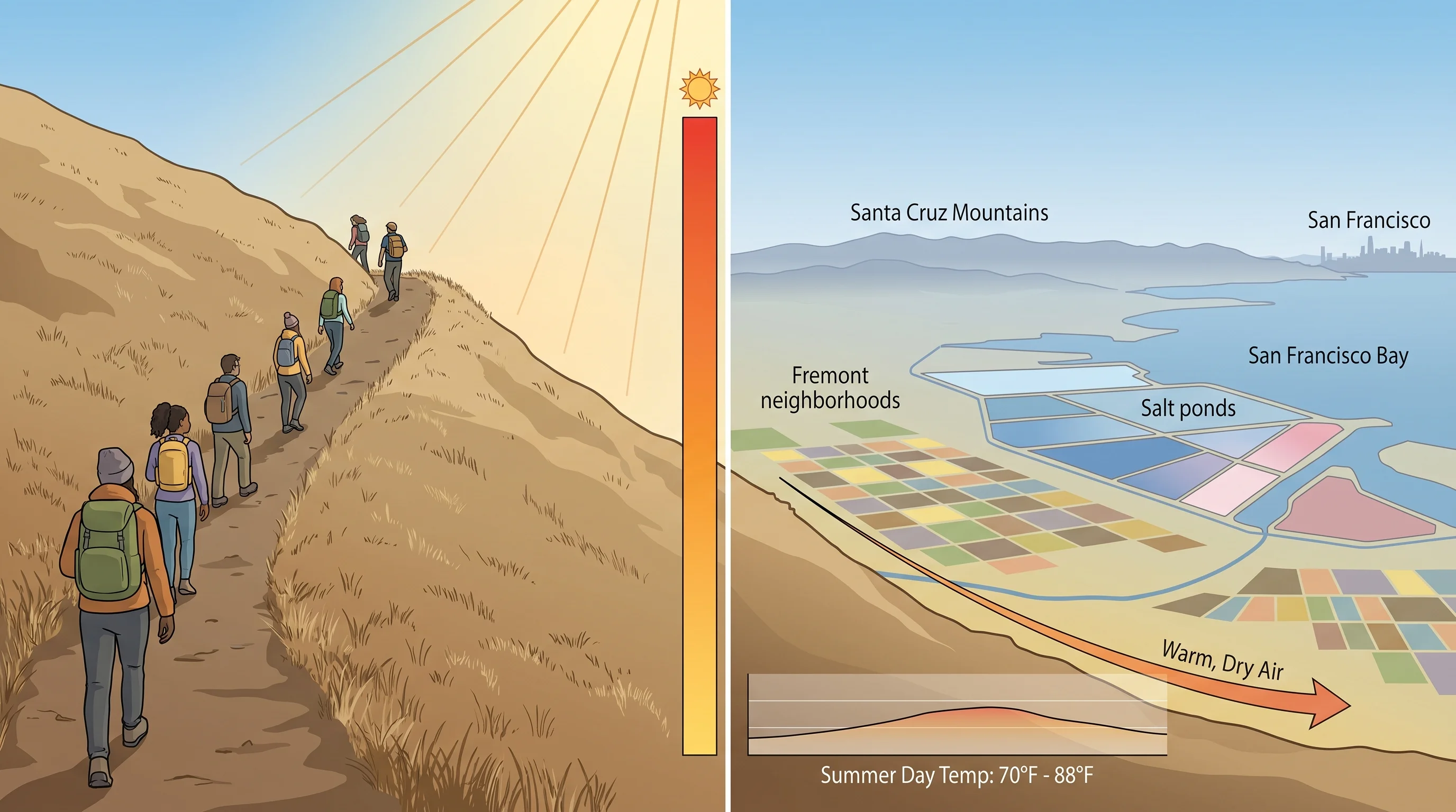
How Does Mission Peak Weather Differ from the Valley Floor?
Mission Peak (2,517 feet) is Fremont's most prominent geographic feature and one of the most popular hiking destinations in the Bay Area. The summit is typically 10-15°F cooler than the valley floor and significantly windier, with gusts exceeding 30 mph on many days. In summer, the peak can be comfortable when the valley is sweltering. In winter, it can be genuinely cold and wind-blasted while the city below is mild.
The best months for hiking Mission Peak are March through May (green hills, wildflowers, moderate temperatures) and October through November (clear views, comfortable warmth). Summer hikes should start before 8:00 AM to avoid heat, as the exposed trail offers no shade and valley-floor temperatures can exceed 90°F by noon. The fog pole at the summit provides clear-day panoramic views from Mount Diablo to the Santa Cruz Mountains, but the summit is socked in by low clouds roughly 20-30% of summer mornings.
How Does Fremont Compare to Nearby Cities?
Fremont is warmer than Union City and Hayward to the north, which sit closer to the bay and receive more marine influence. It is cooler than Livermore to the east, which sits behind the hills in a true inland climate with summer highs regularly exceeding 95°F. Fremont is comparable to San Jose in rainfall (both around 15 inches) and summer temperatures, though San Jose runs 2-3°F warmer on average because of its position deeper in the South Bay valley.
Fremont's climate is one of its underappreciated advantages. It avoids San Francisco's fog, Livermore's extreme heat, and Oakland's higher rainfall. The trade-off is that it lacks the dramatic coastal scenery and cooler summer temperatures that draw people to the west side of the hills. For day-to-day livability, though, Fremont's moderate climate, with warm but not extreme summers, mild winters, and modest rainfall, ranks among the most comfortable in the Bay Area.