A fire weather warning is an urgent alert issued by the National Weather Service (NWS) when weather conditions are capable of producing extreme wildfire behavior. In the Bay Area, these warnings are issued by the NWS San Francisco Bay Area forecast office (WFO MTR) when a specific combination of low relative humidity, strong winds, dry fuels, and warm temperatures aligns to create conditions where any ignition can become a fast-moving, uncontrollable wildfire within hours. The most common form of fire weather warning in the Bay Area is the Red Flag Warning, but the NWS uses a tiered system of alerts with distinct thresholds that are worth understanding clearly.
What Are the Fire Weather Alert Tiers?
The NWS organizes fire weather alerts into three escalating tiers, each reflecting increasing certainty and severity. The lowest tier is the Fire Weather Watch, which signals that conditions favorable for extreme fire behavior are possible in the next 12 to 72 hours. A Fire Weather Watch is a planning tool: it tells fire agencies, land managers, and the public to begin preparing for the possibility of dangerous fire weather.
The next tier is the Red Flag Warning, which means critical fire weather conditions are either imminent or already occurring. In the Bay Area, a Red Flag Warning is typically issued when sustained winds reach 25 mph or gusts exceed 35 mph, relative humidity drops below 15%, and fuel moisture levels are critically low. These are the conditions that produced the 2017 Tubbs Fire in Santa Rosa and the 2019 Kincade Fire in Sonoma County. The warning means conditions are confirmed, not speculative.
Above these formal NWS alerts, there is the rarely invoked Extreme Fire Weather condition, sometimes referenced in forecaster discussions when an event is expected to be particularly catastrophic. This is not a separate product but a qualifier that tells fire agencies the upcoming event could rival the worst in the historical record.
What Thresholds Trigger a Fire Weather Warning?
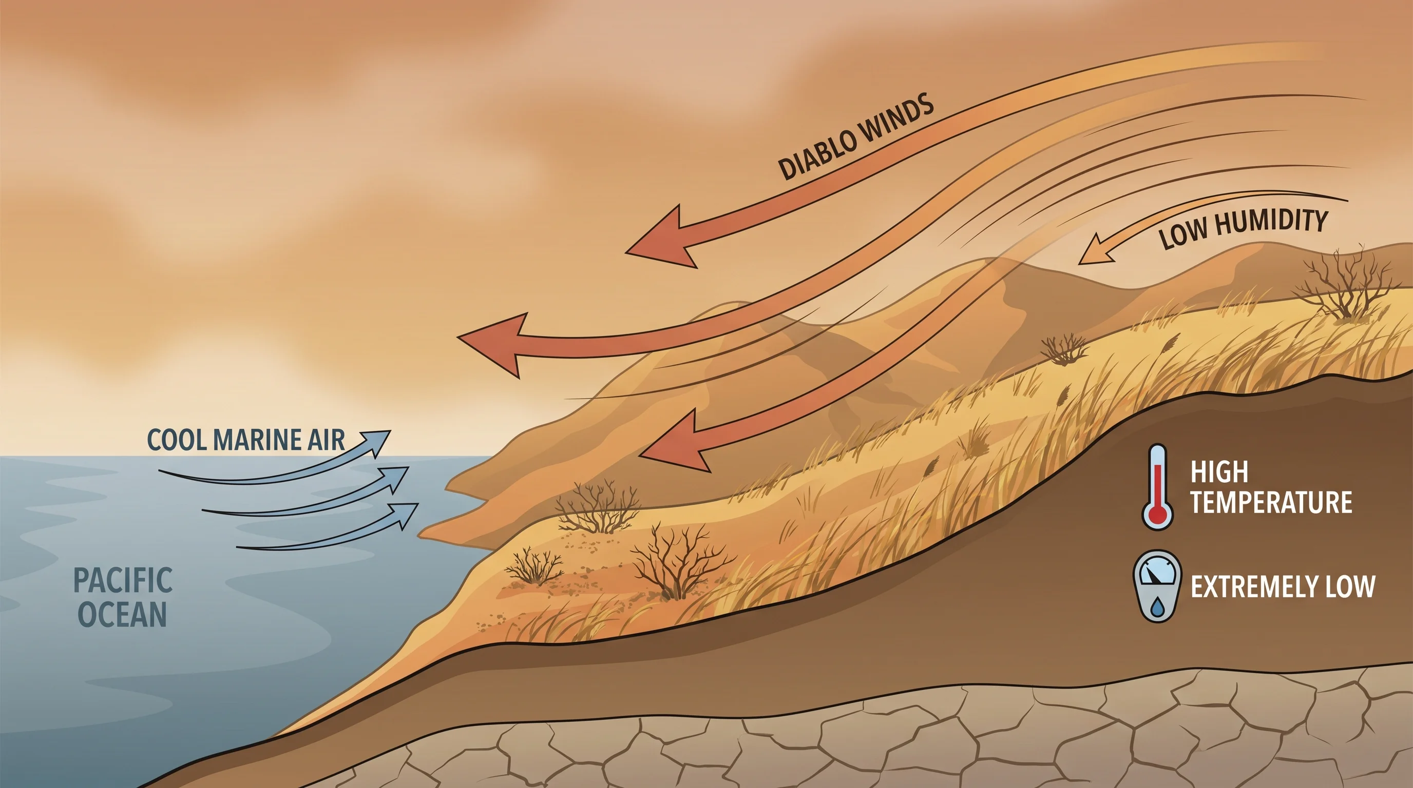
The NWS does not use a single national formula for fire weather warnings. Thresholds are calibrated to each region's fire climatology, which means the specific numbers for the Bay Area reflect local fuels, terrain, and wind patterns. For the San Francisco Bay Area forecast office, the standard Red Flag Warning criteria require at least two of the following conditions to be met simultaneously: sustained winds of 25 mph or greater (or gusts of 35 mph or more), relative humidity at or below 15%, and critically dry fuel moisture content. In practice, these conditions almost always occur together during Diablo wind events, when offshore flow compresses and warms air as it descends through East Bay and North Bay canyons.
Relative humidity is one of the most important variables in fire weather forecasting. In the Bay Area's normal summer pattern, coastal areas like San Francisco might maintain 50-80% relative humidity, while inland valleys like Concord and Napa might sit at 20-40%. During a Diablo wind event, humidity across the entire region can crash to 5-10%, including in areas that are normally maritime and moist. At 10% relative humidity, dead vegetation can lose its remaining moisture within hours, and any spark from a downed power line, an exhaust pipe, or a cigarette can ignite dry grass that carries fire into brush and timber.
Wind speed matters because it drives fire spread rate and intensity. A wildfire burning in grass with 5 mph winds might advance at 2-3 mph and be containable. The same fire with 40 mph gusts, which Diablo wind events regularly produce in the hills above Oakland and Berkeley, can advance at 10-15 mph, throwing embers a mile ahead of the main fire front. This is how the 1991 Oakland-Berkeley Hills Fire destroyed nearly 3,000 structures in a single afternoon.
How Is a Fire Weather Watch Different From a Red Flag Warning?
The distinction between a Fire Weather Watch and a Red Flag Warning is entirely about timing and certainty. A Fire Weather Watch is a heads-up issued 12 to 72 hours in advance, when forecasters see a developing weather pattern that could meet Red Flag criteria. Watches give fire agencies time to pre-position resources, staff additional lookout towers, and prepare public notifications. For Bay Area residents in fire-prone areas like the East Bay hills, the Santa Rosa corridor, or the slopes above Napa Valley, a Fire Weather Watch is the signal to review evacuation routes, charge phones, and ensure go bags are ready.
A Red Flag Warning replaces the Watch when forecasters have high confidence that critical thresholds will be met or are already being met. At this point, the advisory becomes operational: utilities like PG&E may initiate Public Safety Power Shutoffs (PSPS) to reduce ignition risk from power lines, Cal Fire increases staffing to maximum levels, and local fire agencies begin activating emergency operations centers. The Bay Area has experienced multiple PSPS events during October Red Flag Warnings since PG&E began the program in 2019, affecting hundreds of thousands of customers in elevated terrain.
In the Bay Area, most Fire Weather Watches are upgraded to Red Flag Warnings as the event approaches and forecast confidence increases. But not every Watch becomes a Warning. Sometimes the anticipated wind event weakens, humidity recovers faster than expected, or the critical combination of factors does not fully materialize. This is why the two-tier system exists: it balances the need for early warning with the cost of false alarms.
When Are Fire Weather Warnings Most Common in the Bay Area?
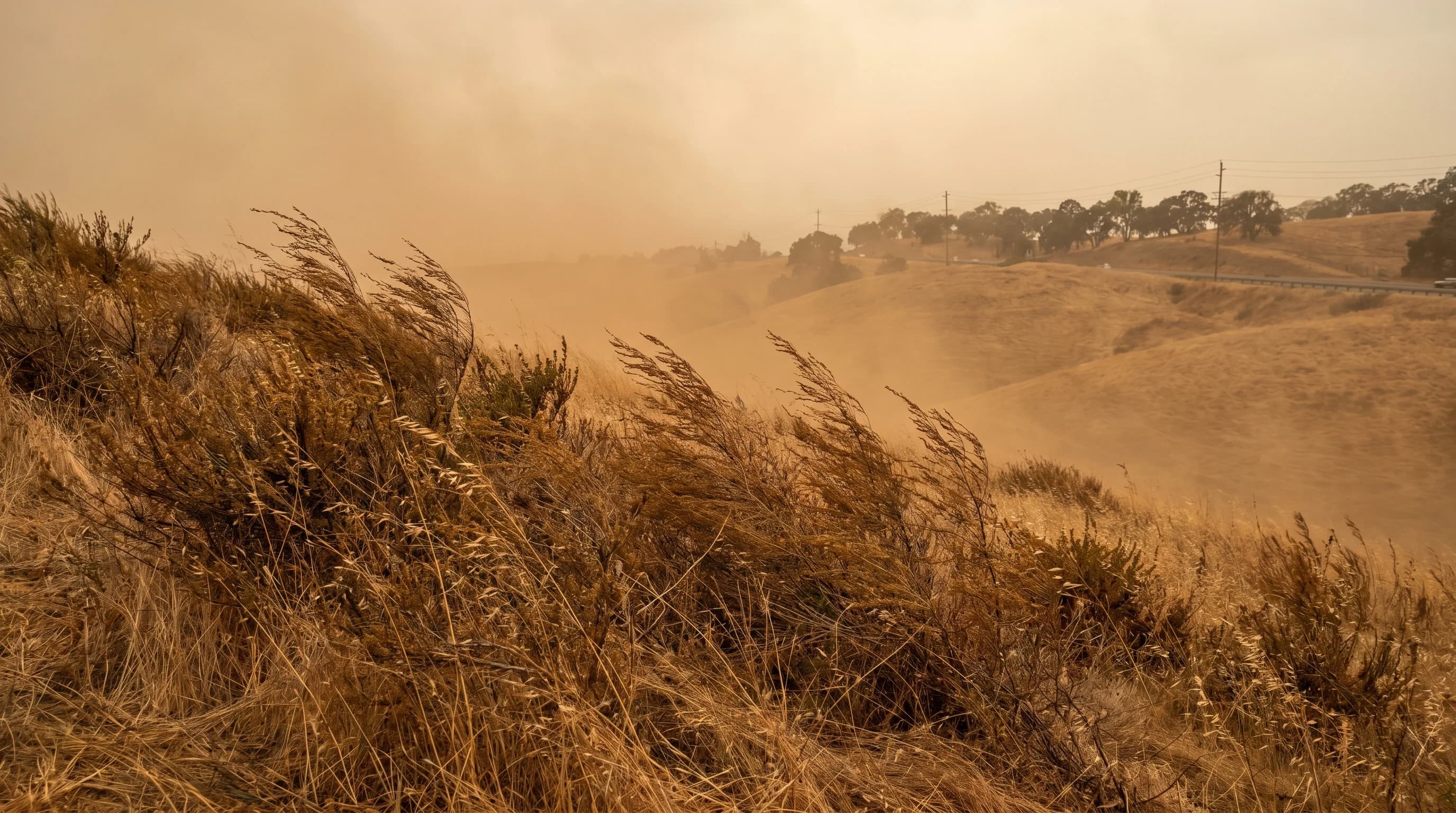
Bay Area fire weather warnings cluster heavily in the fall months. The peak window is September through November, when two seasonal factors converge. First, vegetation fuels have been drying since the last spring rains, typically in April or May. By October, the large dead fuel moisture index in Bay Area grasslands and chaparral reaches its annual minimum, often below 10%. Second, the offshore wind pattern that produces Diablo winds becomes more frequent as the jet stream shifts southward and high-pressure systems build over the Great Basin.
The NWS San Francisco office typically issues 5 to 15 Red Flag Warnings per fire season, though the number varies significantly from year to year. October 2017, which produced the Tubbs Fire, saw back-to-back Red Flag events that were among the most intense in the office's history. October 2019 brought the Kincade Fire during another prolonged Red Flag period. By contrast, a wet fall can compress the fire weather window to just a few weeks or even eliminate significant Red Flag events entirely.
Summer fire weather warnings are less common in the Bay Area because the strong marine influence keeps coastal and bayside humidity relatively high. The exception is during heat dome events, when the marine layer breaks down completely and inland valleys bake under temperatures exceeding 100 degrees F for multiple days. These events can produce fire weather warnings for interior locations like Concord, Livermore, and upper Napa Valley even in July and August.
What Should You Do During a Fire Weather Warning?
During a Red Flag Warning in the Bay Area, the most important action is situational awareness. Monitor local emergency alerts through systems like Nixle, AlertSCC, SoCoAlert, and AC Alert, depending on your county. If you live in or near the wildland-urban interface, have your go bag packed with documents, medications, phone chargers, and essentials. Know at least two evacuation routes from your neighborhood, because fire can block the obvious route.
Outdoor activities during fire weather warnings carry real risk beyond just fire. Air quality can deteriorate rapidly from wildfire smoke, even from fires burning 50 to 100 miles away. Checking the AQI before heading outdoors is essential during any Red Flag period. Trail access in regional and state parks is often restricted or closed entirely during Red Flag Warnings, and for good reason: a single spark from a vehicle, a campfire ember, or even metal dragging on pavement can start a fire that moves faster than a person can run in high winds.
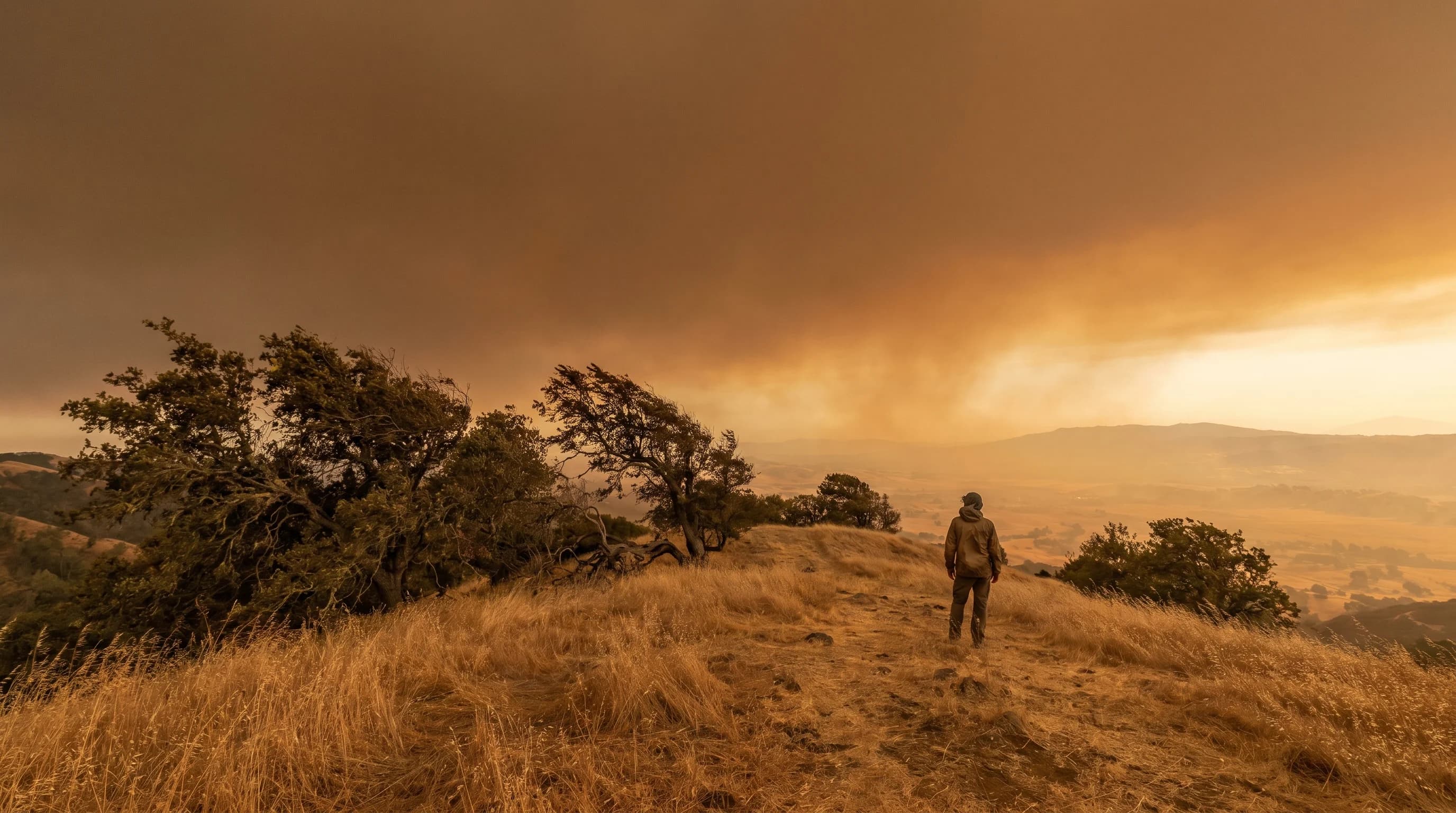
For Bay Area residents who have lived through the smoke events of 2017 through 2020, fire weather warnings carry a weight that purely coastal or purely urban populations may not feel as viscerally. The fires that burned through Santa Rosa neighborhoods in 2017 moved through suburban streets, not remote wilderness. Understanding the terminology and thresholds behind fire weather warnings is not academic. It is the vocabulary of the planning and preparation that keeps people safe when the Diablo winds arrive and the hills turn the color of straw.