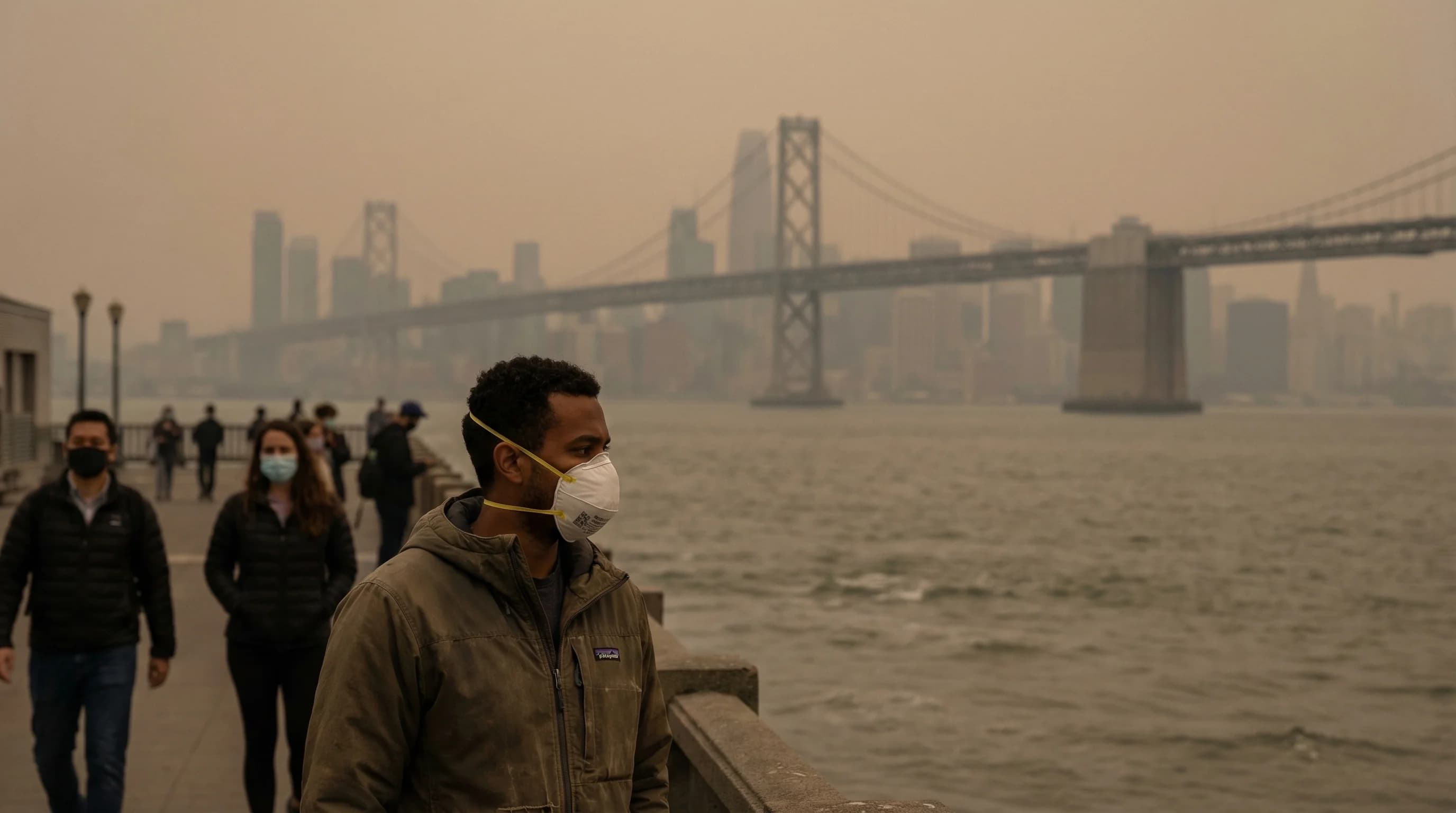
Wildfire smoke has become the Bay Area's most significant and unpredictable air quality event of the past decade. In the summers and falls of 2017, 2018, 2019, 2020, and 2021, the region experienced episodes of hazardous smoke-induced air quality that closed schools, canceled outdoor events, emptied streets, and strained health systems. The smoke did not come from local fires. It came from fires in the Sierra Nevada, the North Coast ranges, the Cascades, and even Oregon and Washington. The Bay Area sits in a geography that concentrates and traps smoke from sources hundreds of miles away, and understanding how that happens is essential for anyone trying to plan outdoor activities, manage health conditions, or simply understand why the sky turns orange.
How Wildfire Smoke Reaches the Bay Area
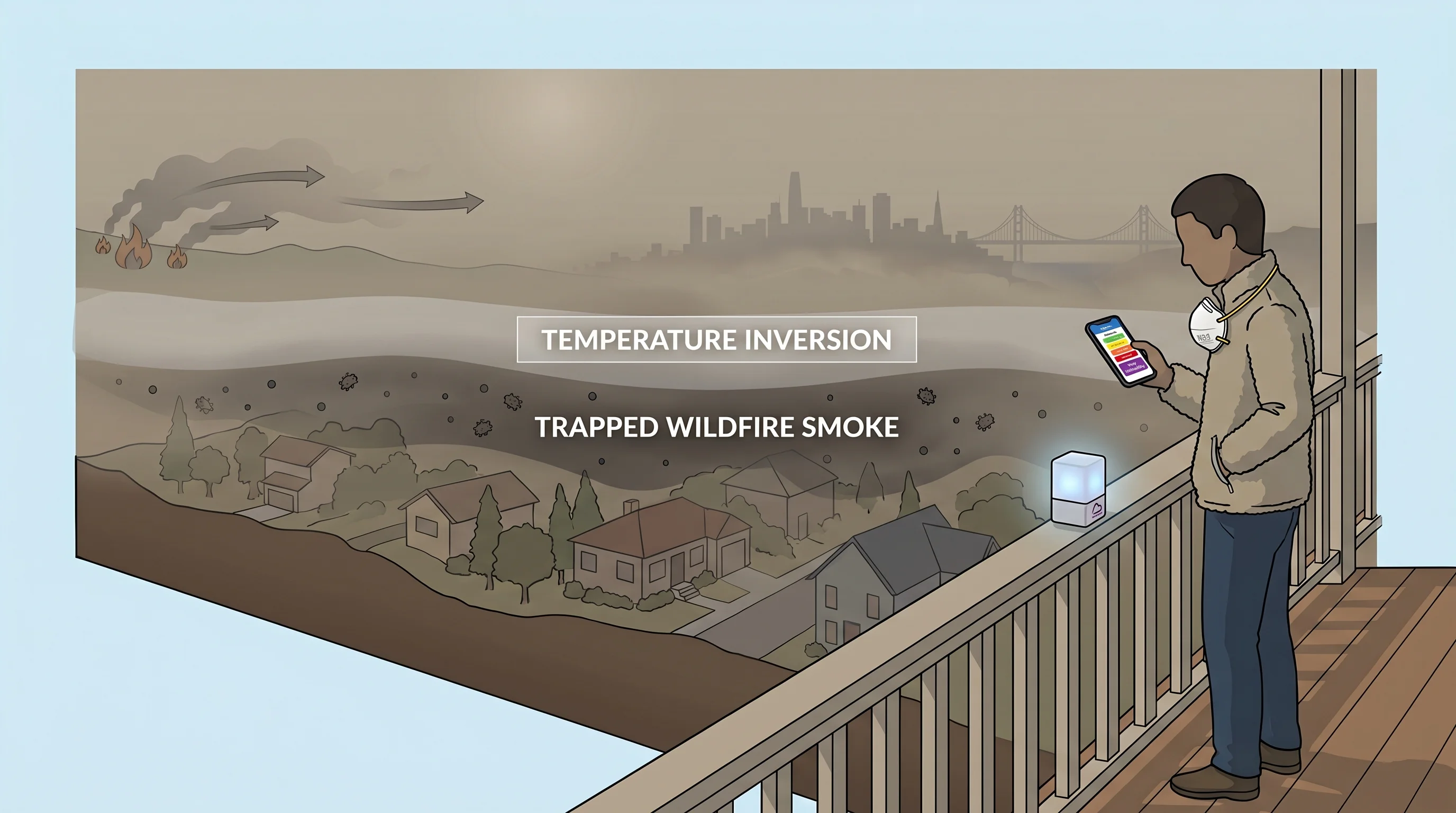
Wildfire smoke is transported in the upper atmosphere by the same wind patterns that drive California's weather. During summer and fall, when fires are most active, the prevailing flow at altitude is often from the north or northeast, the same direction as Diablo offshore winds at the surface. Smoke from fires in Northern California, Oregon, and Washington rises to several thousand feet altitude and rides these upper-level winds southward and westward toward the Bay Area.
The critical factor for Bay Area air quality is what happens when that smoke descends. During inversion conditions, which are common in summer and fall, the smoke cannot mix through the atmosphere vertically. It descends through or under the inversion base and becomes trapped in the surface layer where people breathe. An inversion that protects the Bay Area from heat by capping the marine layer can simultaneously trap wildfire smoke at ground level, producing air quality that is far worse than the same amount of smoke would produce in an atmosphere without an inversion.
The Camp Fire: November 2018
The most damaging smoke event in Bay Area history was produced by the Camp Fire in Butte County in November 2018. The fire, which destroyed the town of Paradise and killed 85 people, ignited on November 8 during a period of strong offshore winds that drove rapid spread. As the fire consumed roughly 153,000 acres in its first days, the smoke column was transported southwestward by upper-level flow directly toward the Bay Area.
For two weeks in November 2018, the Bay Area experienced what were at the time the worst air quality conditions in its recorded history. AQI readings exceeded 300 at multiple Bay Area monitoring stations, with the Unhealthy for Sensitive Groups threshold at 101 and Hazardous beginning at 301, for consecutive days. Schools closed throughout the region. Masks, which few Bay Area residents owned, sold out at hardware stores. The experience was a watershed moment: for the first time, wildfire smoke had disrupted Bay Area life for an extended period in a way that felt like a new normal rather than an aberration.
Protecting Yourself During Smoke Events
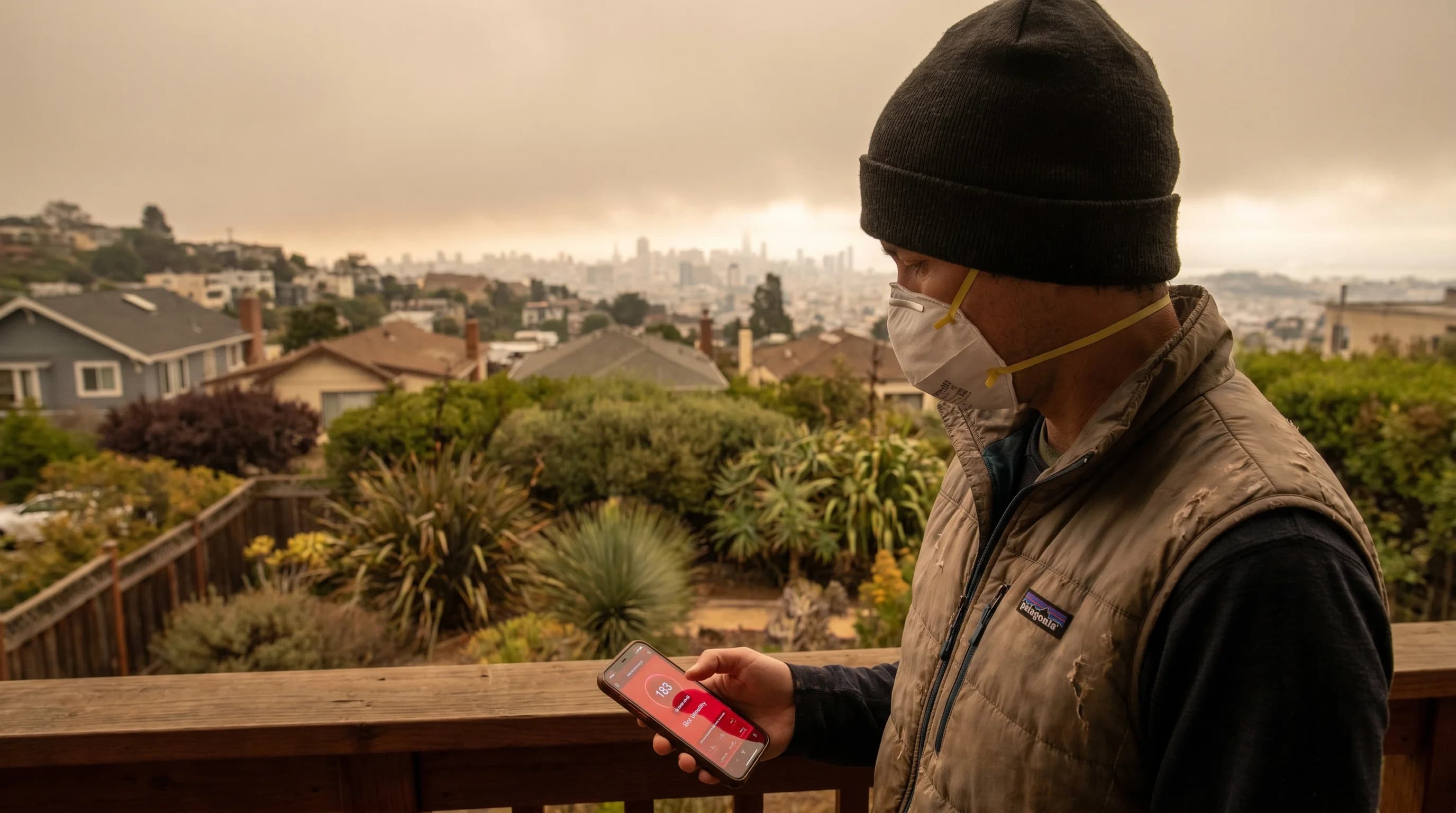
The primary protective actions during smoke events are straightforward but require preparation. Stay indoors with windows and doors closed. Use air purifiers with HEPA filtration. A single room air purifier in a bedroom provides the most critical protection for sleeping hours. If you must go outside, N95 or KN95 masks provide meaningful filtration of fine particulates; surgical masks and cloth masks are far less effective. Check AQI before outdoor exercise, as activities that increase breathing rate also increase particulate inhalation. Those with asthma, heart disease, or other cardiopulmonary conditions should be especially cautious when AQI exceeds 100.
The Bay Area Air Quality Management District provides real-time AQI readings at monitoring stations throughout the region. Air quality can vary significantly within the Bay Area during smoke events. The marine layer can scrub smoke from coastal areas while inland areas remain severely affected, or an inversion can trap smoke in the East Bay flatlands while the Marin Coast is clear. Checking the nearest monitoring station rather than a regional average gives the most actionable information for your specific location.