On most summer days, the Bay Area is protected from extreme heat by the marine layer and the sea breeze: the North Pacific High sends cool, moist air onshore, the afternoon wind cools the inland valleys, and even the hottest East Bay cities rarely exceed 100 degrees. But several times a year, this protection breaks down. A heat dome develops, the marine layer retreats or disappears entirely, and the Bay Area bakes. Temperatures in Livermore hit 115 degrees. San Francisco, which rarely exceeds 80, breaks 100. Even the coast, normally a refuge, reaches 90. These events are not normal Bay Area summer heat. They are a distinct meteorological phenomenon with a specific mechanism, and understanding it explains why they are so surprising, so dangerous, and so different from the region's typical warm weather.
What Is a Heat Dome?
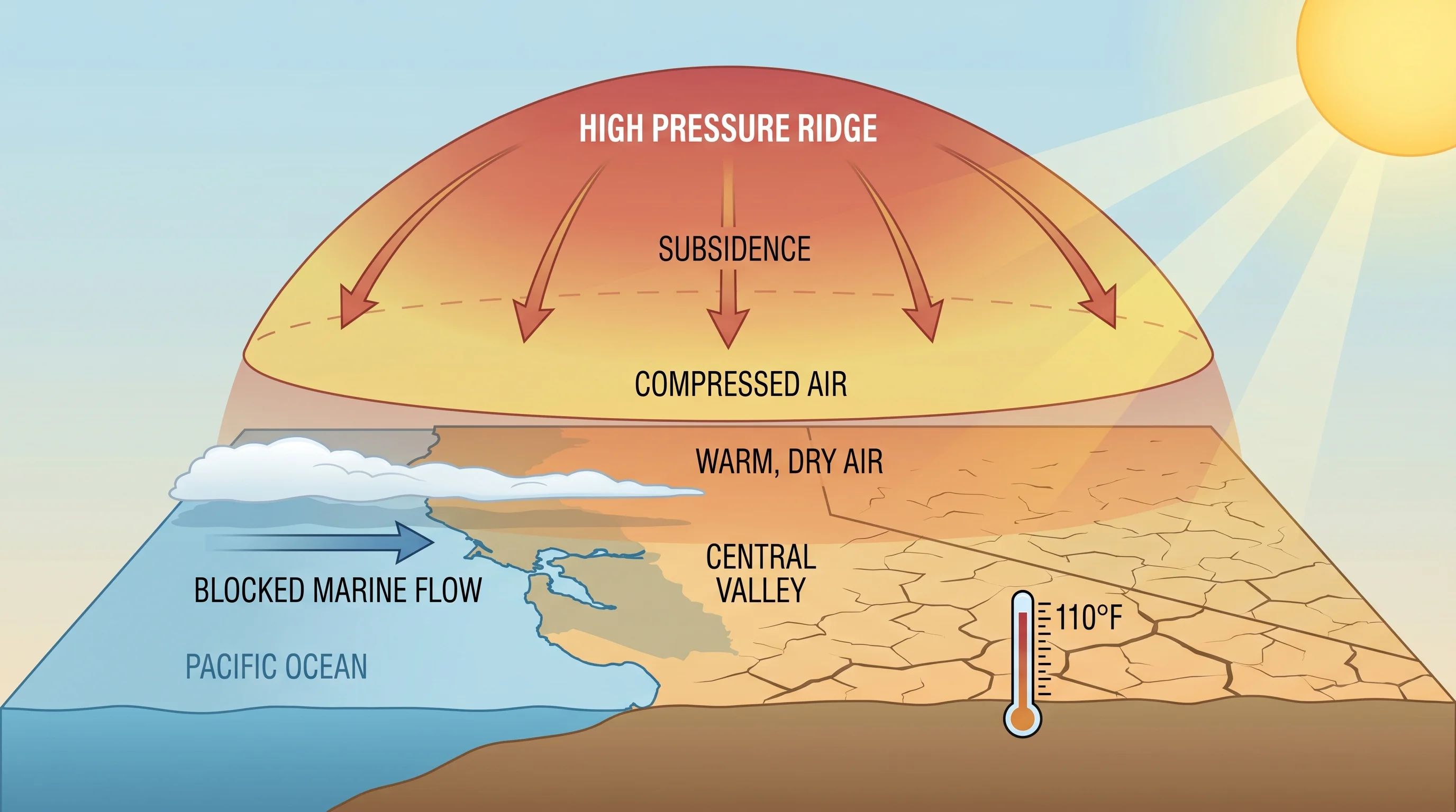
A heat dome forms when a large area of high pressure stalls in the upper atmosphere over a region. At the surface, high pressure means descending air. Descending air compresses and warms at the dry adiabatic lapse rate, about 5.4 degrees Fahrenheit per 1,000 feet of descent. When this happens over a large area and persists for days, the descending air suppresses cloud formation, prevents thunderstorms, and allows the ground to absorb solar radiation without relief. Each day, the surface heats up more. Each night, less heat escapes because the air above is warm. Temperatures build progressively, and the dome of high pressure holds the hot air in place like a lid.
For the Bay Area, a heat dome requires a specific configuration. The North Pacific High must amplify and shift position, extending a ridge of high pressure inland over California. When this ridge is positioned correctly, it blocks the onshore flow that normally delivers the marine layer. The sea breeze disappears or reverses, bringing warm, dry air from the interior. The Diablo winds, hot, dry offshore flow from the northeast, often accompany heat dome conditions, adding to the heating and driving humidity to single digits.
Bay Area Heat Dome Characteristics
What makes Bay Area heat domes particularly dangerous is the population's lack of acclimatization and infrastructure. Less than half of Bay Area households have air conditioning, because the climate almost never requires it. When temperatures hit 100 or above for multiple consecutive days, cooling centers become overwhelmed, power grids strain under unprecedented air conditioning loads, and vulnerable populations, the elderly, young children, those without housing, face acute health risks. The 2006 California heat wave, one of the deadliest in state history, killed more than 600 people statewide, with the Bay Area among the hardest-hit regions.
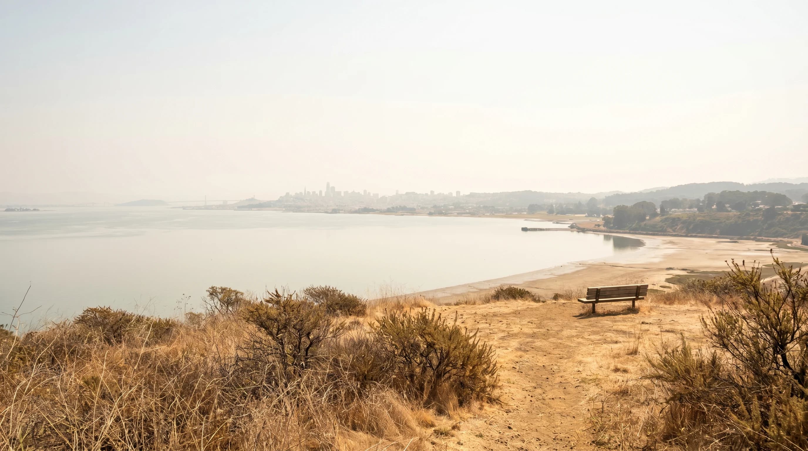
The inland valleys are the most extreme during heat dome events. Livermore, Concord, and Walnut Creek can reach 110 to 115 degrees during the worst events. The normally moderate coastal cities are also affected, which is what makes these events feel so disorienting. San Francisco reaching 106 degrees, as it did in September 2017, is not a normal heat event; it is a complete failure of the marine influence that normally guarantees that SF stays cool.
Heat Domes and Wildfire
The combination of heat dome conditions and low humidity creates the Bay Area's most dangerous fire weather. The record-breaking August 2020 heat dome directly triggered the Lightning Siege, a series of dry lightning storms that ignited more than 560 fires simultaneously across Northern California. The SCU Lightning Complex, LNU Lightning Complex, and CZU Lightning Complex all started during this event. Heat dome conditions, high temperatures, single-digit humidity, and strong offshore Diablo winds, turn the dry summer vegetation into a fire environment that can produce explosive, fast-moving fires.
The connection between heat domes and fire is partly direct (hot, dry conditions reduce fuel moisture) and partly indirect (heat domes often coincide with the offshore wind patterns that drive fire spread). The Diablo winds that frequently accompany heat dome conditions are the same winds responsible for the worst fires in Bay Area history, including the 2017 Tubbs Fire in Santa Rosa, the 1991 Oakland Hills Fire, and the 2017 Atlas Fire in Napa.
Heat Dome Frequency and Climate Change
Heat domes have always occurred in California, but their frequency, intensity, and duration are increasing. The 2021 Pacific Northwest heat dome, which broke records across the region with temperatures above 115 degrees in Portland, was assessed by climate scientists as virtually impossible without human-caused climate change. For the Bay Area, the practical concern is that the buffer provided by the marine layer is not unlimited, and that as background temperatures rise, even the normal marine-layer influence produces warmer conditions. A future Bay Area heat dome will start from a higher baseline, potentially pushing temperatures well above what the region has experienced historically.