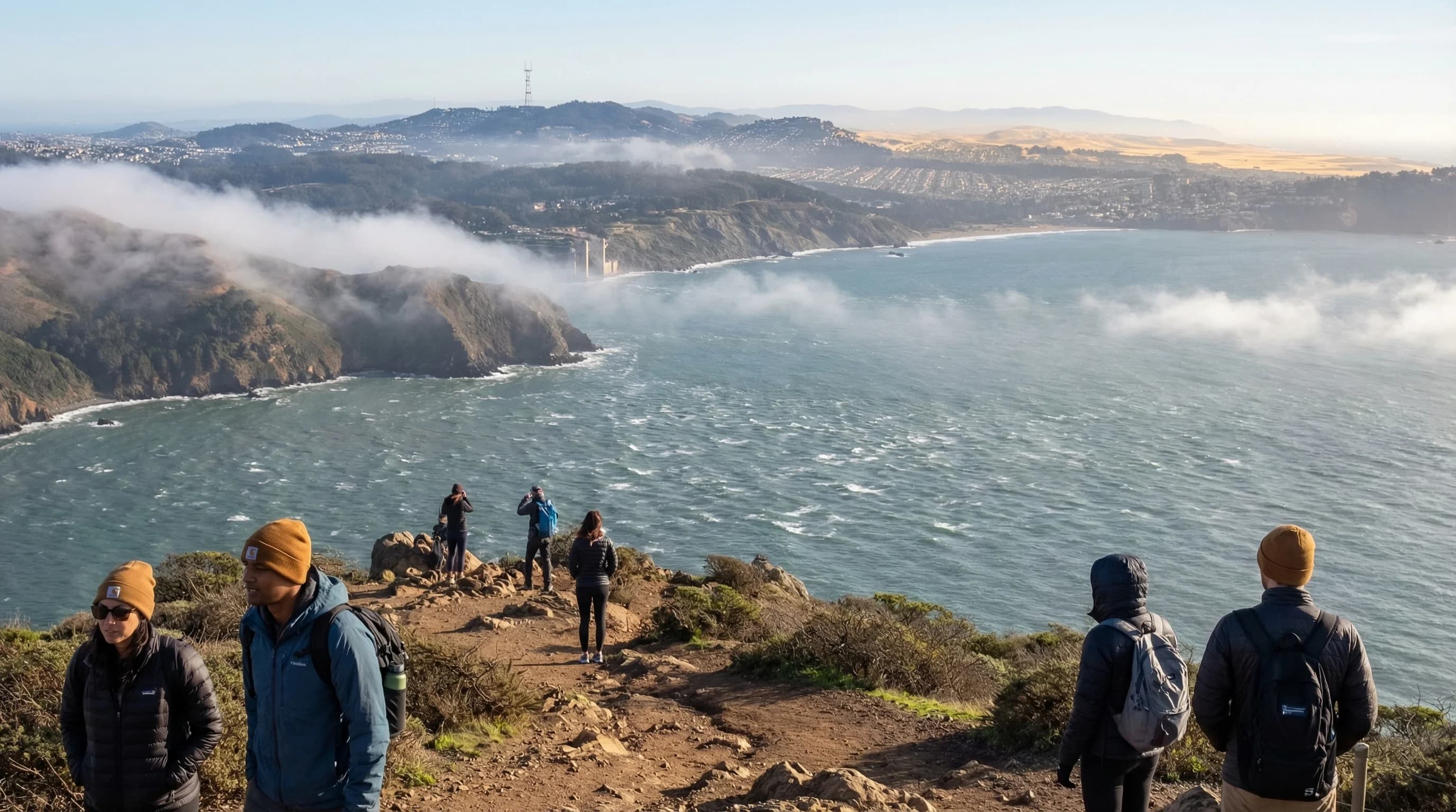
Every summer afternoon in the Bay Area, a predictable sequence plays out across the region. By 1 or 2 p.m., as the inland valleys have heated to 90 or 100 degrees, a coolness arrives from the coast, a steady, sometimes sharp westerly wind that pushes through the gaps in the Coast Ranges, races across the bay, and pours into the Central Valley through the Carquinez Strait. This is the sea breeze, and it is the Bay Area's most important weather mechanism during the warm, dry summer months. It explains not just why San Francisco never gets hot, but why Livermore is breezy at 4 p.m., why Alcatraz is perpetually windswept, and why parts of the East Bay feel twenty degrees cooler at 5 p.m. than at noon.
The Physics of the Sea Breeze
A sea breeze is a thermally driven wind, powered by the temperature difference between land and water. As the sun heats the land, the air above it warms and becomes less dense. This warm, light air rises, creating a relative low pressure at the surface. The cooler, denser air over the ocean remains at higher pressure. Air flows from high to low pressure, so the cool ocean air moves toward the coast and then onshore, the sea breeze.
The process reverses at night, when the land cools faster than the water and a gentler land breeze develops, carrying cool inland air back toward the coast. This overnight flow is responsible for the moderate temperatures at Bay Area beaches on summer mornings, before the sea breeze kicks in.
The Bay Area Sea Breeze Pathway
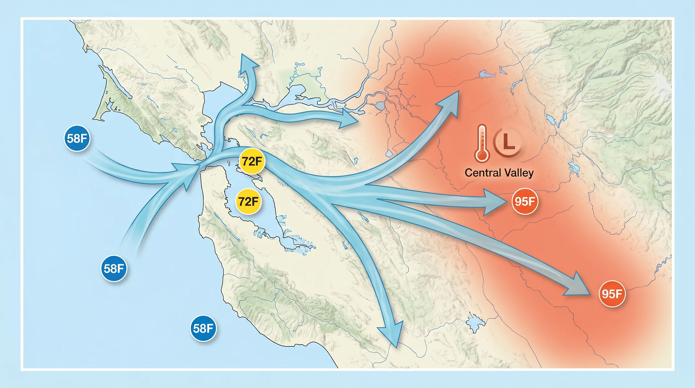
What makes the Bay Area's sea breeze exceptional in scale and consistency is the specific topography it flows through. The California Coast Ranges block direct ocean-to-inland airflow almost everywhere except at gaps, and the Bay Area sits at one of the most significant of these gaps. The San Francisco Bay is a vast inland estuary connected to the Pacific by the Golden Gate, the only sea-level opening in the coastal ranges for hundreds of miles. When the sea breeze develops in the afternoon, the marine air pours through the Golden Gate and across the Bay before spreading inland and eventually funneling through the Carquinez Strait east of Martinez into the Sacramento-San Joaquin Delta and Central Valley.
This routing means the sea breeze affects an enormous geography. San Francisco is the entry point, receiving the coolest and often most intense initial flow. The Bay itself distributes the marine air in multiple directions. Wind reaches Berkeley and Oakland from the west and southwest. It pushes south through the San Jose corridor. It accelerates northeast through the Carquinez Strait, producing some of the strongest sustained winds in the region at Benicia and the Suisun Bay area. The entire Delta is cooled by late-afternoon flow that originated as Pacific marine air moving through the Golden Gate.
Sea Breeze Timing Across the Bay Area
The sea breeze does not arrive simultaneously everywhere. It propagates inland from the coast, and the timing reveals the structure of the flow. At the Golden Gate and Ocean Beach, the marine push is strongest by noon or early afternoon. In the Mission District and downtown San Francisco, the breeze typically arrives by 1 p.m. At Oakland and Berkeley, it arrives between 1 and 2 p.m. In Livermore, the sea breeze reaches the valley between 2 and 3 p.m., dropping temperatures 15 to 20 degrees in an hour. In the Delta communities east of the Carquinez Strait, the afternoon breeze arrives between 3 and 5 p.m.
This propagation delay has practical consequences. A morning hiker in Livermore leaving at 9 a.m. faces a very different temperature environment than one leaving at noon, and by 3 p.m., the same trail that was at 98 degrees at noon may be at 78 degrees with a steady westerly wind. Bay Area residents who live inland have developed an intuitive sense of the sea breeze timing, using it to schedule outdoor activities, plan gardening, and decide when to open or close windows.
Sea Breeze vs. Land Breeze: The Night Cycle
After sunset, as the land cools, the temperature gradient that drives the sea breeze gradually diminishes. By late evening, the pressure gradient may reverse, and a land breeze develops, cooler air from the inland valleys flowing back toward the coast. Land breezes are gentle by comparison, typically 5 to 10 mph, but they deliver the cool, calm conditions that make summer nights in the Bay Area so pleasant compared to other parts of California. The diurnal swing between sea breeze and land breeze is part of what gives Bay Area summer weather its characteristic pattern: hot afternoon, cool evening, foggy morning.
The sea breeze system operates on a seasonal schedule as well as a daily one. In winter, when the land and ocean temperatures are similar, the gradient is weak and sea breezes are minimal. The system ramps up in spring as land temperatures begin to rise and the North Pacific High builds the May wind pattern. It reaches peak intensity in July and August, when the Central Valley is hottest and the Pacific is coolest relative to the land. In September and October, as the North Pacific High weakens and the land begins to cool, the sea breeze weakens, contributing to the Indian summer conditions that make early fall in the Bay Area feel warm and settled in ways that summer never quite achieves.