The delta breeze is a flow of cool marine air that travels from the San Francisco Bay through the Carquinez Strait and into the Sacramento-San Joaquin River Delta on summer evenings. It is the Bay Area's natural air conditioning for the inland valleys, dropping temperatures 15 to 25 degrees between afternoon and evening in cities like Concord, Walnut Creek, and Livermore. Without the delta breeze, the Central Valley and eastern Bay Area would be significantly hotter than they already are. Sacramento residents track the delta breeze forecast the way coastal residents track fog: it determines whether the evening is pleasant or miserably hot.
How Does the Delta Breeze Work?
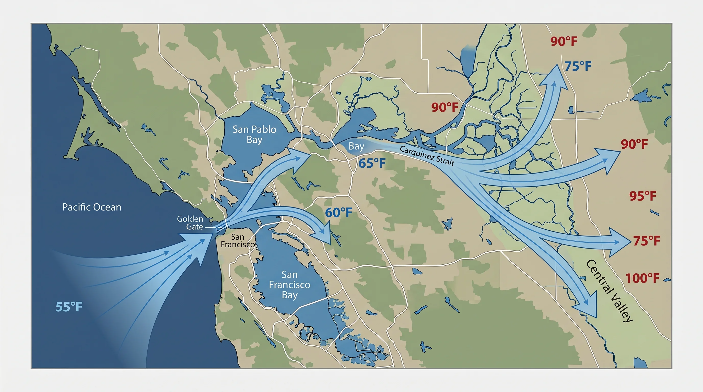
The delta breeze is driven by the same pressure gradient that produces San Francisco's fog. The Central Valley heats up during summer afternoons, with temperatures routinely reaching 95 to 105 degrees F. Hot air rises, creating a thermal low pressure area over the valley. Meanwhile, the Pacific Ocean keeps the Bay Area coast at 55 to 65 degrees, maintaining relatively higher pressure. Cool, dense marine air flows toward the hot, low-pressure interior, following the path of least resistance through the gaps in the coastal mountains.
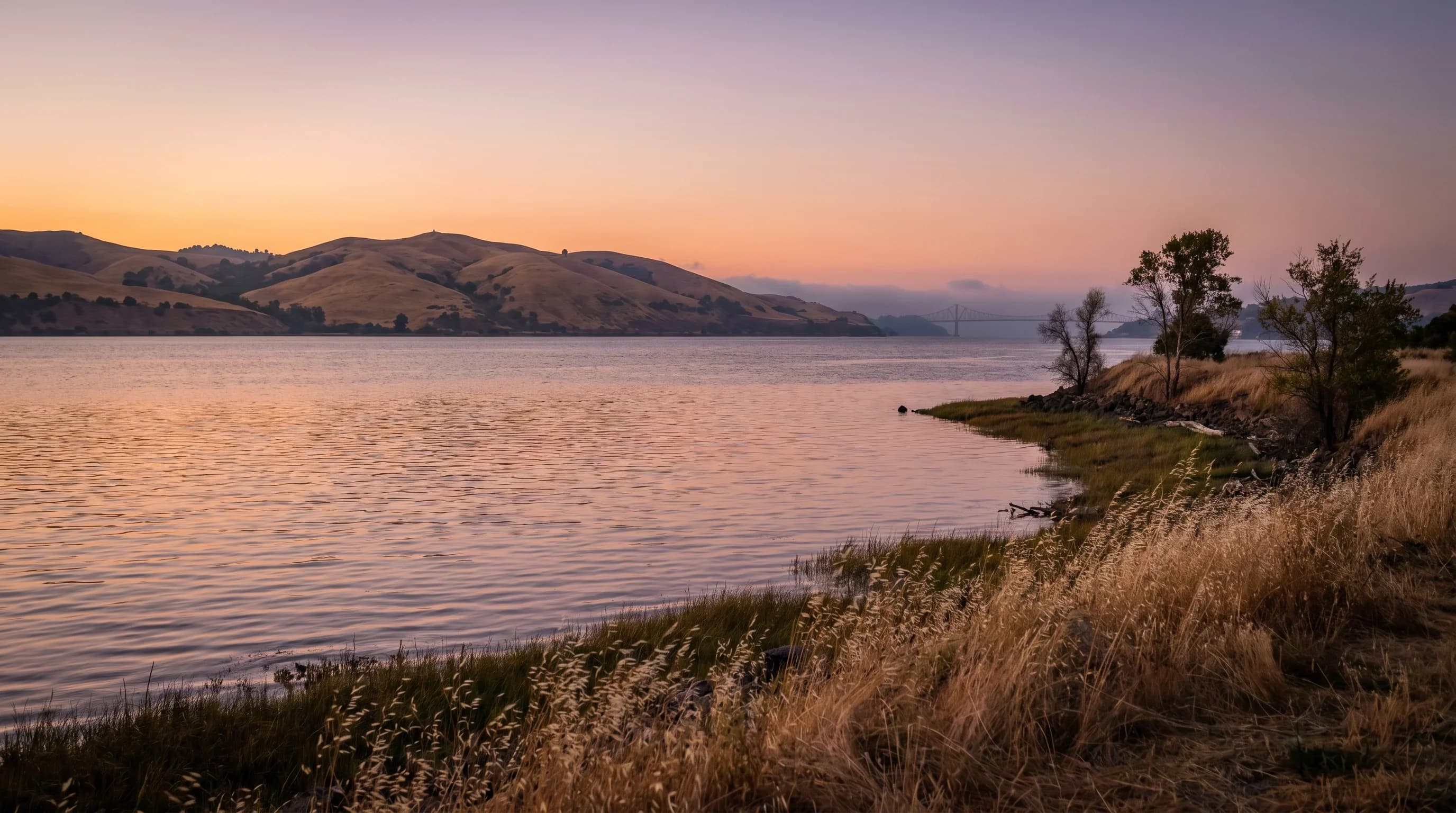
The most efficient gap is the Carquinez Strait, the narrow water passage between the North Bay hills and the East Bay hills where the Sacramento and San Joaquin rivers merge and flow into San Pablo Bay. Marine air funnels through this strait, picking up speed as it passes through the narrow opening, and spreads into the broad, flat expanse of the Sacramento-San Joaquin Delta. From there, the cool air continues inland toward Sacramento, Stockton, and the surrounding agricultural communities. The breeze typically arrives in the early evening, between 6 and 9 PM, as the valley heat reaches its daily peak and the pressure gradient is strongest.
When Does the Delta Breeze Blow?
The delta breeze is a summer phenomenon, strongest from June through September. It blows most reliably on days when the Central Valley temperature exceeds 95 degrees F and the coast-to-valley temperature difference is 30 degrees or more. On these days, the pressure gradient is strong enough to pull marine air through the Carquinez Strait at 15 to 25 mph.
The breeze does not blow every hot day. When the North Pacific High is positioned directly over the coast, it can suppress the onshore flow and prevent the marine air from pushing inland. During heat dome events, when high pressure sits directly over Northern California and temperatures reach 110 degrees or more in the valley, the delta breeze often fails entirely. These are the most dangerous heat events precisely because the natural cooling mechanism is absent: nighttime temperatures stay in the 80s instead of dropping to the 60s, and the accumulated heat becomes a public health crisis.
How Does the Delta Breeze Affect Bay Area Temperatures?
The delta breeze moderates temperatures across the entire eastern Bay Area, not just the Delta itself. Cities along the breeze corridor, including Concord, Walnut Creek, Antioch, Brentwood, and Pittsburg, experience the most dramatic evening cooling. A 100-degree afternoon can drop to 70 degrees by 9 PM when the delta breeze is strong. Without it, those cities might only cool to 85 degrees, creating uncomfortable sleeping conditions in areas where many homes lack air conditioning.
The breeze also affects the western Bay Area indirectly. As marine air is pulled through the Carquinez Strait, it draws additional marine air into the bay from the Golden Gate, reinforcing the sea breeze pattern that keeps San Francisco, Oakland, and the Peninsula cool. The entire system is connected: the valley heating that creates the pressure gradient for the delta breeze also drives the fog and wind that define the coast.
Is Climate Change Affecting the Delta Breeze?
Research from UC Davis and other institutions suggests the delta breeze may be weakening over time as climate change alters the temperature patterns that drive it. A warming Pacific Ocean reduces the coast-to-valley temperature gradient, potentially weakening the pressure difference that pulls marine air inland. At the same time, more frequent and intense heat dome events suppress the breeze at exactly the times when it is most needed.
The delta breeze is one of those weather patterns that most people take for granted until it fails. For Bay Area residents in the eastern valleys and the greater Sacramento region, the delta breeze forecast is the difference between a comfortable summer evening and a night spent unable to sleep. It is a product of the same oceanic influence that makes the Bay Area's climate so distinctive: cold Pacific water, a powerful pressure gradient, and a geography that channels marine air deep into the continental interior.