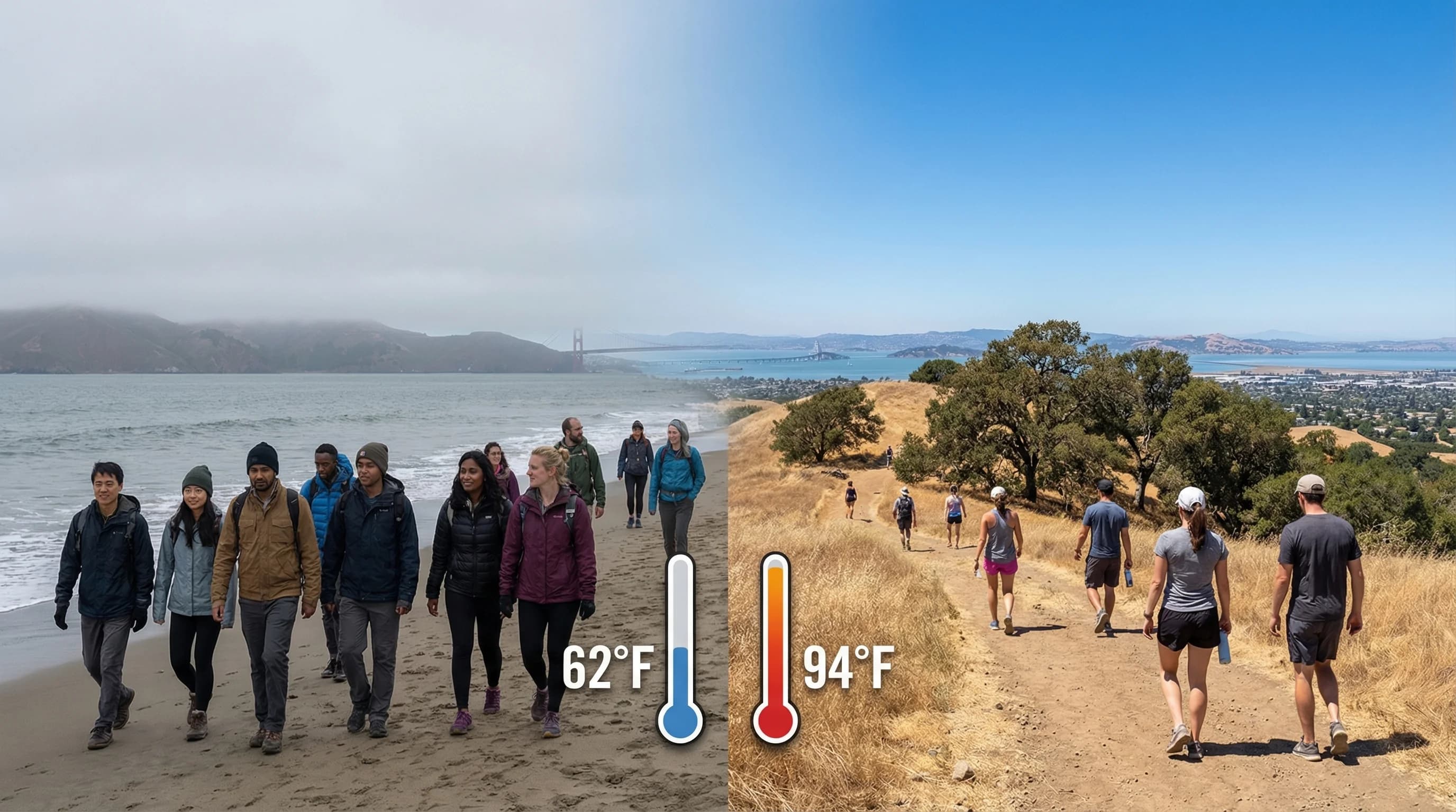
On a typical summer afternoon, the weather in Oakland and San Francisco could hardly be more different. In San Francisco, it is 62 degrees, foggy, and the wind is gusting at 20 miles per hour off the Pacific. In Oakland, 8 miles across the bay, it is 78 degrees, sunny, and the breeze is light and pleasant. In Walnut Creek, 25 miles from the coast, it is 92 degrees with a dry wind. In Livermore, 40 miles from the ocean, it is 98 degrees. All four cities are in the same metropolitan area. They share the same general climate system. But the 30-degree temperature difference between the coast and the inland East Bay is not a weather event. It is the normal daily pattern of summer, explained entirely by geography.
The Marine Layer as the Dividing Line
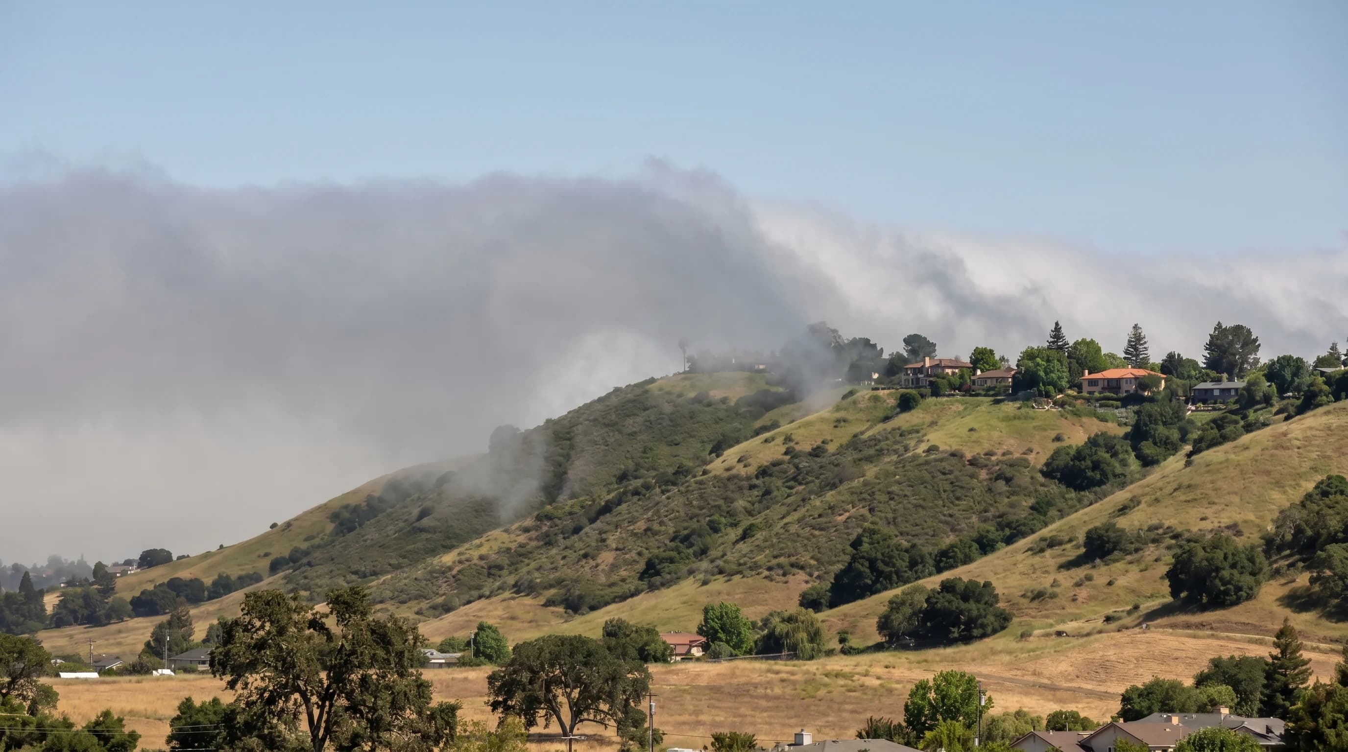
The fundamental explanation for East Bay heat is the marine layer. The marine layer is a shallow body of cool, moist air that forms over the Pacific Ocean and flows onshore through the Golden Gate on summer afternoons. San Francisco, on the ocean-facing tip of the peninsula, is in the full path of this flow. The city sits directly within the marine layer for most of the summer, receiving the cooling effect at its most powerful.
Oakland sits across the bay. The marine air does reach Oakland, eventually. But by the time it has traveled across the bay's 8-mile width, it has warmed slightly, and Oakland's eastern position means it sees the leading edge of the sea breeze rather than the dense marine core that San Francisco experiences. Oakland is noticeably sunnier than San Francisco, routinely logging 30 percent more sunshine hours. It is also warmer, with summer afternoons that typically run 10 to 15 degrees above San Francisco.
The Hills as the Barrier
The Berkeley Hills, the ridge that separates the flatland East Bay cities from the Lamorinda communities and inland valleys, mark the effective eastern boundary of significant marine influence on most summer afternoons. The sea breeze and marine air flow over the hills and can reach the inland valleys, but by the time they arrive in Concord or Livermore, they have been significantly modified by compression and mixing. The inland valleys receive a version of the sea breeze that is weaker, warmer, and drier than the version Oakland receives.
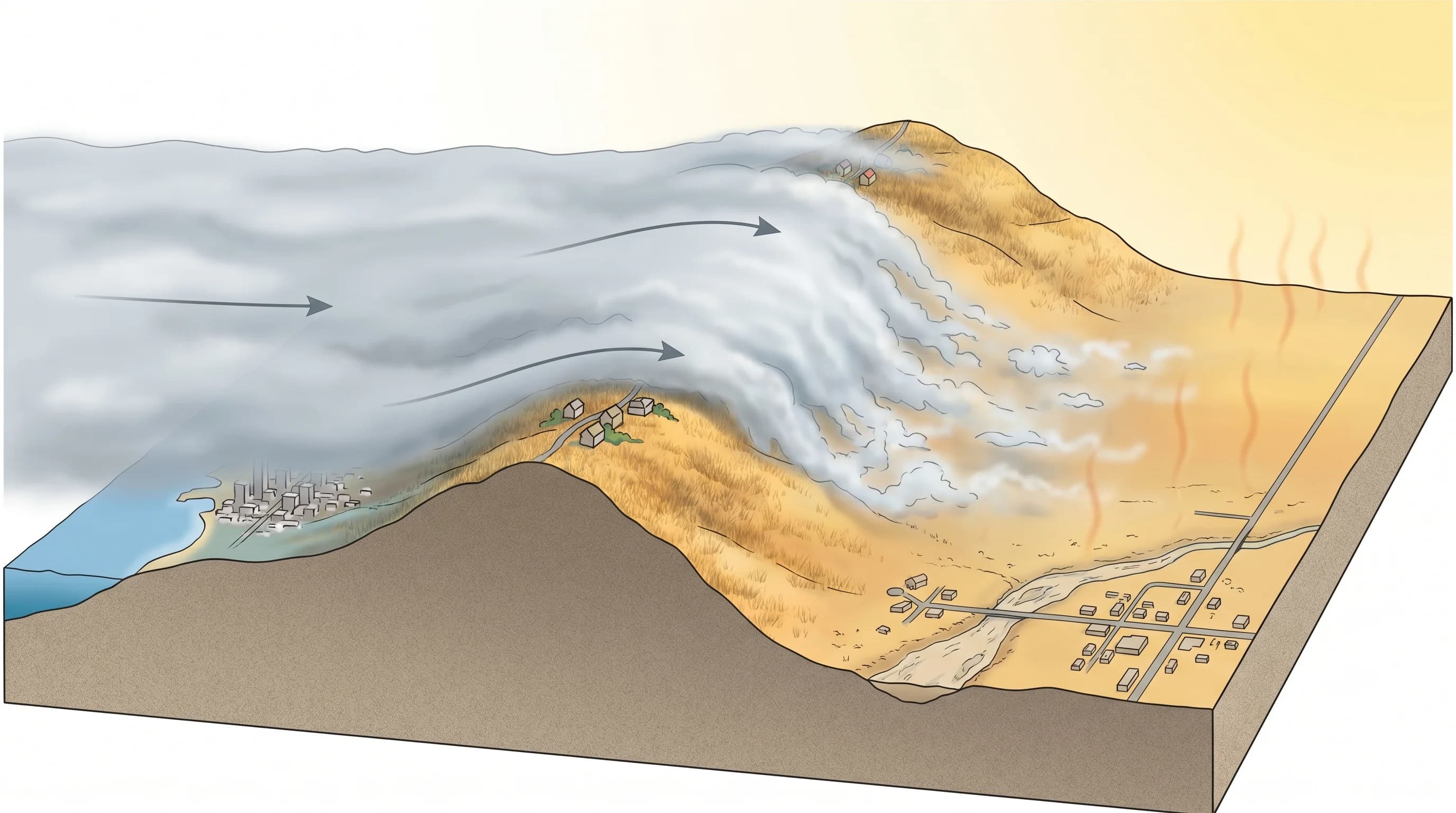
The result is a progressive temperature increase from coast to inland that roughly follows the distance from the Pacific. Berkeley runs slightly cooler than Oakland. Oakland runs cooler than the Diablo Range foothills. The foothills run cooler than the valley floors. And the farthest inland valleys, Livermore and Antioch, run at their own temperature extreme, routinely 30 to 35 degrees warmer than San Francisco on the same afternoon and occasionally exceeding that by wide margins during heat waves.
Why the Difference Matters
The coast-to-inland temperature gradient is not merely interesting to weather observers. It determines where Bay Area residents seek out summer activities and where they retreat from heat. San Francisco's beaches are cold. The East Bay hills are pleasant for hiking when the coastal cities are foggy. The inland East Bay needs swimming pools and indoor cooling that the coast does not. The same metropolitan area contains climate zones that would be considered separate weather regions in most other parts of the country.