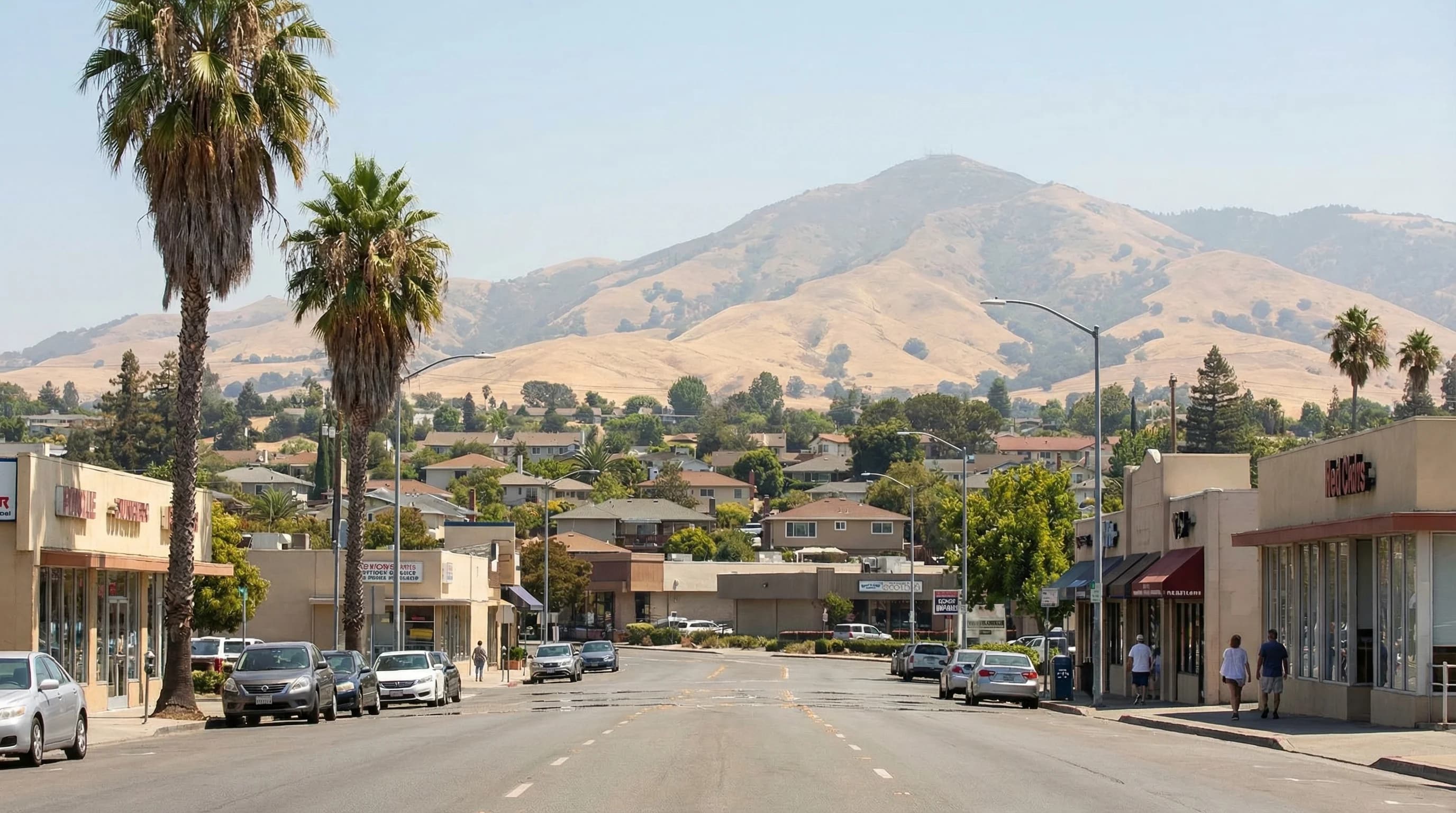
Concord sits in the northern Diablo Valley, close enough to the Carquinez Strait that it catches a partial marine influence that its neighbor Livermore to the southeast mostly misses. This geography makes Concord one of the Bay Area's hottest cities, summer highs regularly reach the low to mid-90s Fahrenheit, and heat waves can push temperatures past 105, while still receiving enough marine air most afternoons to prevent it from becoming the oven that exposed Central Valley cities endure. Concord is the northern end of the Diablo Valley heat belt, and understanding it means understanding the interplay between the Sacramento Valley air and the marine corridor that runs through the Carquinez Strait.
The Carquinez Corridor and Concord
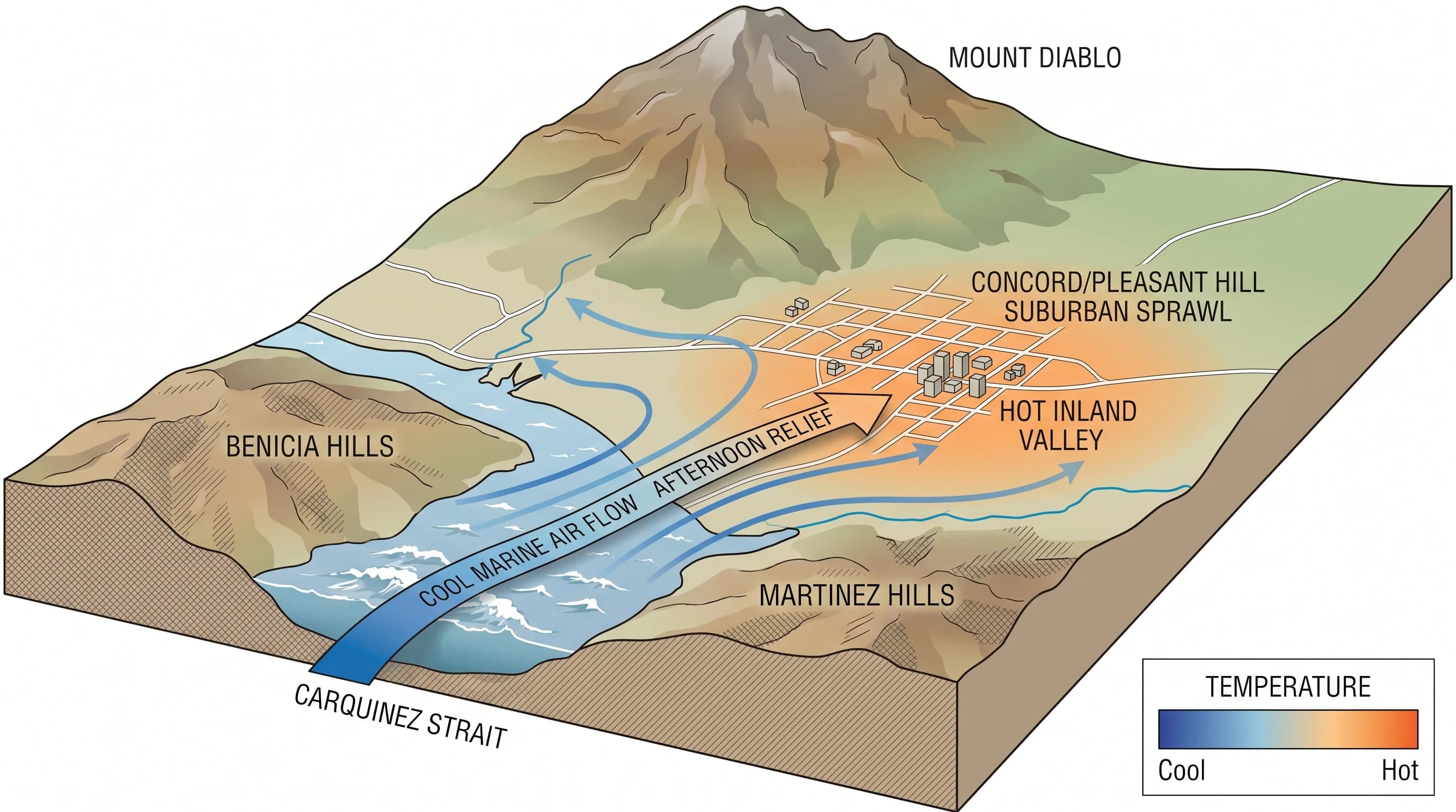
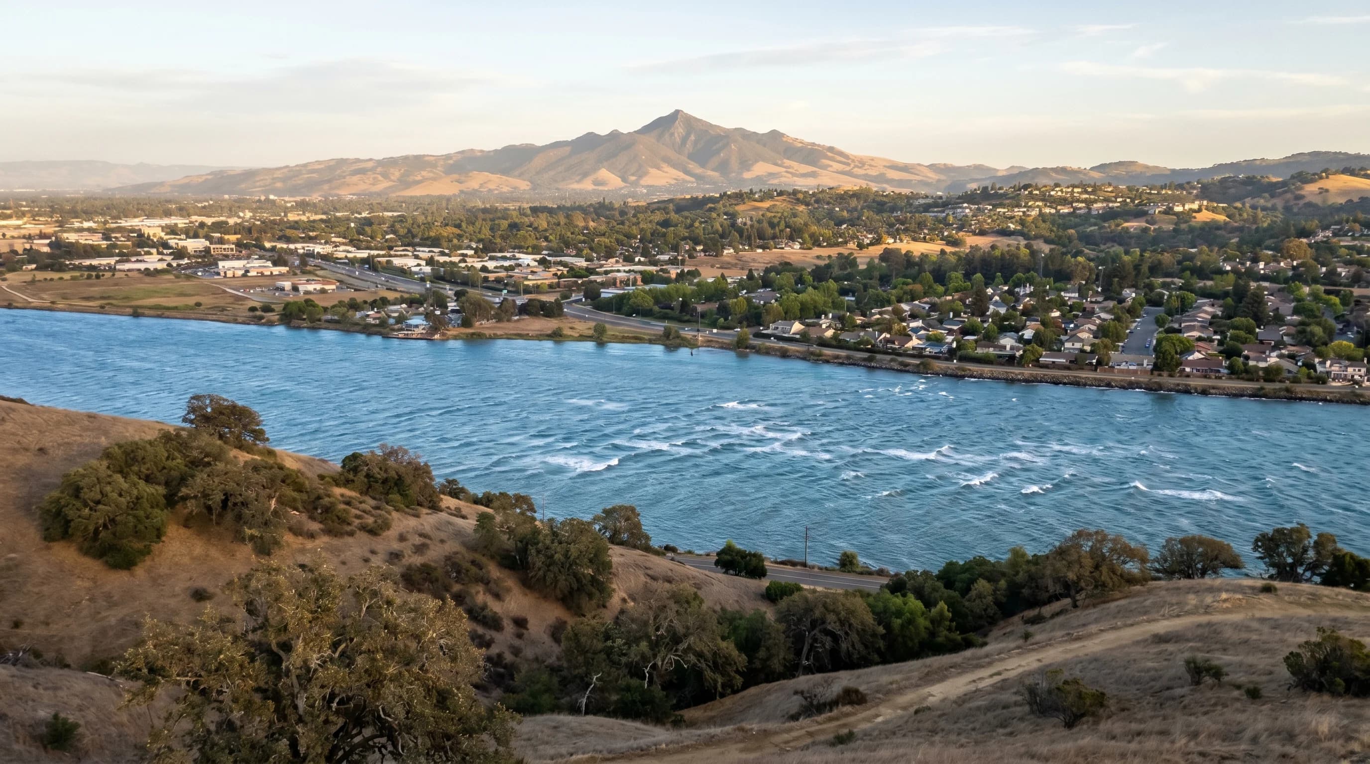
The Carquinez Strait is a narrow water gap connecting San Pablo Bay to the Sacramento-San Joaquin Delta, and it serves as the Bay Area's primary northern marine corridor. Cool, moist air from the Pacific flows through the strait on summer afternoons, drawn inland by the thermal low over the Sacramento Valley. Concord sits just south of this corridor, close enough to receive measurable cooling on most summer afternoons but far enough that the marine air is already warming as it pushes inland.
The practical effect is that Concord typically runs 3 to 8 degrees cooler than Livermore on summer afternoons, despite both cities being inland East Bay communities. On a day when Livermore reaches 100, Concord might peak at 93 or 95. On extreme heat wave days, when the marine push is suppressed by high pressure, both cities bake; but Concord's proximity to the Carquinez corridor gives it slightly more protection on typical days.
Summer Temperatures and Heat Waves
July and August are Concord's hottest months, with average high temperatures in the low to mid-90s Fahrenheit. The diurnal range is large: mornings start in the mid-60s, often clear and pleasant, before the valley heats rapidly through the morning. By noon temperatures are in the 80s; by 2pm, in the 90s on typical days. The afternoon sea breeze from the Carquinez Strait usually arrives between 2 and 4pm and drops temperatures five to ten degrees within an hour or two.
Heat waves are a recurring feature of Concord summers. When high pressure builds over the interior West and blocks or weakens the marine flow, temperatures can reach 105 to 110 degrees for several consecutive days. These events are dangerous, particularly for elderly residents and those without air conditioning. The East Bay Municipal Utility District reservoir at Briones, visible from the hills above Concord, provides a visual reminder of the watershed that makes this inland heat survivable with sufficient water.
Concord vs. Walnut Creek and Livermore
Within the Diablo Valley, Concord sits toward the hotter end of the local spectrum. Walnut Creek, to the south, is slightly more sheltered by the hills between the two cities and tends to run a few degrees cooler. Livermore, accessible via the Altamont Pass to the southeast, has less marine corridor access and runs hotter still. Pleasant Hill, immediately southwest of Concord, splits the difference between Concord and Walnut Creek in temperature.
The comparison is most stark during heat waves. On days when the marine push fails entirely, Concord and Livermore converge toward the same brutal temperatures, 105 or above, and the normal hierarchy breaks down. On moderate summer days with good marine push, the temperature gradient across the Diablo Valley is real and noticeable to residents who drive across it regularly.
Fall and Winter
Fall brings significant relief to Concord. September marks the beginning of the transition from summer heat to the Indian summer pattern, with temperatures dropping into the low to mid-80s and the marine layer retreating enough that mornings are pleasant rather than oppressively warm. October is arguably Concord's most comfortable month: warm afternoons in the 70s to low 80s, clear skies, and the dramatic golden light that falls on Mount Diablo's slopes as the angle of the sun changes.
Winter is mild and wet. Concord receives about 18 to 20 inches of annual rainfall, less than San Francisco's 22 inches and far less than the wetter mountain communities of Mount Diablo and Mount Tamalpais. Tule fog occasionally settles into the Concord area during winter high pressure events, particularly overnight and in the morning hours. The combination of seasonal temperature extremes, genuine heat in summer, mild but foggy winters, gives Concord more of a continental climate character than most Bay Area cities, and it is the weather that most distinguishes it from the coastal communities that often come to mind when people think of Bay Area weather.