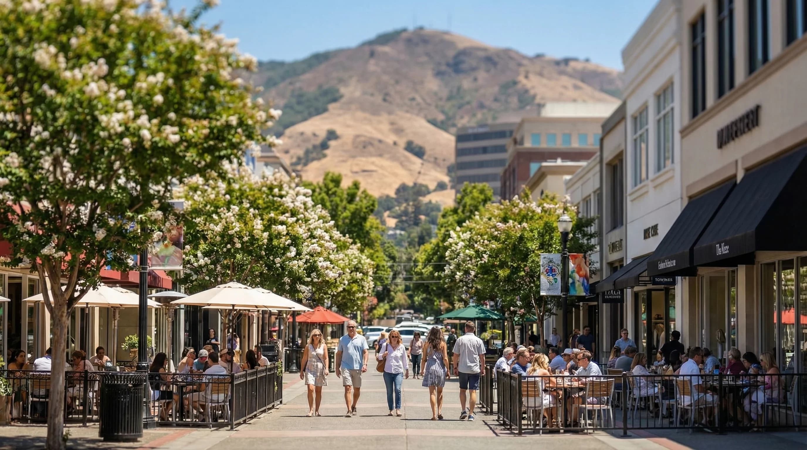
Walnut Creek sits in the Diablo Valley, the inland basin east of the Berkeley Hills and west of Mount Diablo, and it experiences the Bay Area's inland climate in concentrated form. Summer here means genuine heat, with days regularly reaching the upper 80s and low 90s Fahrenheit, with heat waves pushing temperatures past 100. Winters are mild enough to feel like a different climate from the Bay's winter norm, with more sunshine and less rain than the coast receives. If San Francisco is the Bay Area's coolest major city, Walnut Creek and the broader Diablo Valley represent the region's warmer, drier inland character, a version of California that matches the postcard more closely than the fog-shrouded coast does.
The Diablo Valley Climate
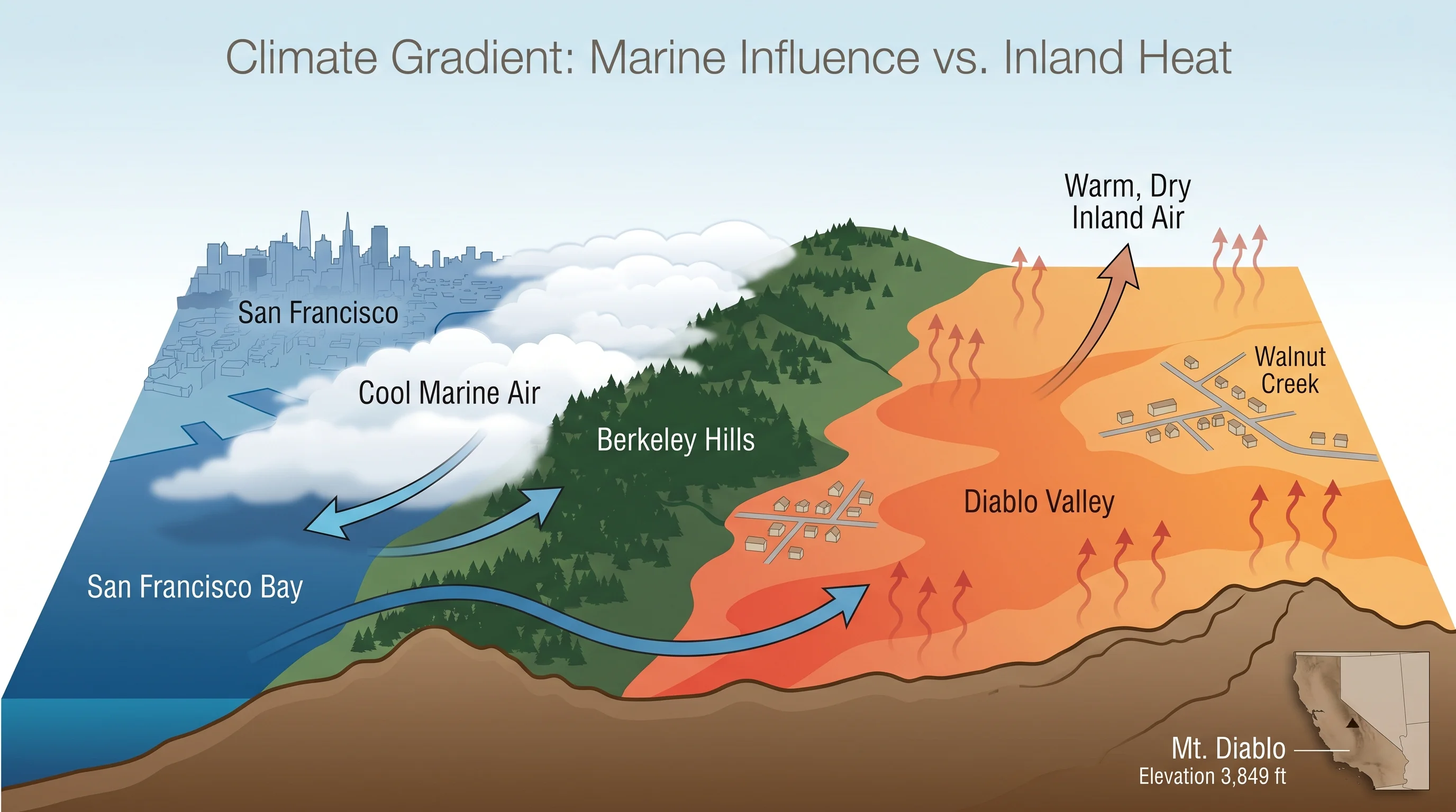
The Diablo Valley is a broad, roughly triangular basin bounded by the Berkeley Hills to the west, the Mount Diablo massif to the east, and the Carquinez Strait corridor to the north. This geography shapes the valley's weather in several important ways. The Berkeley Hills block the direct marine flow from the Bay, allowing the valley to heat up in summer without the immediate sea breeze relief that Oakland and Berkeley receive. The Carquinez Strait to the north provides a channel for cooler air from San Pablo Bay, which moderates temperatures somewhat compared to more sheltered inland areas like Livermore.
The result is a climate that is significantly warmer than the Bay's western shores in summer but cooler than the most exposed inland valleys. Walnut Creek typically runs 15 to 20 degrees warmer than San Francisco on summer afternoons. July highs average in the upper 80s Fahrenheit, while San Francisco averages around 65. On hot inland heat wave days, Walnut Creek can reach 105 while the city sits at 70. The gap is most dramatic during heat events and collapses almost entirely during winter, when both cities average highs in the low to mid-50s.
Summer Heat Patterns
Walnut Creek's summer follows a daily rhythm that inland Bay Area residents know well. Mornings are often pleasant, starting in the mid-60s with blue sky and low humidity. By noon the temperature has climbed into the mid-80s. By 2pm, if it is a hot day, it is in the 90s. The afternoon sea breeze typically arrives between 2 and 4pm, coming through the Carquinez Strait and dropping temperatures five to ten degrees within an hour. By evening, the valley has usually cooled to something tolerable.
On days of strong marine push, when the pressure gradient between the hot interior and the cool coast is steep, the afternoon wind arrives earlier and stronger, and temperatures never reach their potential peak. On heat wave days, by contrast, the marine push is suppressed by high pressure, and the afternoon wind either doesn't arrive or arrives weakly and late, allowing temperatures to peak well into the 100s before a slow evening cool-down begins.

Walnut Creek vs. Concord and Pleasanton
Within the Diablo Valley, Walnut Creek sits at the cooler end of the local spectrum. Concord, several miles to the north and closer to the flat Sacramento Valley floor, runs a few degrees hotter on summer afternoons because it has less shelter from the valley's thermal extremes. Pleasanton and Dublin, in the Tri-Valley to the southeast, are similar to Walnut Creek in summer temperature but slightly warmer due to their position further from the Carquinez marine corridor.
Lafayette and Moraga, west of Walnut Creek and partially sheltered by their positions in smaller valleys that drain toward the Berkeley Hills, run slightly cooler still. The East Bay inland climate is not monolithic; a five-mile drive can mean a five-degree temperature difference on a hot day, and residents of the area develop intuitions about which valleys heat the most and which valleys stay coolest that take years to build through direct experience.
Fall: The Sweet Season
September and October are the most pleasant months in Walnut Creek, and residents who spend summer dreading the heat tend to reward themselves with appreciation of fall. The temperatures drop from summer extremes into the 80s, the morning air is cool and clear, and Mount Diablo's slopes turn golden with dry grass and the first hints of changing oak foliage. The valley loses the oppressive quality that makes July and August genuinely difficult and enters a period of comfortable warmth that the coast, still shaking off the last of the marine layer, often cannot match.
The hiking on Mount Diablo State Park during fall is exceptional. The park covers over 20,000 acres directly east of Walnut Creek, and the summit at 3,849 feet offers some of the most expansive views in California on clear fall days when the marine layer is suppressed. The Bay Area's entire geography becomes visible from the summit: the Bay, the city skyline, the Central Valley, and on the clearest days, the Sierra Nevada. Getting to those views requires tolerating the park's summer heat or the winter fog, but fall offers both the views and the comfort to enjoy them.