Berkeley contains one of the sharpest climate gradients in the Bay Area, compressed into a city that is only four miles wide. The flatlands along the bay average 60°F on a summer afternoon, receive marine layer fog most mornings, and get about 22 inches of rain per year. The hills above UC Berkeley, climbing to 1,700 feet at Grizzly Peak, average 68°F in summer, sit above the fog line, and receive 30 or more inches of rain per year. The Berkeley Hills weather divide is one of the most dramatic examples of Bay Area microclimates operating at the neighborhood scale.
What Is Berkeley's Summer Weather Like?
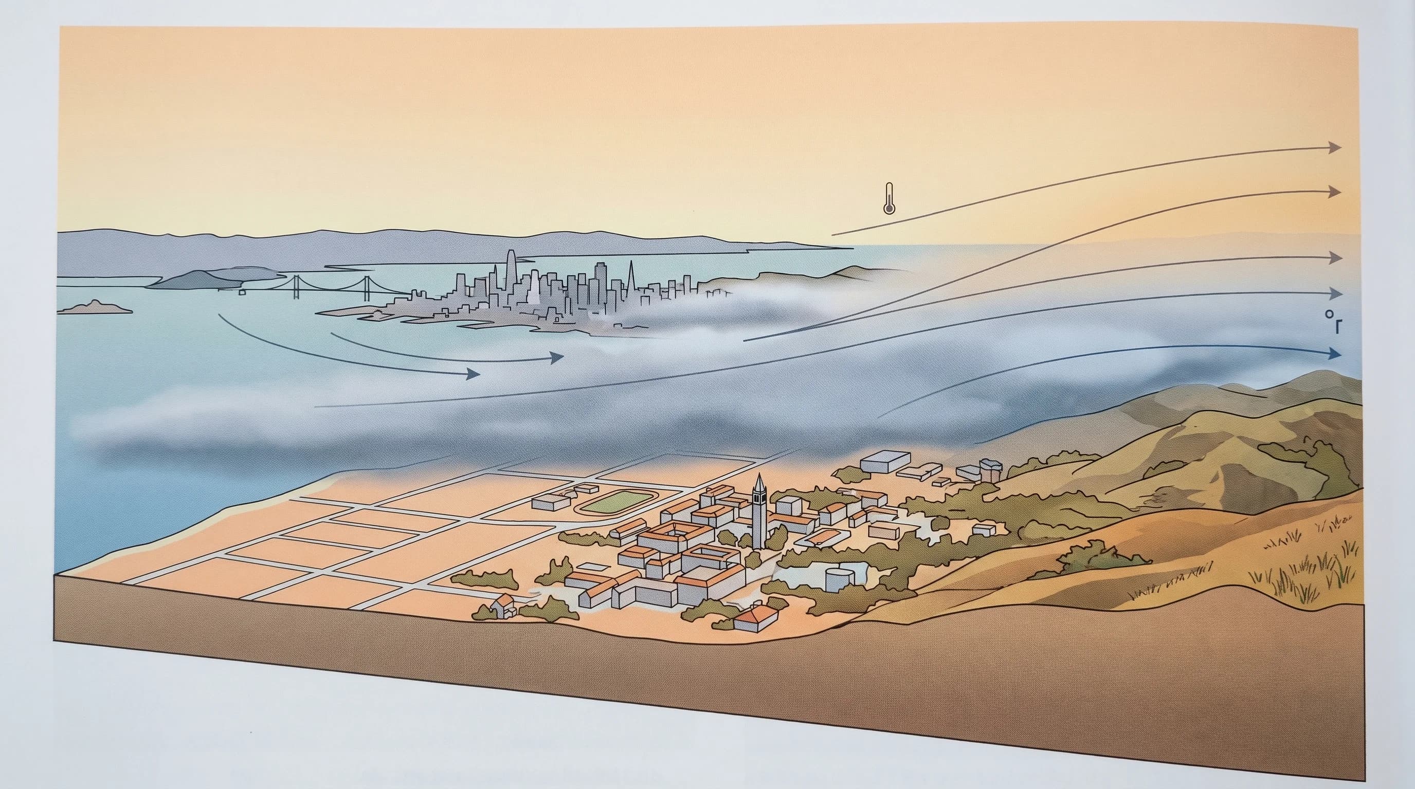
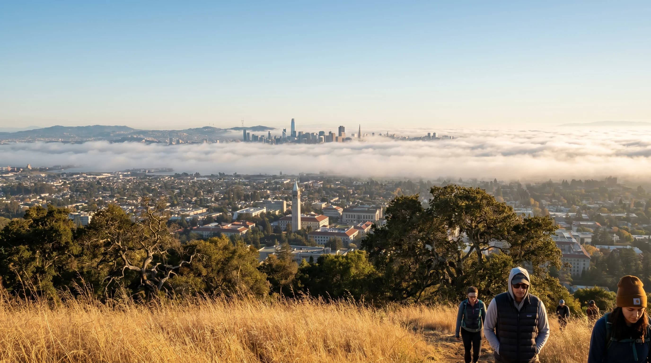
Berkeley summers are cool and foggy in the flatlands, warm and sunny in the hills. The marine layer pushes through the Golden Gate and across the bay most summer mornings, producing low clouds and cool temperatures (55-60°F) along the waterfront and the western half of the city. By early afternoon, the fog usually burns off and temperatures reach 65-72°F in the flatlands. The hills, starting around the Claremont Hotel and extending up through Claremont and North Berkeley, are often above the fog line and see sunshine from morning onward, with highs of 70-78°F.
Heat waves affect Berkeley less severely than inland cities. When Livermore hits 105°F and Concord reaches 100°F, Berkeley flatlands might see 85-90°F while the marina and waterfront stay in the 70s. The bay acts as a massive thermal buffer, and the gap between the Golden Gate and the Berkeley hills creates a natural wind corridor that channels cool marine air into the city. Even during the strongest heat events, Berkeley rarely holds extreme temperatures for more than two or three days.
How Much Rain Does Berkeley Get?
Berkeley's rainfall varies dramatically with elevation. The flatlands near the bay average 22 inches per year, comparable to San Francisco. The hills above campus average 28-32 inches, with Tilden Regional Park at the ridgeline receiving about 30 inches. This gradient is driven by orographic lift: Pacific storms approach from the west, and the East Bay hills force moist air upward, squeezing out additional rainfall on the western slopes. The difference between downtown Berkeley and the hill neighborhoods is measurable in a single rainstorm.
Nearly all rain falls between November and March, with January averaging about 5 inches in the hills. Winter temperatures are mild: highs of 55-60°F, lows of 42-46°F. Frost is rare in the flatlands but can occur in the hills on clear, calm winter nights when cold air drains into sheltered canyons. The flood risk in Berkeley is concentrated along Strawberry Creek and other urban creeks that drain the steep hillsides, particularly during intense atmospheric river events.
What Is Fire Weather Risk in the Berkeley Hills?
The Berkeley Hills are in one of the highest fire-risk zones in the Bay Area. The combination of steep terrain, dense eucalyptus and Monterey pine groves, and Diablo wind events creates conditions for catastrophic fire. The 1991 Oakland Hills fire (Tunnel Fire) burned 1,520 acres and destroyed 2,843 homes in the hills directly adjacent to Berkeley, driven by Diablo winds gusting to 65 mph with temperatures above 90°F and humidity below 10%.
Red flag warnings in the Berkeley Hills are most common from September through November, when dry vegetation, warm temperatures, and offshore wind events align. Residents in the Wildland-Urban Interface (the neighborhoods above Grizzly Peak Boulevard and along the ridgeline) should monitor fire weather forecasts closely during fire season and have evacuation plans ready. The narrow, winding hill roads can become gridlocked during evacuations, as the 1991 fire tragically demonstrated.
When Is the Best Weather in Berkeley?
September and October are Berkeley's best weather months. The summer fog retreats, temperatures in the flatlands reach a comfortable 72-78°F, the hills are warm and clear, and rain has not yet arrived. These are the months when the entire city, from the marina to the ridgeline, enjoys consistent sunshine and moderate warmth. April and May are also excellent, with green hills, wildflowers in Tilden Park, and fewer fog days than summer.
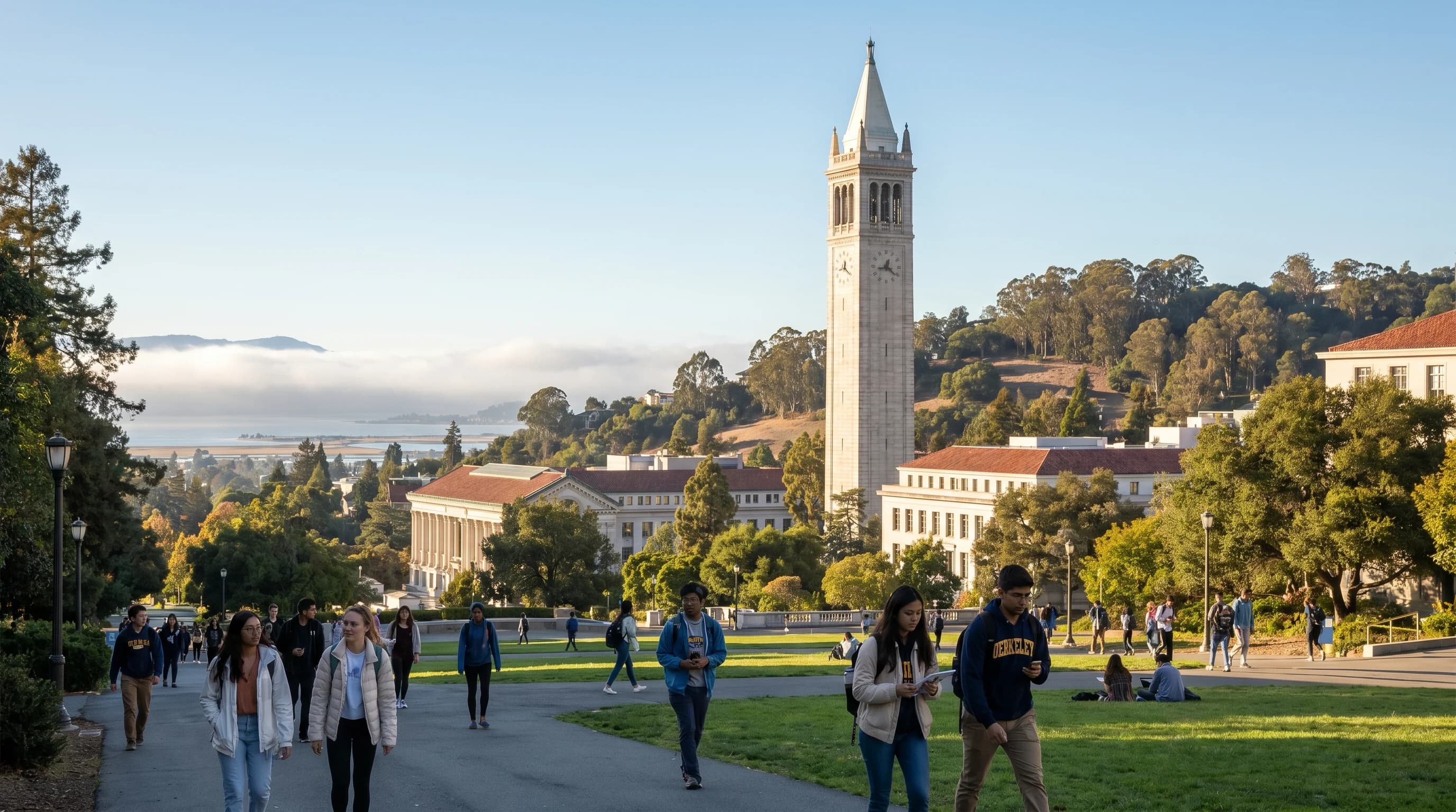
Berkeley's climate rewards people who understand its vertical dimension. A foggy, 60°F morning in the flatlands can be a sunny, 72°F morning in the hills, just a 10-minute drive apart. The university campus sits at the transition zone, where fog often hovers at the treeline of the eucalyptus groves. Knowing which elevation you will be at, and whether the fog has burned off yet, is the key to dressing correctly and planning your day in Berkeley.