destinationsmicroclimatessafety

Santa Rosa Weather Patterns

By SFBayWeather||Updated |6 min read
Santa Rosa Weather Patterns

Key Takeaways

  • Santa Rosa averages around 82°F July highs with reliable afternoon marine cooling from the Petaluma Gap, significantly warmer than San Francisco but cooler than Napa or Calistoga.
  • The 2017 Tubbs Fire, which destroyed more than 5,600 structures in Santa Rosa, burned during a Diablo wind event with 70+ mph gusts and single-digit humidity.
  • Santa Rosa receives about 29 inches of annual rainfall, more than San Francisco's 23 inches, with the wet season running November through March.
  • The Petaluma Gap delivers marine air to Santa Rosa on summer afternoons, dropping temperatures 10-15°F in an hour and making evenings reliably pleasant.
  • Sonoma Coast, just 30 miles southwest, can be 20°F cooler and fogged in at the same time Santa Rosa is sunny and 85°F. The microclimate gradient is dramatic.

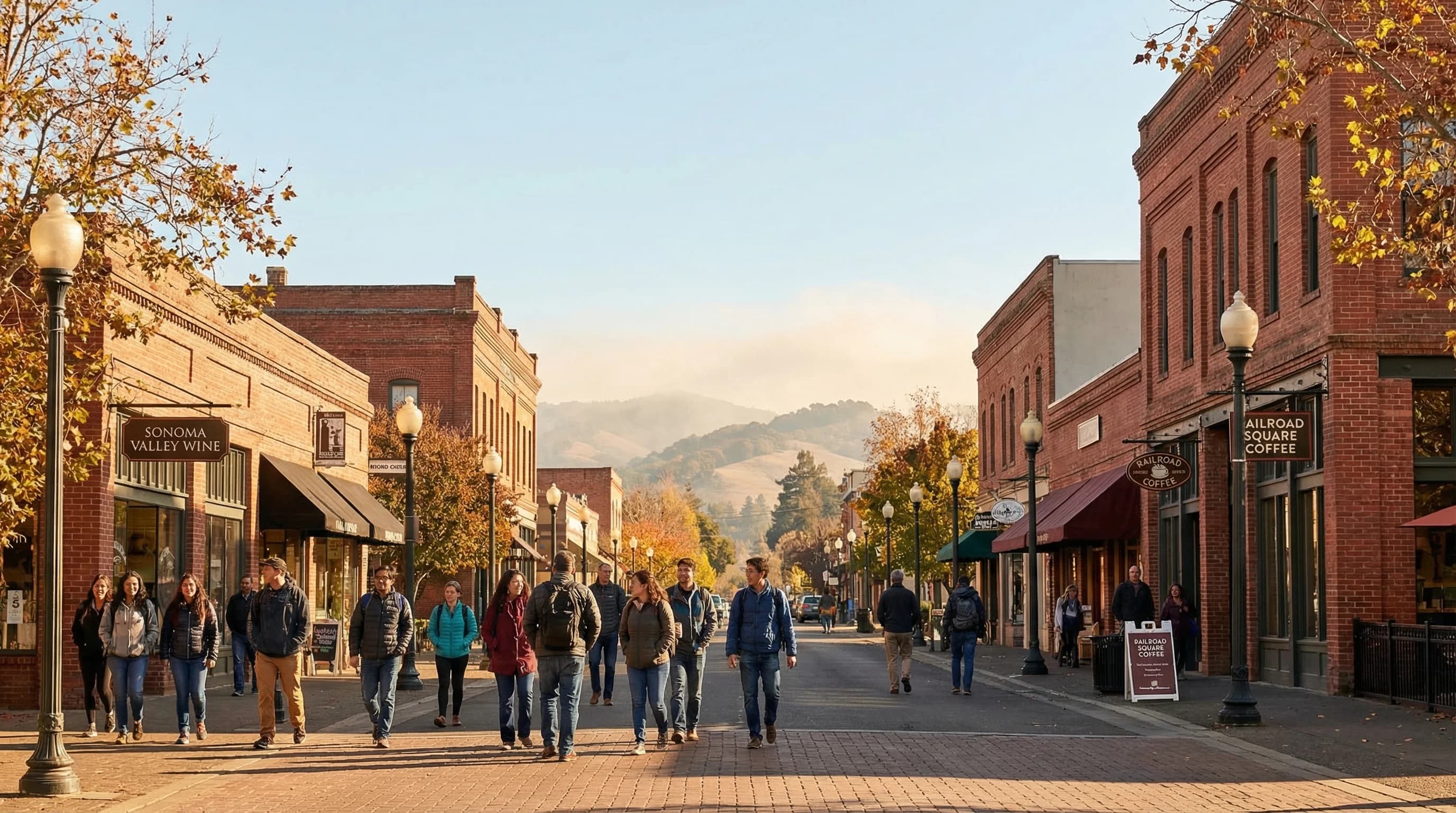
Santa Rosa sits in the heart of Sonoma County, 55 miles north of San Francisco at the head of the Santa Rosa Plain. It occupies the transitional zone between the coastal fog belt and the warmer interior valleys, giving it a climate that is more variable than the Bay Area coast and more moderate than the deep inland valleys. On a summer day, Santa Rosa often reaches the mid-80s Fahrenheit by afternoon while San Francisco sits under its marine layer at 65, but Santa Rosa is rarely as relentlessly hot as Napa or Calistoga. It is wine country weather in its most livable form, and the reason Sonoma County's vineyards have developed such distinctive character.

The Santa Rosa Climate in Context

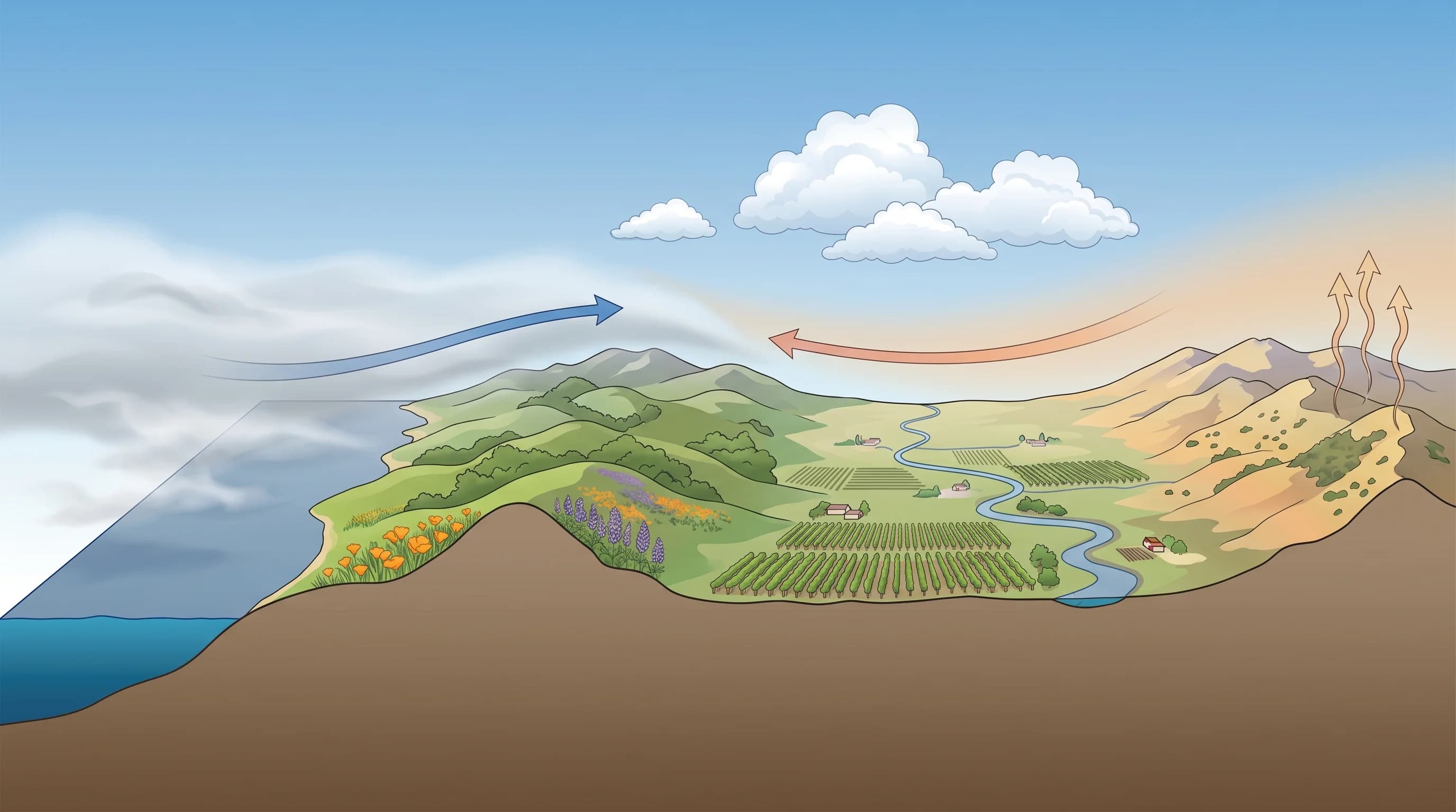
Santa Rosa benefits from proximity to the Petaluma Gap, a low point in the Coast Ranges northwest of San Francisco Bay through which marine air flows inland toward the Santa Rosa Plain. This gap provides cooling marine air on summer afternoons that moderates Santa Rosa's temperatures relative to inland valleys further from the coast. The marine air typically arrives in the late afternoon, dropping temperatures 10 to 15 degrees in an hour and making summer evenings in Santa Rosa reliably pleasant.

The seasonal climate follows a pattern familiar across Northern California: cool, wet winters from November through March, a dry spring transition with green hills and mild temperatures, a warm dry summer with the characteristic afternoon marine push, and an Indian summer window in September and October when the marine layer retreats and the valley sees its warmest, most golden weather of the year. Santa Rosa receives about 29 inches of annual rainfall, more than San Francisco's 23 inches but less than the wettest Sonoma County communities in the coastal mountains.

Santa Rosa downtown on a warm clear fall day, wine country town atmosphere with the Sonoma County hills visible in the background under blue sky
Santa Rosa occupies the transitional zone between coastal fog and interior valley heat. July highs average around 82°F with reliable afternoon marine cooling, making it one of the Bay Area's most livable climates.

Fire Weather: The Defining Risk

Santa Rosa's weather history is inseparable from the 2017 Tubbs Fire, which burned more than 5,600 structures in the city's Coffey Park and Fountaingrove neighborhoods on the night of October 8-9, killing 22 people in Sonoma County and becoming at the time the most destructive wildfire in California history. The fire ignited during a Diablo wind event with gusts exceeding 70 mph and relative humidity in the single digits, the conditions that make Sonoma County's fall fire season one of the most dangerous in the state.

Scientific illustration explaining Santa Rosa Weather Patterns

The same autumn warmth and offshore wind pattern that makes October in Santa Rosa feel like a gift, with clear skies, warm temperatures, the harvest in full swing in the surrounding vineyards, is the pattern that creates catastrophic fire risk. The dry summer vegetation, the low humidity, and the hot, dry Diablo winds combine to produce a fire environment where ignitions spread rapidly. Santa Rosa and the broader North Bay now maintain extensive fire weather monitoring and evacuation protocols that residents treat as routine preparation, not exceptional emergency measures.

Wine Country Weather and the Cool Coastal Divide

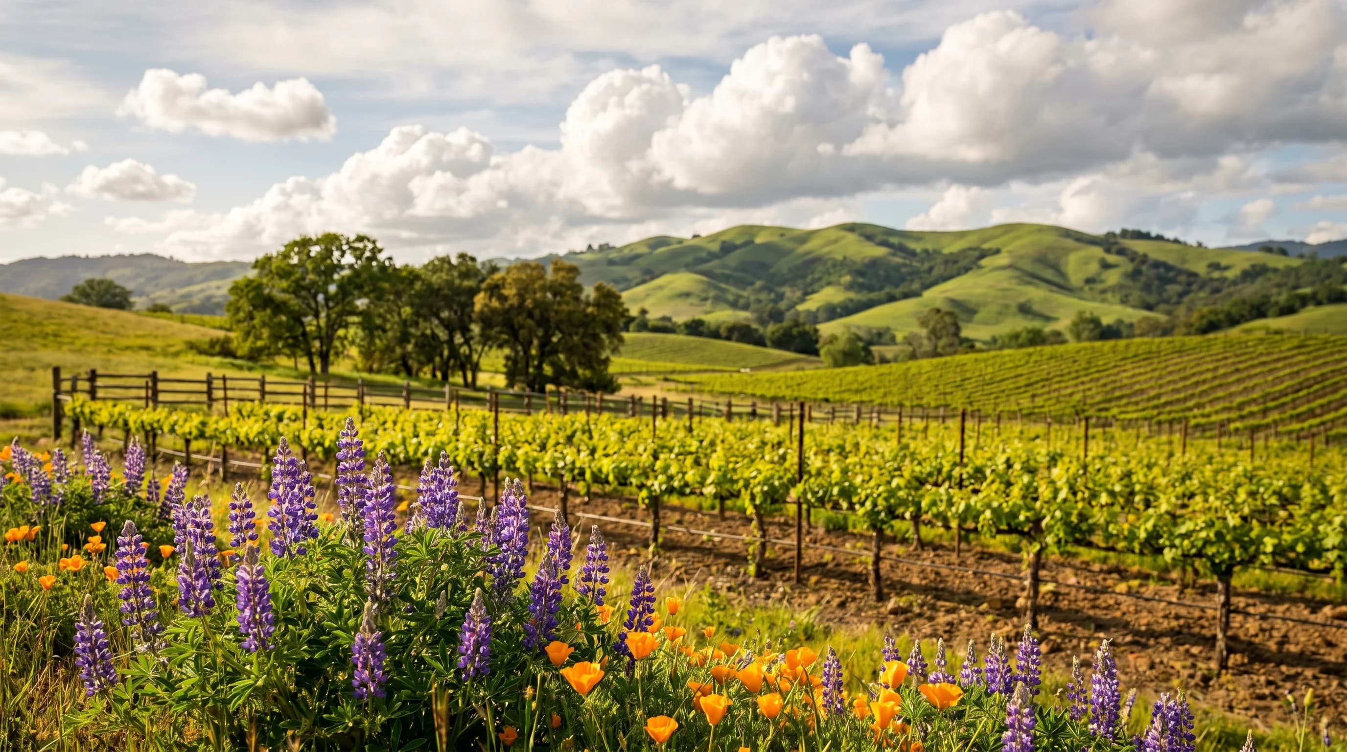
Sonoma County's wine country is not a single climate. The Sonoma Coast appellation, closest to the Pacific, is dramatically cooler and foggier than the Sonoma Valley, just 15 miles east. The Russian River Valley, which follows the river's path toward the coast, is specifically cooled by marine air flowing up the river corridor, making it one of California's most reliable regions for cool-climate varieties like Pinot Noir. Santa Rosa sits at the northern edge of this system, warm enough for Cabernet Sauvignon in its warmer blocks but cool enough to maintain the acid structure that wine regions need.

For visitors to Santa Rosa, the practical weather implication is that summer afternoons are warm and pleasant but not oppressive, evenings are reliably cool after the marine push, and the surrounding countryside transitions rapidly from warm valley to cool coast within a 20-minute drive. The variation in microclimate between Santa Rosa and Bodega Bay, barely 30 miles to the southwest, rivals anything the Bay Area produces. The same fog that keeps Bodega Bay in the 60s can leave Santa Rosa sunny and 85, on the same afternoon, as clearly as if the two towns were in different climate zones.

Frequently Asked Questions

What is the weather like in Santa Rosa?

Santa Rosa has a Mediterranean climate with wet winters and warm, dry summers. July highs average around 82°F, with afternoon cooling from the Petaluma Gap typically dropping temperatures to the low 60s by evening. Winters are mild and rainy, with most of the 29-inch annual rainfall falling November through March. Fall (September-October) brings warm, clear Indian summer conditions that are locally beloved but also carry the highest wildfire risk of the year.

Is Santa Rosa at risk of wildfires?

Yes, significantly. The 2017 Tubbs Fire destroyed more than 5,600 structures in Santa Rosa's Coffey Park and Fountaingrove neighborhoods during a Diablo wind event in October. The combination of dry summer vegetation, low autumn humidity, and hot offshore winds creates severe fire conditions every fall. Santa Rosa and Sonoma County now maintain extensive fire weather monitoring and evacuation protocols. The city has rebuilt with improved fire-resistant construction and expanded defensible space requirements.

When is the best time to visit Santa Rosa?

May through June for mild weather, green hills, and active harvest preparation in the wine country. September and October for warm, clear Indian summer conditions and harvest season in the vineyards. Summer (July-August) is warm and pleasant with reliable afternoon cooling. January through March is the rainy season but also the quietest and most affordable for wine country visits. Avoid late October and November on high fire-risk days, when Diablo wind events can make outdoor conditions both hazardous and unpleasant.

How does the Petaluma Gap affect Santa Rosa's summer weather?

The Petaluma Gap is a low corridor in the Coast Range that connects San Pablo Bay to the Santa Rosa Plain, allowing the afternoon sea breeze to penetrate north into Sonoma County. Most summer days, this marine air arrives in Santa Rosa between 2 and 4 p.m., dropping temperatures 10-15°F within an hour. Without this mechanism, Santa Rosa would rival Calistoga for heat. With it, evenings are reliably pleasant in the low-to-mid 60s°F even after 90°F afternoons.

How much does Santa Rosa's rainfall differ from San Francisco?

Santa Rosa receives about 29 inches of annual rainfall versus San Francisco's 23 inches. The difference comes from orographic lift: as Pacific storms move inland, air rises over the North Bay hills and mountains, enhancing precipitation in Sonoma County. The wettest years coincide with strong El Nino winters, when Santa Rosa has recorded 55-60 inches. The wet season runs from November through March, with summer months receiving essentially no rainfall.

Live Bay Area Conditions

Compare fog, temperature, wind, and comfort across the map.

See which microclimates are clear, cool, windy, or warming up right now.

Open the Weather Map
🔒Privacy Policy📄Terms of Service