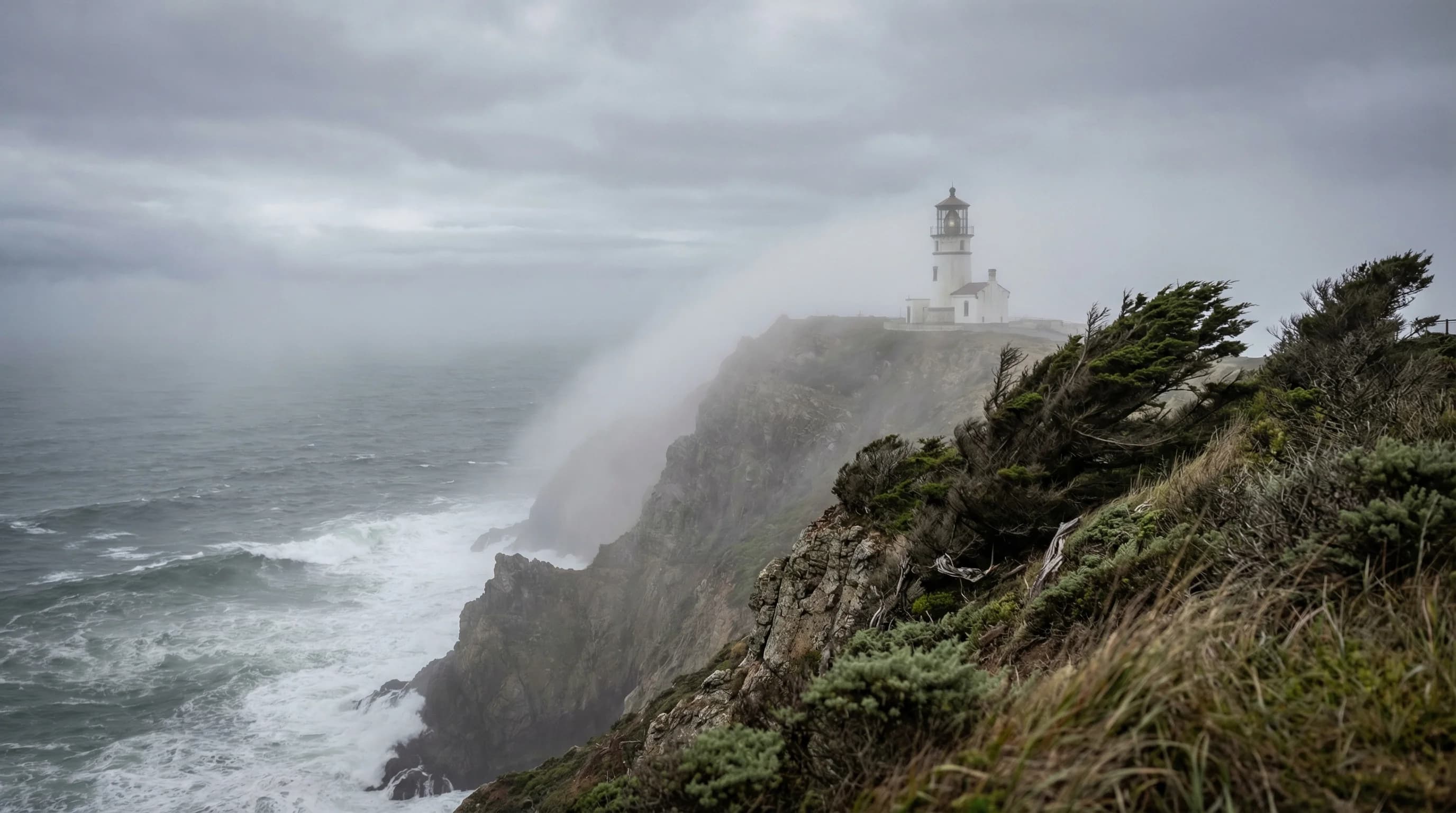
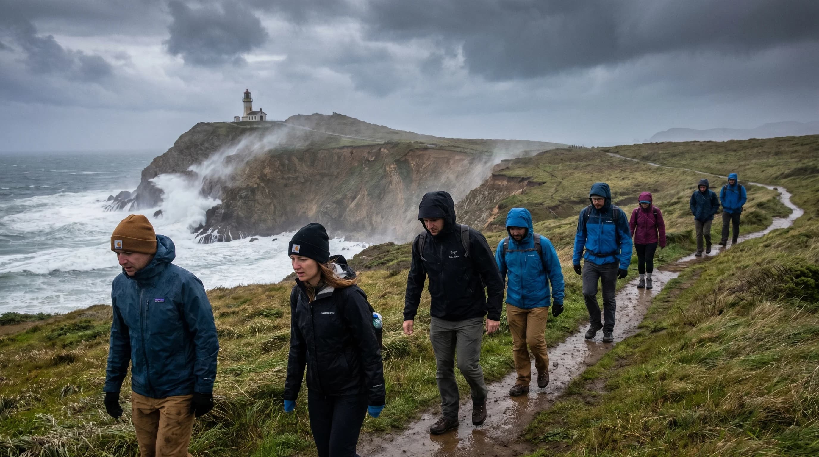
Point Reyes National Seashore is the most exposed piece of coastline in the Bay Area, a triangular peninsula that juts 10 miles into the Pacific and intercepts everything the ocean sends toward the California coast. The lighthouse at Point Reyes is one of the windiest and foggiest spots in the entire United States, routinely recording fog for more than 100 days a year and wind gusts that exceed 100 miles per hour in storms. This is not typical Bay Area weather as San Francisco residents experience it. Point Reyes is a genuinely harsh maritime environment, and visiting it requires preparation that most Bay Area destinations do not demand.
Why Point Reyes Is So Foggy
Point Reyes juts directly into the path of the California Current, the cold southward-flowing ocean current that keeps Northern California's coastal waters in the low to mid-50s Fahrenheit. The peninsula's orientation means that prevailing northwest winds blow almost directly onshore, pushing warm moist air over cold water and generating advection fog with exceptional efficiency. The lighthouse, at the tip of the point, has no geographic protection whatsoever from this process.
The fog statistics at Point Reyes are striking. The lighthouse area averages over 2,000 hours of fog per year, making it one of the foggiest coastal stations in North America. During peak summer months, the lighthouse can be in fog for 20 or more consecutive days without a clear break. The interior of the park, sheltered by the Inverness Ridge, fares somewhat better, but even pastoral areas like Bear Valley and Drakes Estero see frequent fog and overcast conditions throughout summer.
The Inverness Ridge Divide
Tomales Bay and the Inverness Ridge create a dramatic weather divide within the park. The western side of the ridge, Point Reyes proper, sits fully exposed to the Pacific and catches the full marine layer. The eastern side of the ridge, overlooking Tomales Bay and the pastoral farming areas toward Olema, is partially sheltered and often significantly warmer and clearer. The town of Inverness, tucked along the eastern shore of Tomales Bay, can be sunny and calm on days when the lighthouse is in dense fog just a few miles away.
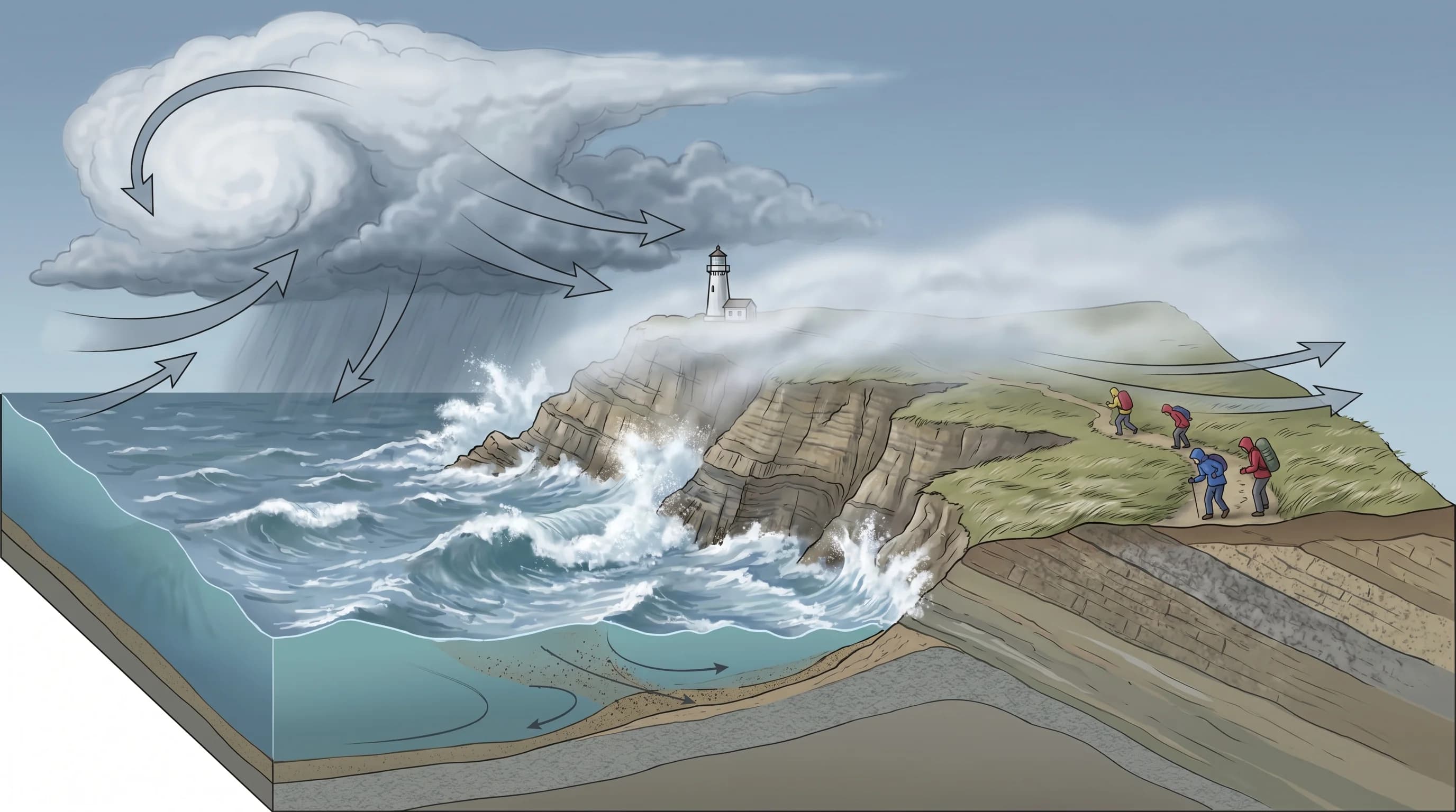
This divide makes a significant difference for hiking strategy. Trails on the western exposures, the Tomales Point trail, the coastal trail to Chimney Rock, the path to the lighthouse itself, can be cold, windy, and foggy even when conditions seem pleasant at the Bear Valley visitor center. The hike from the lighthouse parking area to the lighthouse stairs is one of the windiest walks in the Bay Area, and the sign at the trailhead that warns of wind gusts strong enough to knock people down is not hyperbole. People have been knocked down.
Wildlife Seasons and Weather
Point Reyes is one of the best wildlife viewing areas in California, and the timing of wildlife activity aligns interestingly with the park's weather patterns. Elephant seal pupping occurs at Drakes Beach from January through March, during the wet season when the park is at its most dramatic with storm swells and green hills. Gray whale migration runs from December through April, with peak viewing in January when the southbound migration brings large numbers of whales within viewing range of the lighthouse headlands. The northbound return migration, when mothers travel with calves, peaks in March and April.
Fall brings tule elk rut to Tomales Point, when the resident elk herd's bulls bugle and spar in the golden grasslands with Tomales Bay below. September and October are generally the park's best weather months, with the marine layer retreating and afternoon temperatures warming enough for comfortable hiking. The wildflower season runs from February through April, coinciding with the end of the rainy season and producing remarkable color on the headlands and mesa grasslands.
Practical Weather Preparation
Point Reyes rewards visitors who prepare for conditions rather than hoping for conditions. The standard advice, bring layers, bring a windproof jacket, expect fog, applies year-round and especially in summer. Visitors who arrive in July in shorts and sandals expecting a warm coastal experience frequently turn around at the lighthouse after five minutes in 40-mile-per-hour wind and 55-degree fog.
A windproof layer is more important than a heavy jacket. The wind at Point Reyes is the defining discomfort, not the temperature alone. A thin windshell makes 55 degrees and 25 mph wind perfectly comfortable; without it, the same conditions feel miserable. The Bear Valley area, which sits in the sheltered valley behind the ridge, is consistently 10 to 15 degrees warmer than the lighthouse and a much more forgiving environment for visitors not equipped for full maritime conditions. Planning to see the lighthouse early in the morning before the afternoon wind peaks is a significant improvement over an afternoon visit.