The Bay Area has two distinct fog systems operating simultaneously, and they have almost nothing in common beyond being made of the same water droplets. Coastal fog, the marine layer that defines San Francisco summers, forms over the cold Pacific Ocean and moves inland on the afternoon wind. Inland fog, which blankets valley floors in Napa, Livermore, and Petaluma on winter mornings, forms in place on land through radiative cooling on calm, clear nights. The two types arrive at different times of year, behave differently through the day, and affect entirely different parts of the region. The distinction explains why the Bay Area's fog experience varies so dramatically depending on where you are and what month it is.
Coastal Fog: The Marine Layer
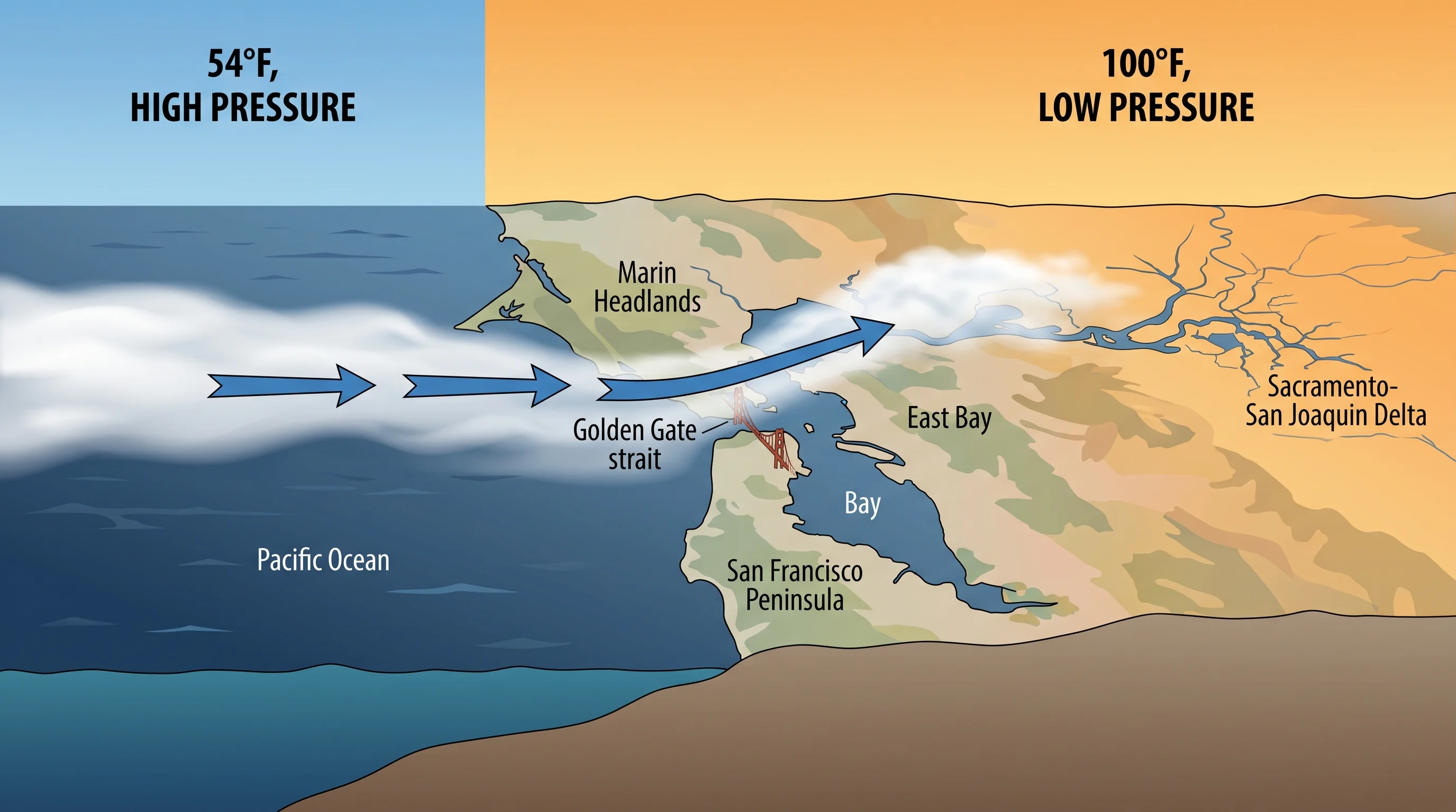
Coastal fog in the Bay Area is advection fog. It forms when warm, moist air flows over the cold California Current, cools to its dew point, and condenses into a low cloud bank over the ocean surface. The fog bank sits offshore until the afternoon pressure gradient, driven by hot inland air, pulls it through the Golden Gate and along the coast. It is fundamentally a summer and early fall phenomenon, because that is when the contrast between cold ocean water and hot inland temperatures is greatest.
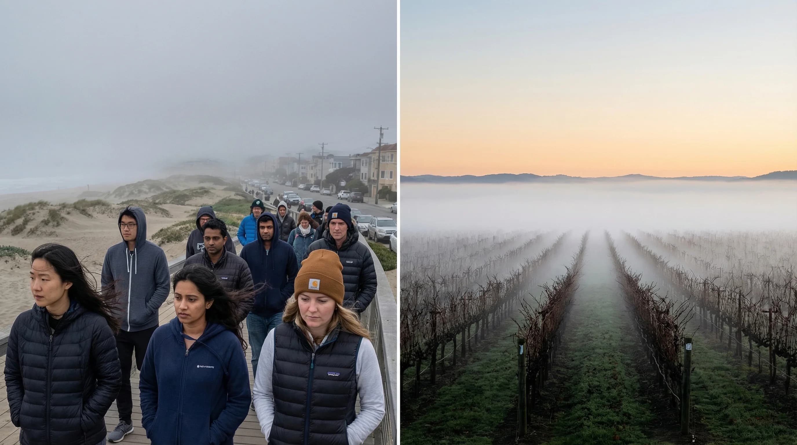
Coastal fog is most intense from May through September. During this period, the Outer Sunset and Outer Richmond in San Francisco can spend more than half their daylight hours in dense fog. The fog arrives with wind, typically in the afternoon or evening, and retreats in the morning when solar heating warms the surface enough to evaporate the fog layer from the ground up. The burn-off is partial and variable: on strong marine push days, the fog may never fully clear. On weak days, it retreats to the coast by noon.
The geography of coastal fog follows the Bay's topography. The Golden Gate is the primary entry point, and neighborhoods directly downwind of it see the most fog. As the marine layer moves inland, it encounters warmer surfaces and gradually thins. San Francisco's western neighborhoods are far foggier than the Mission District. Oakland is sunnier than the Sunset. Walnut Creek and Livermore, shielded by the East Bay hills, may have 30 degrees more warmth on the same afternoon.
Inland Fog: Radiation Fog in Bay Area Valleys
Inland fog in the Bay Area is radiation fog. It forms through a completely different mechanism: on clear, calm nights, the ground loses heat by radiating infrared energy into space. The air in contact with the ground cools along with it. When that air reaches its dew point, the water vapor condenses into fog. The fog pools in low-lying areas where cold air drains and accumulates: valley floors, creek corridors, and flat basins.
Inland fog is a winter and fall phenomenon. It requires long nights for the ground to cool sufficiently, clear skies that allow maximum heat loss, and calm winds that let the surface air stratify. In the Bay Area, the prime inland fog season runs from October through February. The Napa Valley, Sonoma Valley, Livermore Valley, and Petaluma lowlands are the most fog-prone inland locations. These are exactly the places where cold air pools: flat, low-elevation terrain sheltered from the wind that breaks up surface stratification.
The behavior of inland fog is more predictable than coastal fog because it depends on local solar heating to clear. By 10 a.m. or noon on most winter days, inland fog has burned off completely, leaving sunny and relatively warm afternoons even in December. This pattern, foggy cold morning followed by sunny warm afternoon, is the defining character of a Bay Area inland valley winter day.
Key Differences at a Glance
The easiest way to tell coastal and inland fog apart is timing and season. If it is June and foggy in San Francisco, it is coastal fog. If it is December and foggy in Napa, it is inland radiation fog. The seasonal and geographic separation is usually that clean.
Coastal fog arrives in the afternoon and evening with wind, driven by the pressure gradient. Inland fog forms after midnight and thickens toward dawn with calm or no wind. Coastal fog can persist all day when the pressure gradient is strong. Inland fog almost always clears by noon as solar heating warms the surface. Coastal fog is thicker and more persistent along the immediate coast and thins as it moves inland. Inland fog is thickest in the valley center and clears first at the edges where the terrain is higher and the sun reaches the surface sooner.
When Both Types Coexist
There are periods, particularly in October and November, when both fog systems operate simultaneously in different parts of the Bay Area. A coastal marine layer may push fog through the Golden Gate and into the western neighborhoods of San Francisco at the same time that radiation fog is filling the Napa and Livermore valleys overnight. The result is a Bay Area where almost no location is completely clear: the coast is gray from the marine layer, the inland valleys are white from ground fog, and the ridgelines and hills between them may be the only places with clear air.
For planning purposes, the coexistence of both systems in late fall means that finding clear, warm weather anywhere in the Bay Area requires checking specifically which type of fog is operating. On a morning when radiation fog fills Napa but the marine layer is weak, heading to Napa early and waiting for the inland fog to burn off by 10 a.m. can yield a perfect afternoon. On a morning when the marine layer is strong but there is no inland fog, the East Bay hills and Marin peaks may be clear while the coast and the valleys are both foggy for different reasons.