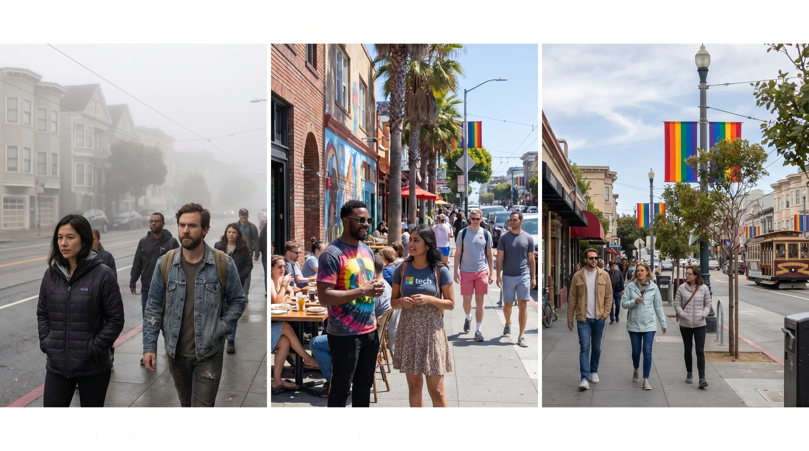
If you have ever stood in the sunny Mission District and watched your friend in the Outer Sunset report gray skies and 62 degrees while you are eating outside in a t-shirt, you have experienced one of the most striking features of San Francisco weather: the fog does not blanket the city uniformly. It targets specific neighborhoods with almost surgical precision, leaving others largely untouched. That pattern matters for tourists, day-trippers, and especially anyone thinking about where to live in San Francisco.
How Hyper-Local Is the Variation?
Very hyper-local. On a typical foggy July day, the Outer Sunset might sit at 62 degrees with 18 or more foggy days logged for the month. The Mission District, three miles to the east and sheltered by a ridge of hills, runs 72 degrees and sees only 8 to 10 foggy days in the same month. That 10-degree difference across a short drive represents a meaningfully different summer experience. Extend the comparison to the Castro, which sits at 200 to 400 feet of elevation, and you find neighborhoods averaging as few as 6 foggy days per month. The Richmond District, facing the bay and partially exposed to marine flow, averages closer to 17 foggy days at around 64 degrees.
These are not anecdotal impressions. San Francisco's fog patterns have been studied and mapped in detail, and the broader pattern of San Francisco microclimates holds consistent from year to year because it is driven by fixed geography, not random weather variability. The fog follows the terrain. Knowing the terrain tells you almost everything you need to know about the fog.
Elevation Is the Strongest Predictor
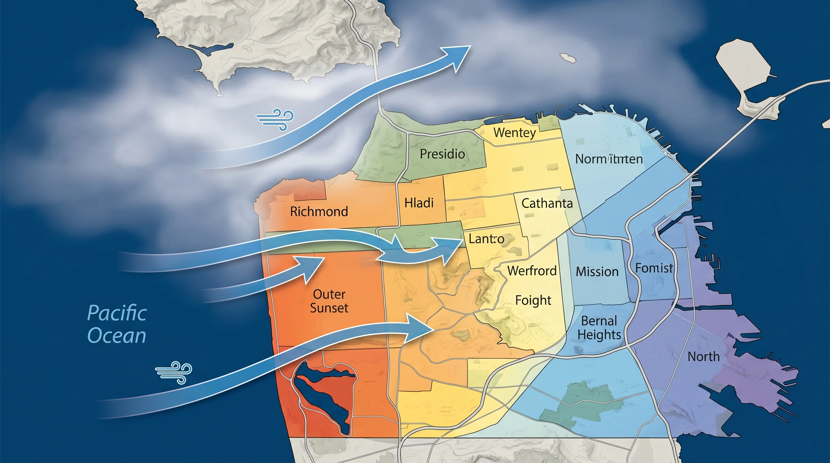
The marine layer that flows into San Francisco typically runs 300 to 800 feet thick. Neighborhoods that sit below that ceiling are inside the fog. Neighborhoods that sit above it are in the sun. As a rough rule, every 100 feet of elevation corresponds to approximately 1.5 to 2 degrees of additional warmth when the marine layer is present, because you are either at the top of the fog layer or above it entirely.
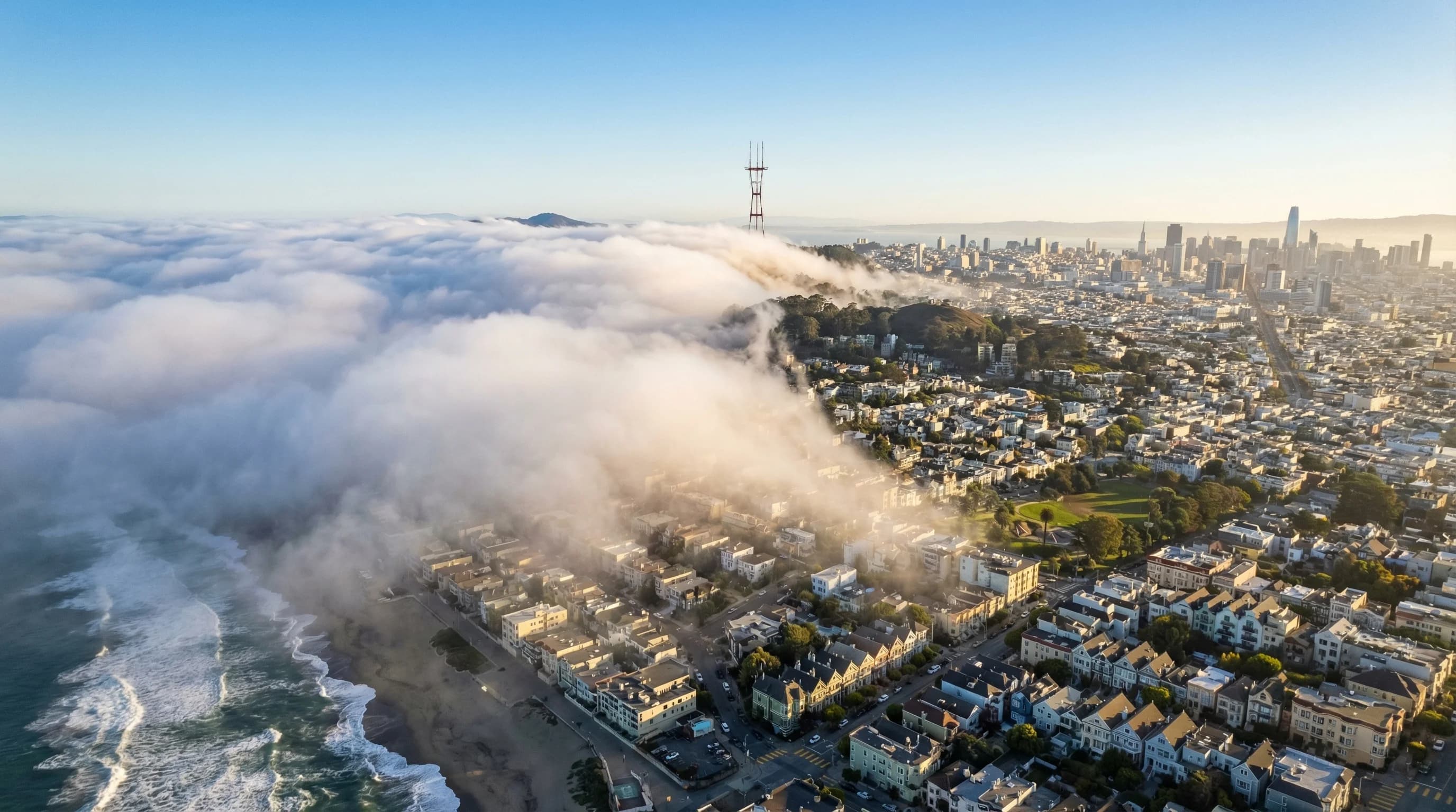
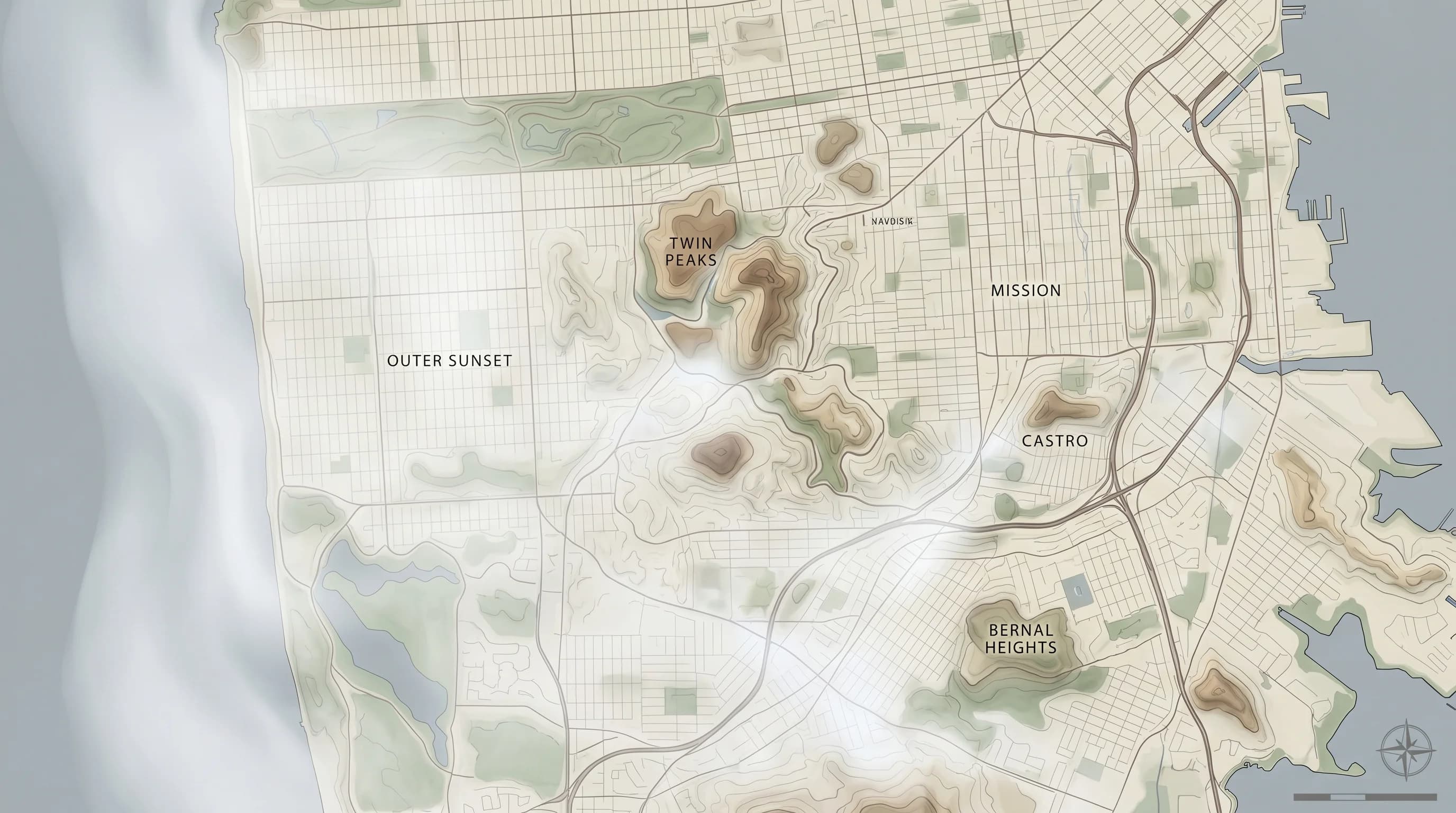
Twin Peaks, at 922 feet, regularly pokes above the fog deck on mornings when the rest of the city is socked in. Driving up Twin Peaks on a foggy morning and watching the city disappear below a white cloud layer while the summit sits in full sunshine is one of the more surreal weather experiences San Francisco offers. The Castro, Noe Valley, Diamond Heights, and the upper slopes of Bernal Hill all benefit from this elevation advantage to varying degrees. They are not fog-free, but they are fog-reduced in a way that their western counterparts at sea level simply are not.
Ocean Exposure and Wind Direction
Elevation explains much of the pattern but not all of it. A neighborhood at 100 feet facing directly west toward the Pacific will see far more fog than a neighborhood at 100 feet sheltered behind a ridge. The Outer Sunset faces Ocean Beach with no terrain buffer between it and the Pacific. When marine air streams in from the west, the Outer Sunset gets it first, gets it strongest, and keeps it longest. The neighborhood essentially has a front-row seat to the fog delivery mechanism.
Daly City, just south of San Francisco's city limits, has the unfortunate distinction of being the foggiest city in the Bay Area, averaging more than 20 foggy days per month during peak summer months. It sits at the top of the San Francisco Peninsula with direct ocean exposure on three sides and almost no terrain shelter. Its elevation is not enough to rise above the marine layer, and its position ensures maximum exposure to marine flow. People who move to Daly City from warmer inland locations are sometimes genuinely shocked by what they signed up for.
Wind Tunneling and Street-Level Effects
San Francisco's street grid, famously laid out in a flat grid pattern over extremely hilly terrain, creates wind tunnels that concentrate marine air flow in predictable corridors. Streets that run east-west, aligned with the prevailing marine wind direction, funnel fog more efficiently than north-south streets that cross the flow. This is why walking one block can sometimes feel like stepping from one microclimate into another. The fog and wind concentrate where the geometry of streets gives them a clear path through the city.
The Wiggle, the famous bike route that zigzags through the city to avoid hills, follows terrain that also happens to channel marine air particularly well. The Lower Haight and western SoMa neighborhoods sit in fog corridors that extend the marine layer's reach further east than their elevation would suggest. Conversely, some neighborhoods just east of the Twin Peaks and Sutro Tower complex enjoy a degree of shelter from the terrain that is not obvious from looking at a flat map.
A Practical Neighborhood Comparison
On a typical foggy July morning, the Outer Richmond and Outer Sunset sit at 62 to 64 degrees with dense fog and no expectation of seeing the sun before noon, if at all. Inner Richmond runs a degree or two warmer and burns off a bit faster. Not dramatically different, but meaningfully so across the summer as a whole. The Marina and Fisherman's Wharf area, facing the bay from the north, gets marine air from a different angle and has its own fog behavior, often clearing earlier than the westside neighborhoods.
Noe Valley has a reputation as a fog-sheltered neighborhood, and the reputation is earned. Surrounded by the Twin Peaks ridge to the north and west, it catches warm air that has been compressed coming down the lee side of the terrain. The Mission District, similarly sheltered by Potrero Hilland the general eastern exposure of the neighborhood, runs consistently warmer and sunnier than the city's western half. These are neighborhoods where having a backyard makes actual sense in July, which is not something you can say about the Outer Sunset.
Where to Live or Visit If Weather Matters to You
If you prioritize sun when choosing a San Francisco neighborhood, the answer is fairly clear: east-facing, elevated, or sheltered neighborhoods. The Castro, Noe Valley, the Mission, Bernal Heights, and the Upper Market area give you the best odds of afternoon sun in summer. Inner neighborhoods east of Twin Peaks offer genuine warmth on days when the Outer Sunset is still fogged in at 3pm. For visitors staying in hotels, the difference between a hotel in Union Square and one on the west side of the city can be meaningful if you are visiting in July and hoping to eat lunch outside.
For people willing to cross the bay, the calculus becomes even simpler. Oakland and Berkeley, sheltered by the East Bay hills from the worst marine intrusions, run consistently warmer through the summer months. The commute by BART from the East Bay into San Francisco takes 15 minutes and crosses a 10 to 15 degree temperature boundary on most summer mornings. Many people who work in San Francisco and care about summer weather choose to live in the East Bay precisely for this reason, spending their evenings in the warmth rather than the fog.
The Bottom Line
San Francisco's neighborhood fog patterns are not random. They are the direct expression of terrain, elevation, and ocean exposure acting on a predictable marine layer system. The fog knows where the low ground is, which way the streets run, and where the ridgelines are. Once you learn to read the terrain the same way the fog does, the weather stops feeling arbitrary and starts feeling almost logical. And you will never again book a July vacation rental in the Outer Sunset without knowing exactly what you are choosing.