Mount Tamalpais is Marin County's dominant peak at 2,574 feet, and it produces some of the most variable and dramatic weather in the Bay Area. The mountain sits directly in the path of the Pacific marine layer, intercepts more rainfall than almost anywhere else in the region, and offers hikers the experience of moving through radically different microclimates within a single outing. The summit can be sunny and warm while the western slopes are wrapped in fog; the eastern flanks can be 20 degrees warmer than the coast-facing ridgeline. Knowing how the mountain's weather works is genuinely important for anyone planning to hike there; it changes not just what to wear but whether to go at all.
The Fog Machine: Western Slopes and the Marine Layer
Mount Tamalpais sits in the direct path of the summer marine layer. The westerly onshore flow carries the Pacific fog directly into the mountain's western face, where the terrain forces the air upward and the fog condenses against the slopes. The western flanks of Tam, from the Bolinas Ridge down to the coast, experience the densest and most persistent fog of any terrain in the Bay Area. Trails like the Matt Davis and Steep Ravine routes that traverse the western slopes can be completely socked in with fog and temperatures in the low 50s Fahrenheit on days when the summit is in sunshine.
The fog on the western slopes captures moisture through fog drip, feeding the dense redwood and Douglas-fir forests that cover the lower elevations. These forests stay remarkably green through the dry summer precisely because the fog compensates for the absence of rain. Muir Woods, on the mountain's southern flank, is the most famous expression of this fog-fed forest ecosystem.
Summit Weather: Above the Marine Layer
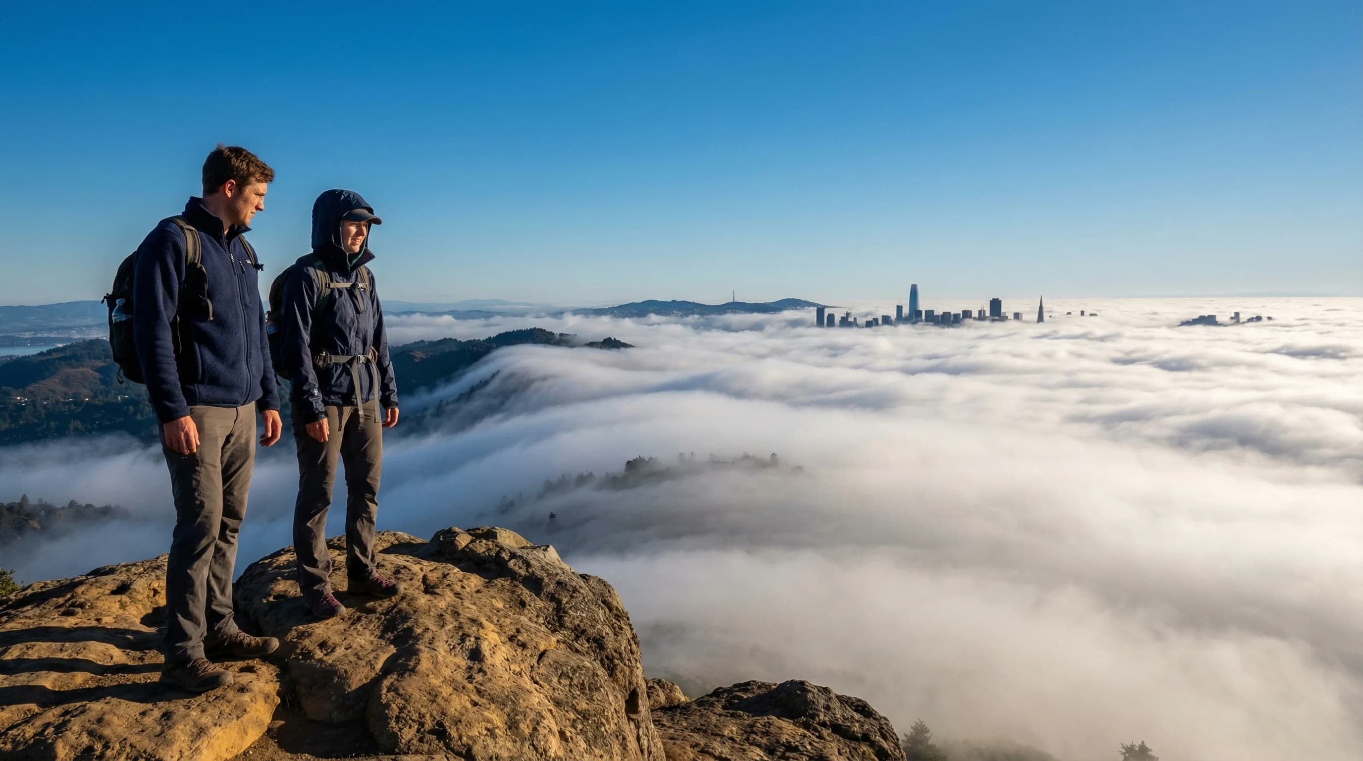
The summit of Mount Tamalpais typically sits above the marine layer's ceiling on summer mornings, at least initially. The marine layer in summer often has a top between 1,500 and 2,000 feet, which means the summit at 2,574 feet pokes above the fog into sunshine while the slopes below are buried in gray. This inversion creates the dramatic "sea of fog" views that draw photographers to the summit at dawn: a flat white layer of cloud stretching to the horizon, with only the tops of the hills and the summit itself visible.
As the morning progresses, the marine layer either retreats (allowing the fog to clear from below and sunshine to reach the slopes) or rises and thickens (enveloping the summit in fog by midday). Which happens depends on the strength of the marine push on that particular day. On strong marine push days, the fog climbs above 2,574 feet and the summit disappears into cloud by late morning. On weak marine push days, the fog burns off entirely by noon and the summit has panoramic views of the Bay, the ocean, and the city.
Rainfall: The Wettest Mountain in the Bay Area
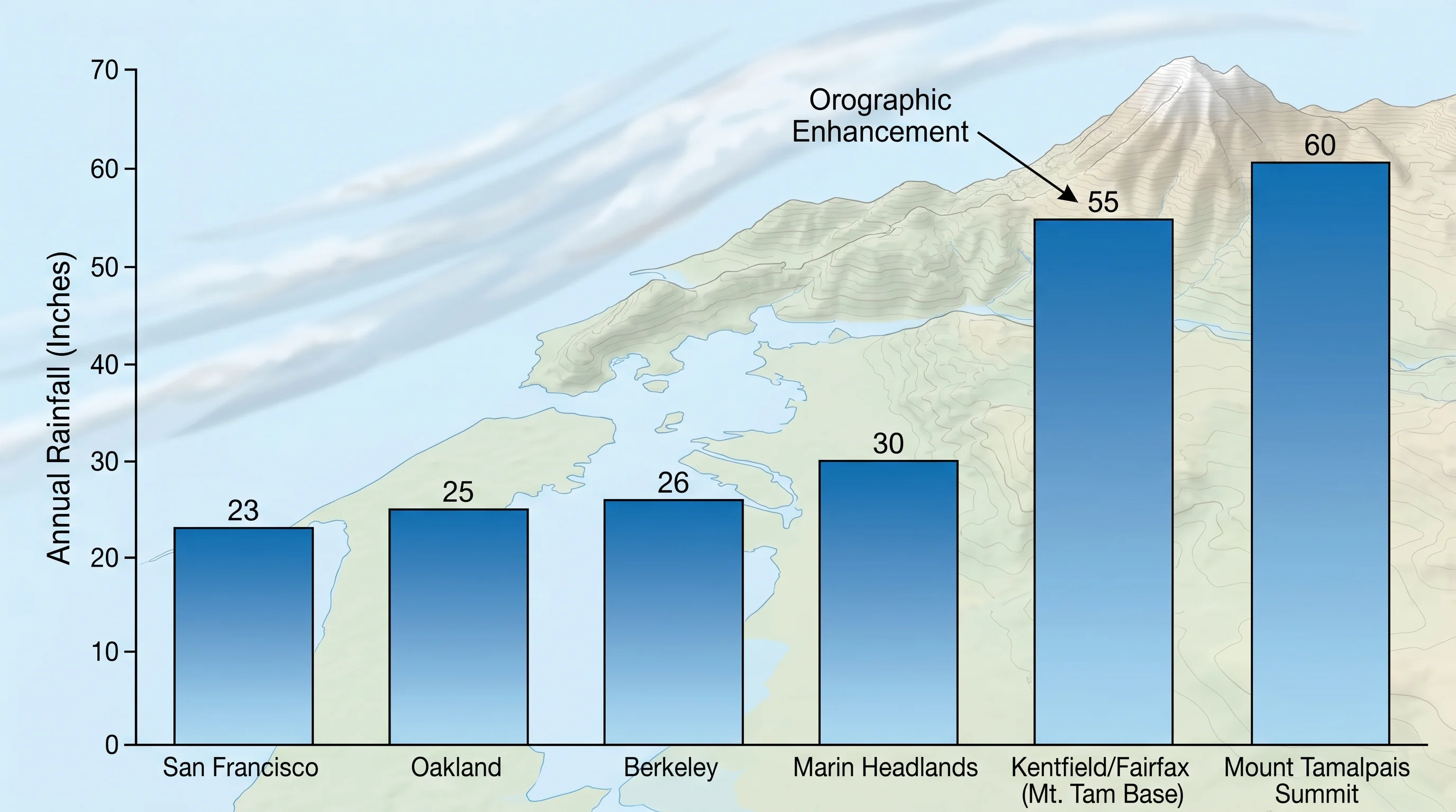
Mount Tamalpais and the surrounding Marin watershed receive more annual rainfall than virtually anywhere else in the Bay Area. The community of Kentfield, just east of the mountain in the Ross Valley, averages around 50 to 55 inches of rainfall per year, more than twice San Francisco's 23 inches and far more than the inland East Bay. The mountain intercepts orographic precipitation effectively: storms approaching from the Pacific are forced upward against the terrain, cooling and condensing as they rise, dropping disproportionate rainfall on the windward slopes.
In wet winters, the mountain's streams run full and waterfalls appear on slopes that are dry in summer. The Cataract Trail on the mountain's north side hosts waterfalls that are among the most dramatic in the Bay Area during strong rain years. The watershed feeds the reservoirs of the Marin Municipal Water District, which serves most of Marin County, making the mountain's rainfall not just scenically important but practically vital to the regional water supply.
Best Conditions for Hiking Mount Tamalpais
The best hiking conditions on Mount Tamalpais depend on what experience you are seeking. For summit views, clear fall days in September and October offer the highest probability of panoramic visibility from the East Peak. Spring days after winter rains are excellent for green hills and flowing streams, though trails can be muddy. Summer offers the dramatic fog-over-bay experience from the summit, but hikers on the western slopes should plan for cold, wet fog regardless of conditions elsewhere.
The most important rule for hiking Mount Tamalpais: always bring a layer, always. The temperature difference between the parking areas on the east side of the mountain, where conditions may be warm and sunny, and the summit ridge or western slopes, where wind and fog can be intense, is often 15 to 20 degrees Fahrenheit. A hiker who starts in Mill Valley at 72 degrees and crosses to the west-facing ridgeline in a T-shirt will be cold within minutes. The mountain's weather is not merely variable; it is geographically stratified in ways that require preparation regardless of what the Bay Area forecast says.