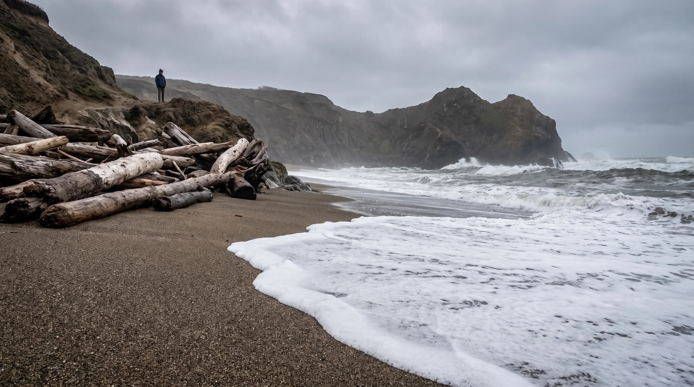
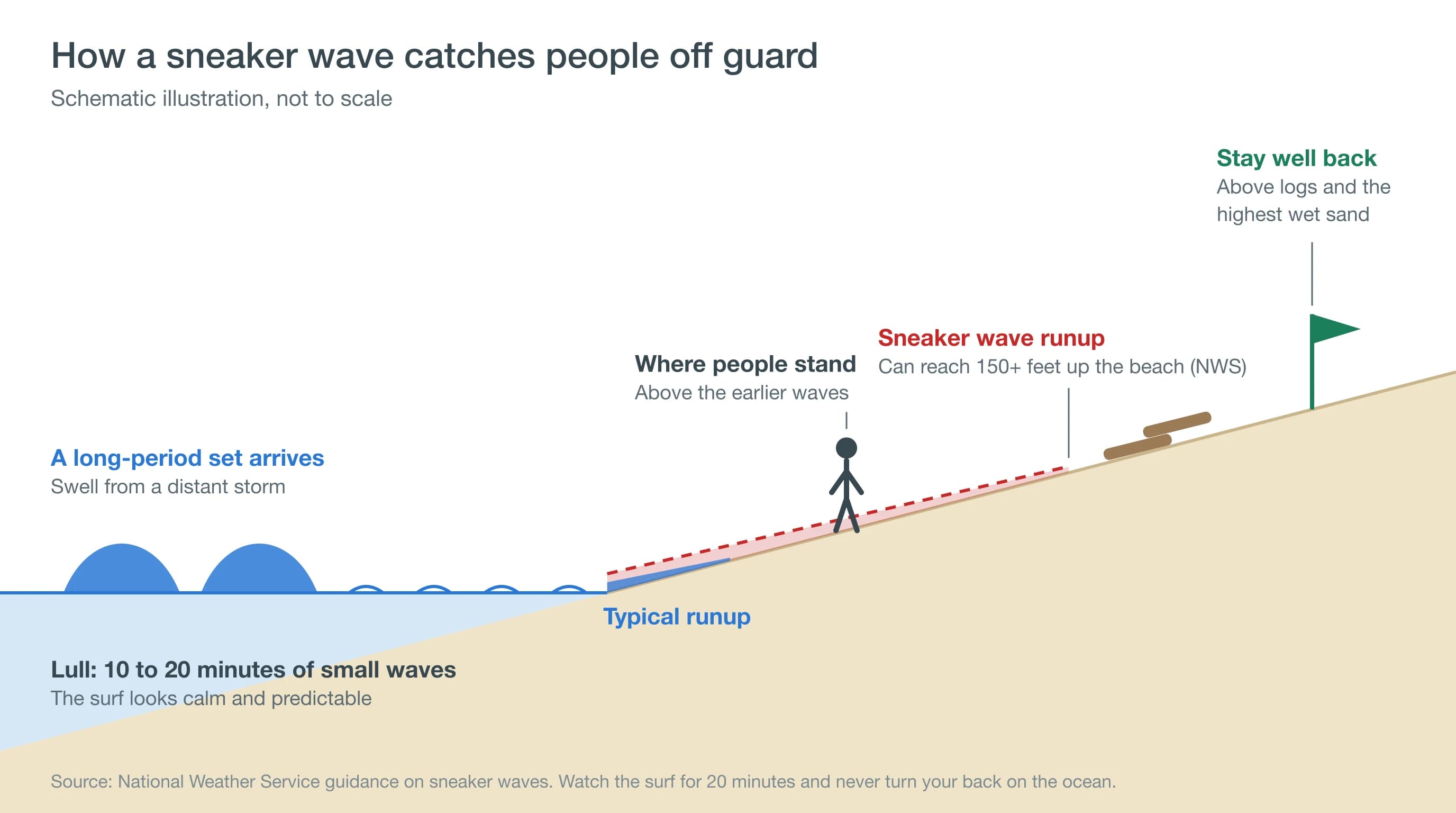
A sneaker wave is an unexpectedly large wave that surges far higher up the beach than the waves before it, often after 10 to 20 minutes of small surf. Sneaker waves come from long-period swells sent by distant storms, and they are most common on steep Northern California beaches from November through March.
The National Weather Service says a sneaker wave can run more than 150 feet up the beach. Off San Francisco, the long-period swells behind those waves arrive on more than half of January days, according to 11 years of NOAA buoy data. Distance from the water, not luck, is what keeps beachgoers safe.
What Is a Sneaker Wave?
A sneaker wave is a wave much bigger than the ones before it that rushes far up the sand with little warning. It can knock people off their feet, pull them into the surf and drag them into cold, deep water within seconds. Sneaker waves are not tsunamis, and they are not the giant rogue waves of the open ocean. They are part of an ordinary swell that simply arrives bigger than expected.
What Causes Sneaker Waves?
Sneaker waves are caused by long-period swell, waves generated by storms hundreds or thousands of miles away. By the time they reach the coast, the waves travel in groups called sets, with long lulls of small surf in between. When a set arrives after a lull, its biggest waves surge much farther up the beach than anything before them.
The swell period, the time between waves, matters more than wave height. A 16-second swell carries far more energy than a 9-second wind swell of the same height, so it runs farther up a steep beach and pulls back harder. For more on how swell shapes the coast, see Bay Area surf by season.
When Are Sneaker Waves Most Likely in Northern California?
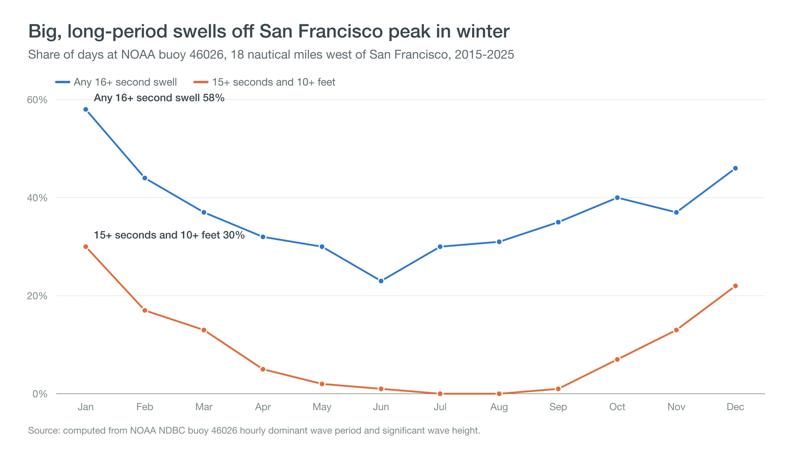
Sneaker waves are most likely from November through March, peaking in December and January, when North Pacific storms send big, long-period swells to the coast. At NOAA buoy 46026, 18 nautical miles west of San Francisco, 30% of January days from 2015 to 2025 brought a swell of 15 seconds or longer and 10 feet or higher, compared with almost none from June through September.
| Month | Days with 16+ second swell | Days with 15+ second, 10+ ft swell |
|---|---|---|
| January | 58% | 30% |
| February | 44% | 17% |
| March | 37% | 13% |
| April | 32% | 5% |
| May | 30% | 2% |
| June | 23% | 1% |
| July | 30% | 0% |
| August | 31% | 0% |
| September | 35% | 1% |
| October | 40% | 7% |
| November | 37% | 13% |
| December | 46% | 22% |
Share of days, 2015-2025, computed from NOAA NDBC buoy 46026 hourly dominant wave period and significant wave height.
Summer is not risk-free. Long-period swells from Southern Hemisphere storms still reach the coast on about 3 in 10 summer days, and they hit south-facing beaches hardest. In June 2026, the National Weather Service kept a Beach Hazards Statement in effect for about a month from Sonoma County to Big Sur, and sneaker waves may have contributed to the deaths of two women in Santa Cruz.
Which Bay Area and Northern California Beaches Are Most Dangerous?
The most dangerous beaches for sneaker waves are steep beaches with coarse sand and deep water close to shore, where waves break hard and the backwash pulls strongly. In the Bay Area that includes the Sonoma Coast, Point Reyes, Ocean Beach in San Francisco, Pacifica, Half Moon Bay and many Santa Cruz County beaches.
On the Sonoma Coast, Goat Rock, Blind Beach and Shell Beach are known for strong surf; in January 2021, a Petaluma man drowned at Blind Beach after a sneaker wave. At Point Reyes, Limantour and Drakes Beach face open swell. Ocean Beach has dangerous currents in every season.
How Can You Tell a Sneaker Wave Is Coming?
You often cannot tell a sneaker wave is coming, which is why distance matters more than watchfulness. The clearest warning signs come before you reach the sand: a Beach Hazards Statement, or a surf forecast with long swell periods of 15 seconds or more.
On the beach, watch for unusually long lulls, wet sand far above where the waves are breaking, and logs or debris pushed high up the slope. The National Weather Service recommends watching the ocean for at least 20 minutes when you arrive, then staying farther back than seems necessary.
What Do Beach Hazards Statements and High Surf Advisories Mean?
A Beach Hazards Statement means sneaker waves, rip currents or both are likely, even if the surf looks ordinary. A High Surf Advisory means large breaking waves are expected, and a High Surf Warning means dangerously large surf. The National Weather Service Bay Area office in Monterey issues these alerts for the coast from Sonoma County to Big Sur.
Beach alerts often come with long-period swell, sometimes on sunny, calm days that draw crowds to the beach. Big winter surf also arrives during king tides, when water reaches higher than usual.
How Do You Stay Safe From Sneaker Waves, and What Should You Do if Someone Is Swept In?
You stay safe from sneaker waves by keeping your distance and your attention on the water. Watch the surf for 20 minutes before settling in, never turn your back on the ocean, stay off logs and low rocks, keep your whole group and any dogs well back from the water, and take extra care at low tide on steep beaches.
If someone is swept in, do not go in after them. Call 911, throw something that floats, and keep the person in sight so rescuers know where to look. The water off San Francisco stays between about 52°F and 58°F all year, cold enough to cause gasping and loss of strength within minutes; see Bay Area water temperatures.
Before a coast trip, check the National Weather Service Bay Area beach and surf forecast for Beach Hazards Statements and swell period, then the Ocean Beach page for wind and conditions. If the forecast shows a long-period swell of 15 seconds or more, enjoy the view from the bluff.