seasonalclimate sciencedestinations

What's the Rainiest Month in the Bay Area?

By SFBayWeather||Updated |5 min read
What's the Rainiest Month in the Bay Area?

Key Takeaways

  • December and January are the Bay Area's rainiest months, each averaging about 4.5 inches in San Francisco. The contest between the two is close and varies by year.
  • November begins the wet season but is rarely the wettest month, because the Pacific storm track takes time to shift into its most California-favorable position.
  • Orographic locations, the Marin watershed, the Santa Cruz Mountains, can receive 15-20 inches in a single December or January in wet years.
  • The Bay Area's Mediterranean climate means monthly rainfall is highly variable. A "dry" December may deliver half an inch; a wet one may deliver 12 inches.
  • Year-to-year variability is driven by atmospheric river events. Monthly totals are the product of how many major AR events arrive in that month, not steady rain.

December and January compete for the title of the Bay Area's rainiest month, and the contest is close enough that it varies by location and by year. In San Francisco, January edges December in most years by a fraction of an inch. In the Santa Cruz Mountains and the Marin watershed, where orographic enhancement amplifies rainfall, the numbers are higher in absolute terms but the December-January competition still holds. February is close behind. The reason it is not November, when the rainy season begins, or March, when the last storms arrive, says a lot about how Bay Area storms work and when to expect the most intense rainfall of the wet season.

December and January: The Peak Months

San Francisco's historical monthly rainfall averages place December and January as the wettest months, each averaging approximately 4.5 inches. The close competition between the two reflects the randomness of when individual atmospheric river events arrive. December gets the most rainfall in some years, January in others, and the difference over many years is small.

The reason December and January are the wettest, rather than November, which is earlier in the wet season, is that the Pacific storm track takes time to fully develop and shift toward California after the summer. November marks the beginning of the wet season, but the North Pacific High has not yet fully weakened and retreated. The storm track that delivers the most intense systems to California is typically most active and positioned most favorably for Bay Area storms in December and January. By February, the storm track begins to shift again.

Bay Area winter storm in January: heavy rain on a San Francisco neighborhood street, flooded gutters, gray sky, people with umbrellas, demonstrating peak wet season conditions
January and December are statistically the Bay Area's rainiest months, each averaging about 4.5 inches in San Francisco. The peak occurs when the Pacific storm track is most active and positioned to deliver atmospheric rivers directly to Northern California.

Location Matters: Orographic Amplification

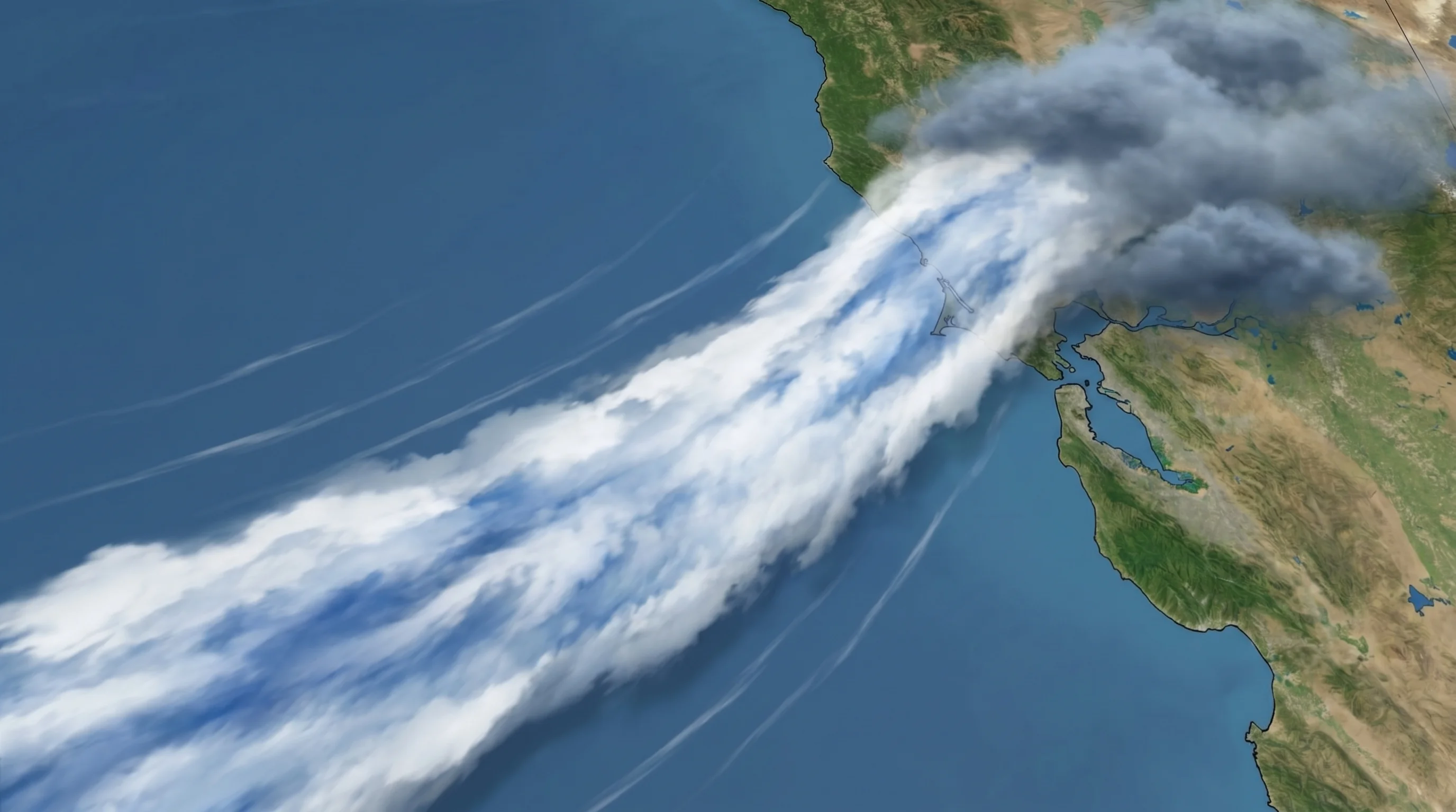
The rainiest months in absolute terms belong not to San Francisco but to the orographic hot spots of the Bay Area. The Marin watershed above Mount Tamalpais and the Santa Cruz Mountains around La Honda and Skylonda can receive 15 to 20 inches in a single December or January in wet years, totals that dwarf the flatland records and reflect the terrain's ability to wring out moisture from atmospheric river events.

In the inland valleys, the same months are the wettest in relative terms. December and January receive the most rainfall, but the absolute totals are lower. San Jose in the sheltered Santa Clara Valley averages around 2 inches in January, about half of San Francisco's total, because the Santa Cruz Mountains intercept most of the orographic moisture before it reaches the valley floor. The flattest parts of the South Bay are in the rain shadow of both the Santa Cruz Mountains and the Diablo Range.

Year-to-Year Variability in Wet Months

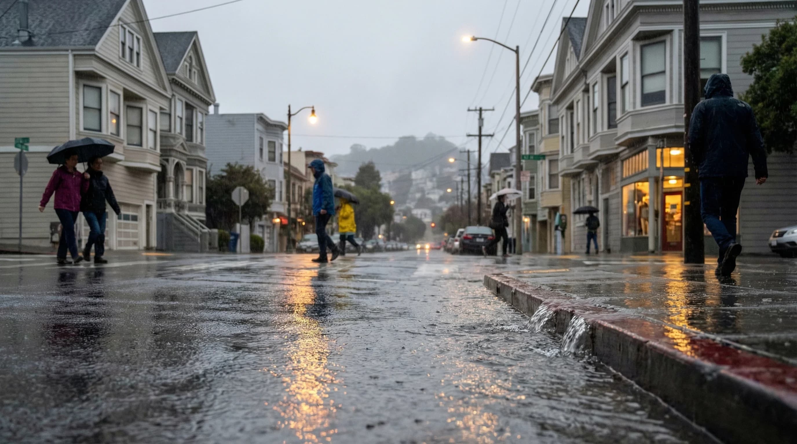
The monthly averages describe a pattern, but any given December or January can deviate dramatically from the average. In a drought year, December may deliver half an inch when the average is 4.5 inches. In an El Niño year or a sequence of atmospheric river storms, January can deliver 10 or 12 inches, more than half the annual average in a single month. The Bay Area's wet season is driven by episodic atmospheric river events, not continuous moderate rain, which means monthly totals are highly variable and dependent on how many major storm events hit in a given month.

This variability is one of the defining characteristics of a Mediterranean climate. The "average" December or January doesn't really exist as a typical experience. You get either a wet month or a dry month, and the averages are the statistical product of many extreme events averaged with many dry ones. The month that feels rainiest and most winter-like in any given year may be November, January, or February depending on which month's atmospheric rivers are most active.

Frequently Asked Questions

What is the rainiest month in San Francisco?

January and December are effectively tied as the rainiest months in San Francisco, each averaging approximately 4.5 inches. In most years, January edges December by a fraction of an inch, but the difference is small enough that any given year can go either way. February averages about 3.5 inches and is the third-wettest month. November, despite being the start of the wet season, averages only about 2.5 inches because the Pacific storm track is not yet fully positioned for California storms.

Why does it rain more in December and January than November?

The Pacific storm track shifts seasonally. In November, the North Pacific High has weakened but has not yet fully retreated, and the jet stream has not settled into its most California-favorable position. By December, the storm track is typically most active and oriented to deliver atmospheric river events directly at Northern California. This timing explains why the wet season begins in November but the wettest months are December and January. The track begins to shift northward again in February and March.

How much rain does the Bay Area get in its wettest months?

In San Francisco, the wettest months (December and January) average about 4.5 inches each. But these averages conceal enormous variability. In a drought year, December may deliver half an inch. In an El Niño year or during a series of atmospheric river events, January can deliver 10-12 inches, more than half the annual average in a single month. Orographic locations amplify these totals dramatically: the Marin watershed above Mount Tamalpais and the Santa Cruz Mountains around La Honda can receive 15-20 inches in a single wet December or January.

Which Bay Area location gets the most rain in the rainy season?

The upper Marin watershed, the slopes above Kentfield and Fairfax behind Mount Tamalpais, consistently receives the most rain in the Bay Area during the wet season. The area above 1,500 feet can receive 15-20 inches in a single December or January in wet years, compared to San Francisco's 4.5-inch monthly average. The Santa Cruz Mountains around La Honda and Skylonda are a close second. Both locations benefit from orographic enhancement: Pacific storm moisture is forced upward over the hills, wringing out dramatically more rain than the flatlands below receive.

Is winter rain in the Bay Area dangerous?

Routine winter rain is not dangerous, but strong storm events can be. The primary hazards are flooding in creek floodplains (particularly in communities along Alameda Creek, Coyote Creek, and Corte Madera Creek), mudslides in steep terrain that was burned by recent wildfires, and localized road flooding. The most dangerous events are major atmospheric rivers that deliver 3-6 inches in 24-48 hours. The Bay Area has extensive flood risk maps; properties in 100-year floodplain areas face real risk during the strongest storms.

Live Bay Area Conditions

Compare fog, temperature, wind, and comfort across the map.

See which microclimates are clear, cool, windy, or warming up right now.

Open the Weather Map
🔒Privacy Policy📄Terms of Service