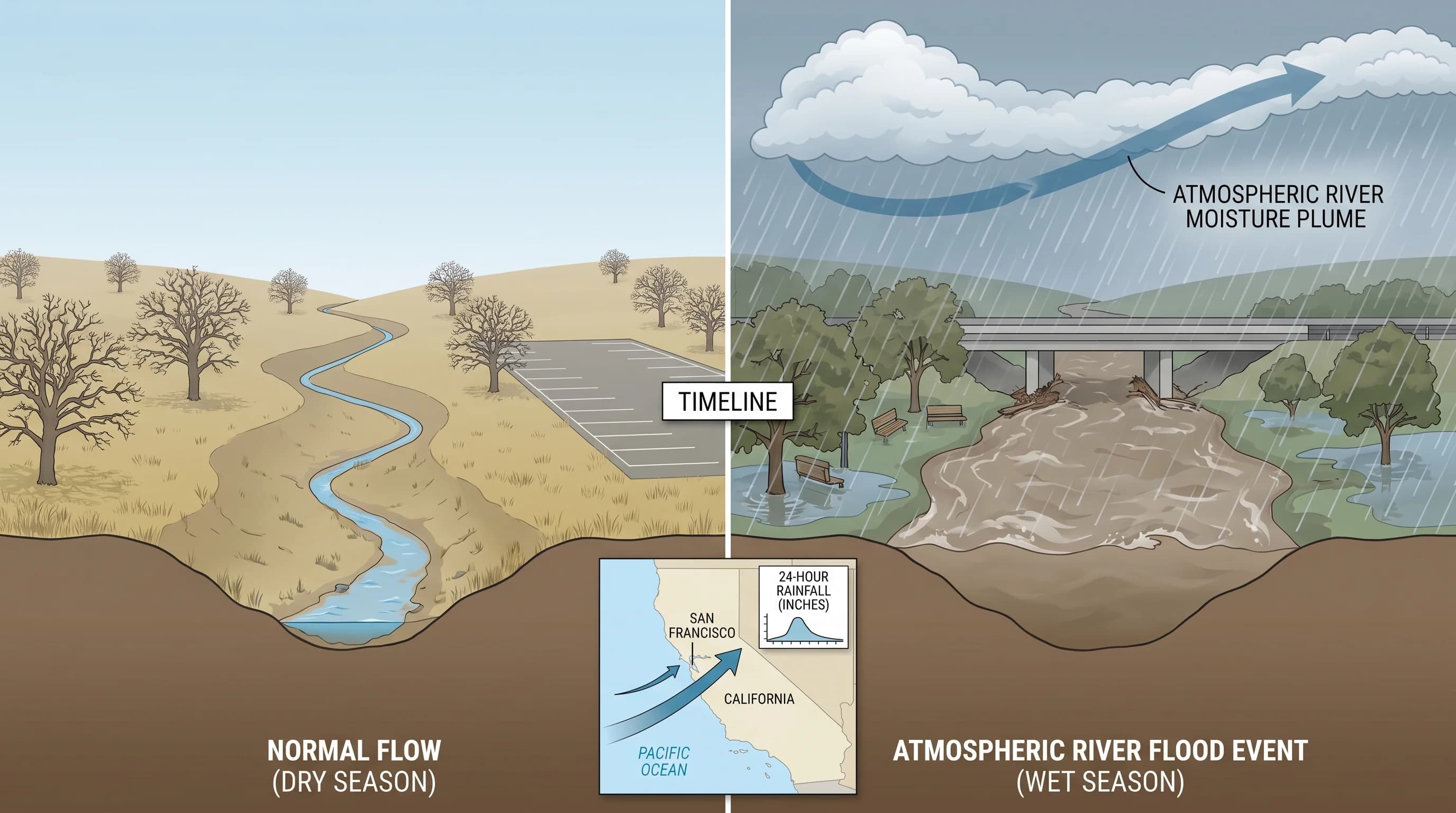
The Bay Area's wettest single days are not produced by the typical steady winter rains that define the wet season from November through March. They are produced by atmospheric rivers, concentrated corridors of moisture that can deliver tropical-quality rainfall totals in 24 hours. When an intense atmospheric river strikes the Bay Area at the right angle, with the right orographic terrain to wring out the moisture, the rainfall records that result can seem implausible for a Mediterranean climate. Yet they happen, and the flood damage they cause is proportional to the water volume; several inches of rain in 24 hours overwhelm creek channels, saturate hillsides, and exceed the capacity of storm drains designed for much more moderate events.
Bay Area Single-Day Rainfall Records
The wettest single days in Bay Area history belong to the high-elevation orographic rain producers, the Santa Cruz Mountains and the Marin watershed, rather than the flatlands. The Marin watershed above Mount Tamalpais has recorded more than 10 inches of rain in a single day during extreme atmospheric river events. The Santa Cruz Mountains around La Honda and Pescadero have similarly recorded 8 to 10 inches in 24 hours during the most intense storms.
San Francisco at sea level has recorded single-day totals above 5 inches during extreme events. The January 4, 1982 storm delivered more than 5 inches in 24 hours to San Francisco and triggered the Marin County debris flows that killed 25 people. The February 1998 El Niño storms delivered more than 4 inches to San Francisco in a single day. More recently, the atmospheric river events of January 2023 produced multi-day totals across the Bay Area that broke monthly records at many stations, with individual days contributing 3 to 4 inches at sea level.
What Extreme Rainfall Does to the Bay Area
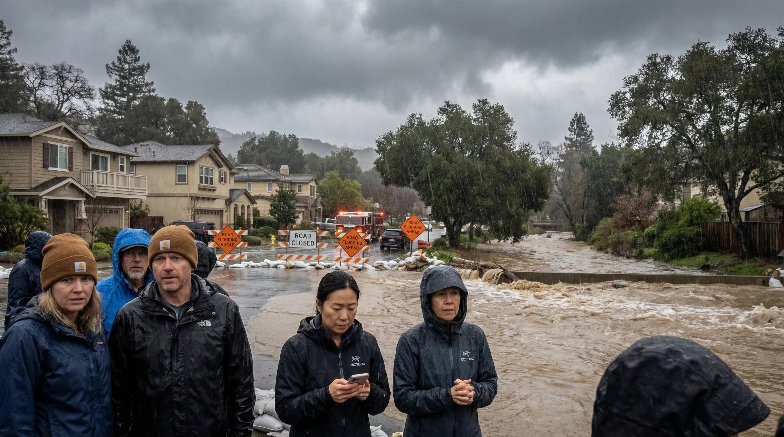
The Bay Area's creek and storm drain systems are generally designed to handle the kind of moderate, multi-day rainfall typical of a wet season storm, not the concentrated bursts that atmospheric rivers deliver. When 3 to 5 inches falls in 24 hours, creeks that are normally a few feet deep can rise by 10 to 15 feet in a matter of hours. Hillsides that have been saturated by weeks of preceding rainfall can fail catastrophically with a final heavy rain event.
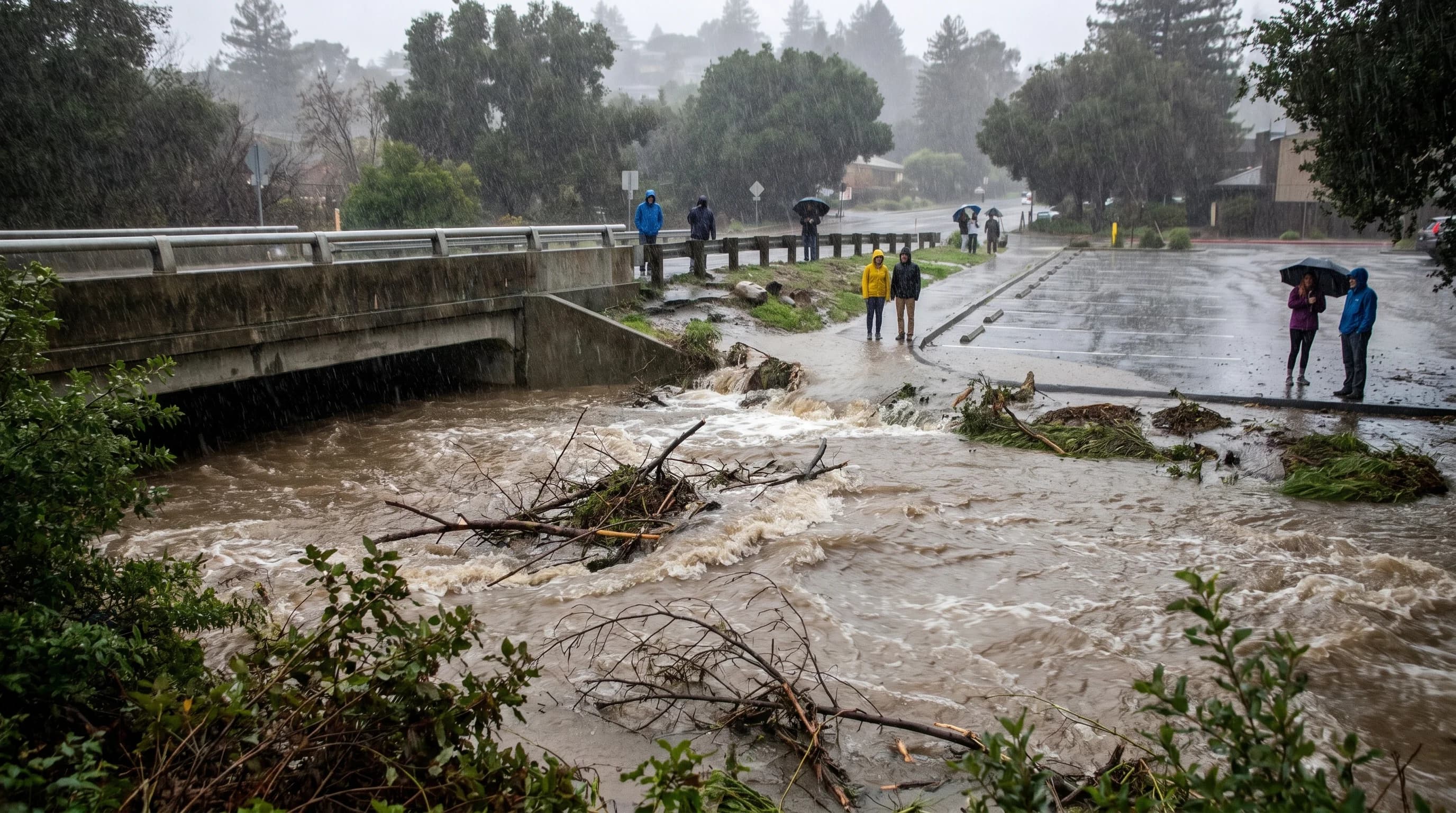
The geography of where extreme rainfall falls matters as much as the total. Rainfall in the headwaters of creek systems, in the Santa Cruz Mountains draining to the South Bay, in the Marin Hills draining to the bay's northern shores, in the Diablo Range draining through creeks like Alameda Creek, concentrates and amplifies in the downstream reaches. A community at the base of a steep watershed can experience flooding even if local rainfall is moderate, because the extreme rainfall upstream has all drained toward that point.
Preparing for Extreme Bay Area Rainfall
The atmospheric river events that produce Bay Area record rainfall days are increasingly well-forecast in the 1-to-5-day range. The National Weather Service issues atmospheric river watches and warnings for the Bay Area when forecast conditions meet thresholds for significant precipitation. For residents in flood-prone areas, near creek channels, in low-lying flatlands, on steep hillsides, these forecasts are the most actionable early warning available. The time between a storm landfall and the flooding of a downstream neighborhood can be as little as a few hours, making advance preparation essential for those in vulnerable locations.