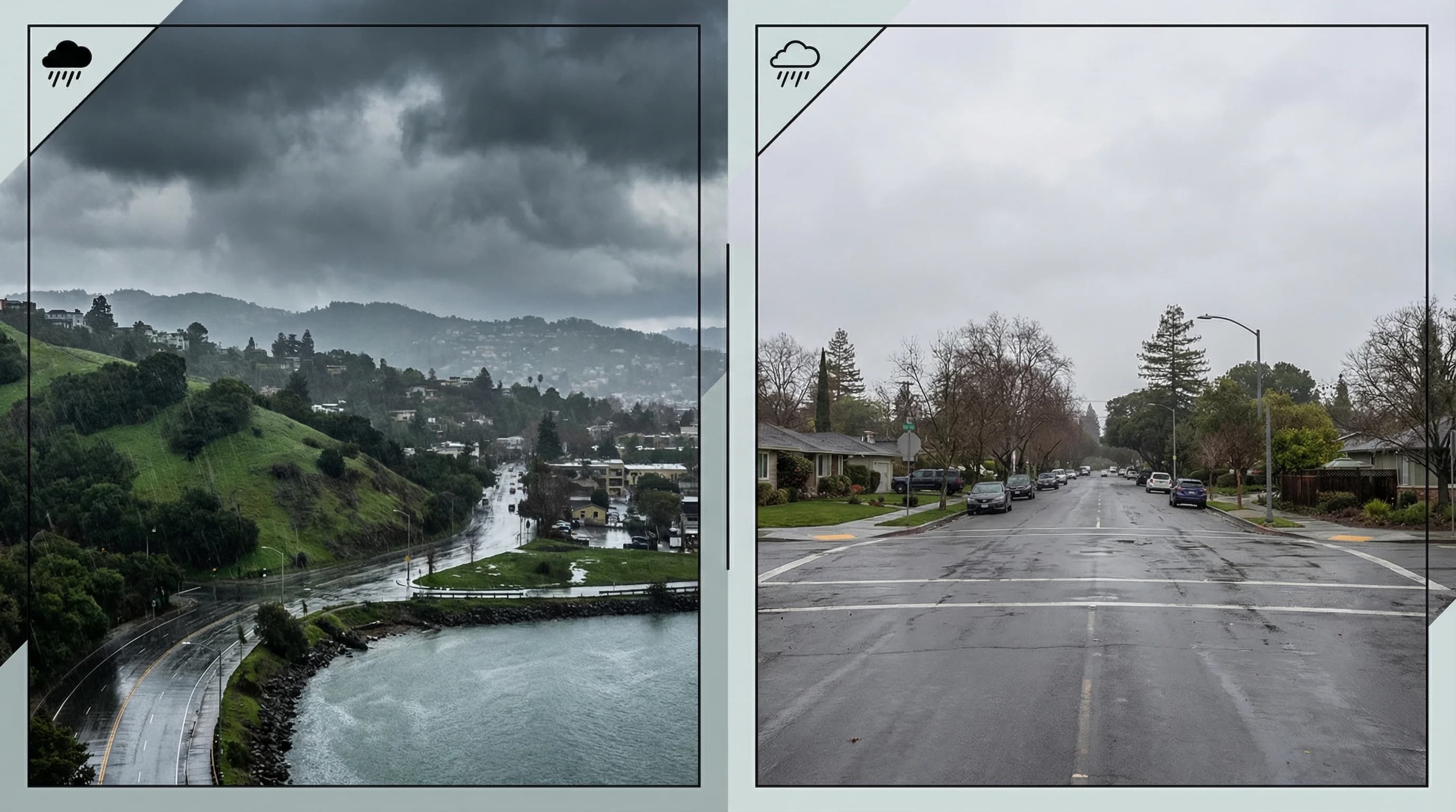
This is one of the Bay Area's counterintuitive weather facts: Oakland and Berkeley typically receive more annual rainfall than San Francisco and the Peninsula, despite being further from the Pacific Ocean and seemingly more sheltered. Oakland averages about 25 inches of rain per year compared to San Francisco's 22 inches. Berkeley gets similar totals. Meanwhile, Palo Alto on the Peninsula averages about 16 inches, and Mountain View about 15 inches. The East Bay is not just a little wetter, it is consistently and significantly wetter than the South Bay and much of the Peninsula, despite sitting east of the bay rather than directly on the coast. The explanation comes down to how storms actually interact with Bay Area geography.
How Winter Storms Actually Enter the Bay Area
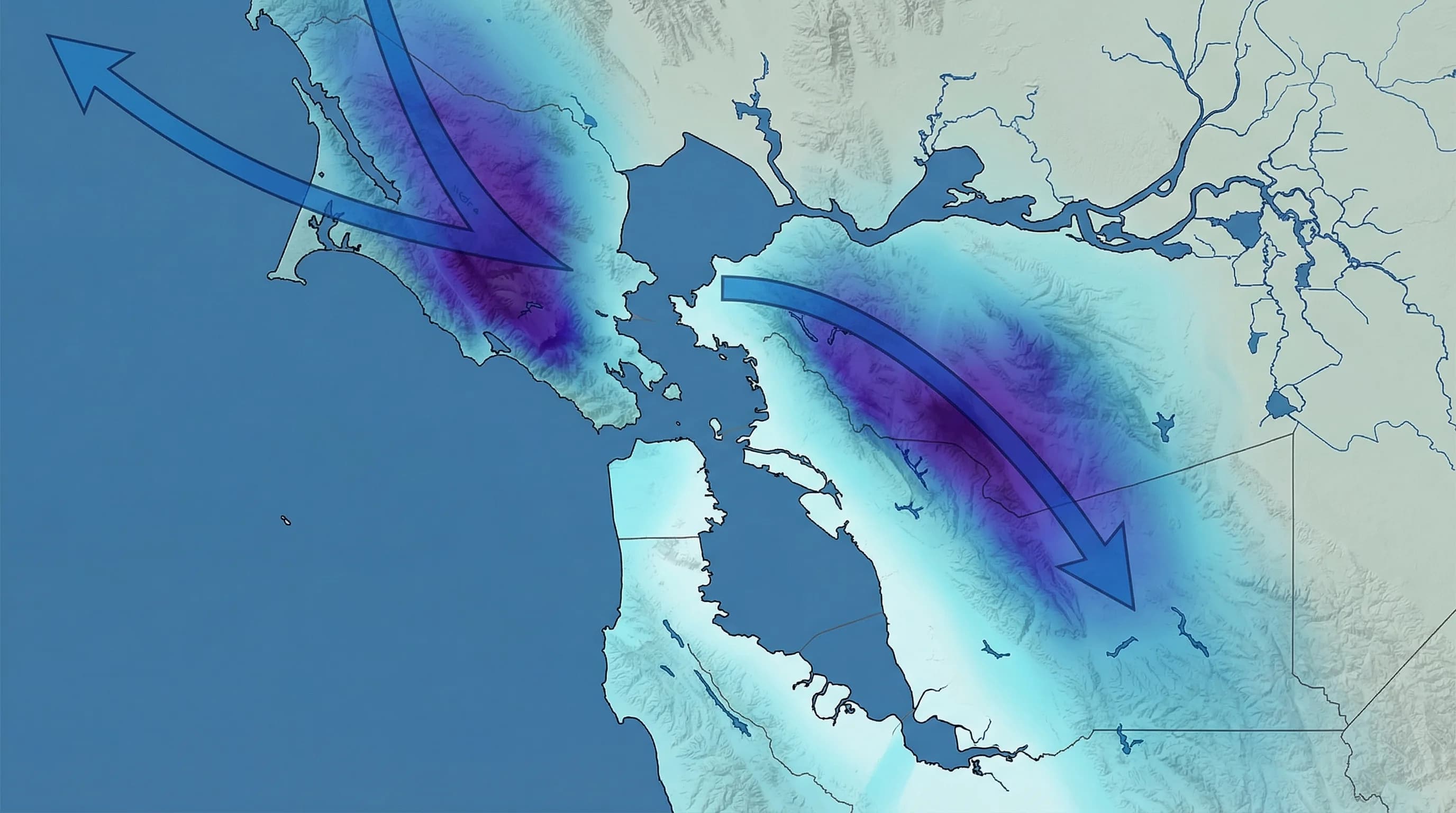
Most people assume storms hit the Bay Area from the west, straight off the Pacific, and distribute rainfall equally across the region. The reality is more complicated. Winter storms approaching from the northwest, which is the dominant direction for most Bay Area winter systems, hit the North Bay first. Marin County and the North Bay hills intercept these systems before they reach San Francisco. The storm track for most Pacific systems runs over the North Bay rather than directly through the Golden Gate.
When these northwest-tracking storms approach, their fronts and precipitation bands sweep through Marin, then across the bay into the East Bay before reaching the South Bay and Peninsula. The Bay Area's unique geography, with the bay acting as a corridor for marine air and the mountains channeling storm tracks, means that the East Bay often sits on the more productive side of storm systems. The Diablo Range rising behind Oakland and Berkeley enhances orographic lift for moisture coming from the northwest, while the South Bay sits further from the primary storm track and in a rain shadow relative to the Santa Cruz Mountains to the west.
Why the Diablo Range Enhances East Bay Rainfall
The Berkeley Hills and the Diablo Range rising east of Oakland and Berkeley do something interesting for East Bay rainfall: they create orographic lift for air masses that enter from the west across the bay. When moist marine air flows into the bay and then encounters the Berkeley Hills rising to 1,800 feet and the Diablo Range peaks above 3,800 feet, it is forced to rise and release precipitation.
This orographic effect is most pronounced for storms approaching from the west or northwest, which is the primary winter storm direction. The East Bay hills act as a collecting surface for precipitation that might otherwise pass over the Peninsula without the same enhancement. Oakland and Berkeley, sitting at the base of these hills, receive the orographic precipitation as it runs off the higher terrain, plus the direct frontal rainfall from the storms themselves.
Compare this to Palo Alto and the central Peninsula, which sit on flat terrain south of the Golden Gate corridor. Storm systems approach from the northwest and lose some moisture to Marin before crossing the bay. The Santa Cruz Mountains to the west of the Peninsula create a mild rain shadow effect over the San Francisco Bay corridor. The Peninsula flat terrain provides no orographic enhancement. The result is consistently lower rainfall than the East Bay hills.
How the Bay Itself Affects Rainfall Patterns
San Francisco Bay is a large water body, and water bodies affect precipitation patterns in complex ways. In winter, the bay water is relatively warm compared to the cold air in storm systems. As cold air passes over the warmer bay surface, it picks up moisture and heat, potentially destabilizing and enhancing precipitation on the downwind side. For northwest-moving winter storms, the downwind side of the bay is the East Bay.
This lake-effect-like mechanism, much weaker than true Great Lakes lake-effect snow but real and measurable, contributes to the East Bay's precipitation advantage. Cold fronts sweeping down from the northwest pick up latent heat and moisture as they cross the bay, then release enhanced precipitation when they hit the East Bay hills. The same air mass produces less rainfall over the Peninsula, which sits to the south and west and does not benefit from this bay-crossing enhancement.
Why the South Bay Is Drier Than the North Bay
The rainfall gradient across the Bay Area runs roughly from northwest to southeast: highest in Marin County and the North Bay, decreasing toward San Francisco, moderate in the East Bay, and lower in the Peninsula and South Bay. San Jose averages only about 15 inches of annual rainfall, making it one of the drier major cities in California. This puts San Jose in a different rainfall category from Oakland, despite both being on the bay and at similar elevations.
The South Bay's relative dryness comes from its position at the tail end of the bay, furthest from the primary storm track entry point through the Golden Gate and north Marin. By the time storms sweep southward through the bay system, they have already deposited much of their precipitation load on the North Bay, East Bay, and Peninsula. The Diablo Range to the east of San Jose creates a rain shadow over portions of the South Bay flatlands. The Santa Cruz Mountains to the west do provide orographic lift for some moisture reaching the hills above San Jose, but the valley floor itself is relatively rain-shadowed.
What These Differences Mean Day to Day
The rainfall differences between the East Bay and Peninsula have real consequences. Oakland and Berkeley's higher rainfall produces more lush vegetation and more persistent year-round greenery compared to Peninsula communities at similar elevations. The East Bay Hills fire risk, while real, is partially offset by somewhat more consistent moisture than drier inland locations. The Berkeley and Oakland hills watershed provides significant local water storage through reservoirs that benefit from the higher precipitation zone.
For outdoor recreation, East Bay regional parks in Tilden, Redwood, and Anthony Chabot tend to have wetter trails after storms than Peninsula parks at similar elevations. After a major storm, the East Bay hills often need a day or two more drying time before trails become passable than the flatter terrain of the South Bay or Peninsula parks. But the payoff is greener, more dramatic landscapes in winter and spring, with waterfalls and streams that remain flowing longer into the dry season than elsewhere in the region.