Thunderstorms in the Bay Area are genuinely rare. The region averages only 2 to 5 thunderstorm days per year, compared to 50 to 80 in Florida and 30 to 50 across the Great Plains. Most Bay Area residents can go years without hearing thunder. When thunderstorms do occur, they are a notable weather event that makes local news and fills social media feeds with photos of lightning over the Golden Gate Bridge. The rarity is not random: the Bay Area's climate is structurally hostile to the atmospheric instability that thunderstorms require.
Why Are Thunderstorms So Rare in the Bay Area?
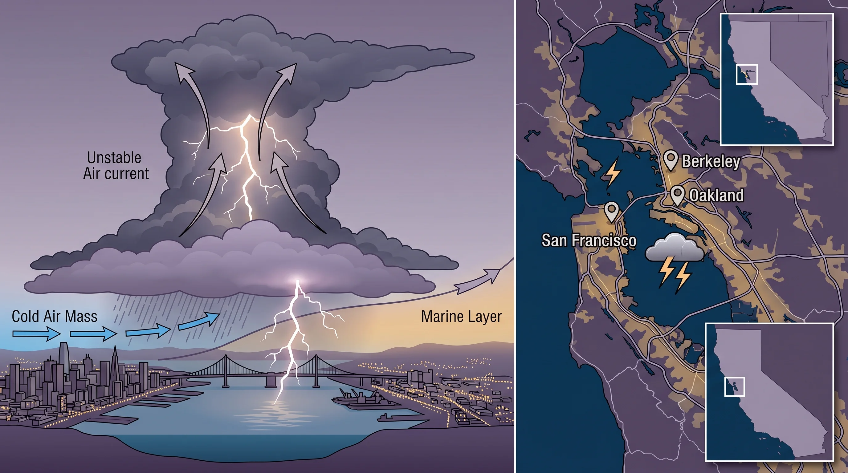
Thunderstorms need three ingredients: moisture, instability (warm air rising rapidly through cooler air above), and a lifting mechanism to trigger upward motion. The Bay Area's summer climate suppresses all three. The cold Pacific Ocean keeps surface temperatures modest, the temperature inversion created by the North Pacific High actively prevents air from rising, and the marine layer keeps the lower atmosphere stable and cool. In thunderstorm-prone regions, hot ground surfaces heat the air above them until it rises explosively into the upper atmosphere. In the Bay Area, the cold ocean prevents that surface heating from ever reaching the threshold needed for convective storms.
The North Pacific High is the primary suppressor. This semi-permanent high-pressure system creates persistent sinking air (subsidence) over the eastern Pacific, which warms as it descends and forms the inversion cap. Air cannot rise through a subsidence inversion, and without rising air, there are no towering cumulonimbus clouds and no thunderstorms. The High is strongest in summer, which is exactly why the Bay Area's summers are almost completely thunderstorm-free despite being the thunderstorm season everywhere else in the country.
When Do Bay Area Thunderstorms Actually Happen?
The few thunderstorms that do reach the Bay Area almost always occur in winter or early spring, from November through March. This is when the North Pacific High retreats southward, the inversion weakens, and Pacific storm systems bring the instability needed for convective activity. The mechanism is different from the hot-air-rises thunderstorms of the interior United States. Bay Area thunderstorms are typically embedded within cold-core low-pressure systems that move across the region from the northwest, bringing a pocket of unusually cold air at altitude that creates instability even though the surface is only 50 to 55 degrees F.
March is the single most common month for Bay Area thunderstorms. The jet stream is still active enough to steer cold lows into the region, but the increasing sun angle provides just enough surface heating to add instability to the lower atmosphere. A typical Bay Area thunderstorm in March might produce a few lightning strikes, brief heavy rain, small hail, and gusty winds for 30 to 60 minutes before the cell moves through. It is a far cry from the multi-hour, tornado-producing supercells of the Midwest, but it is enough to get Bay Area residents to stop what they are doing and look out the window.
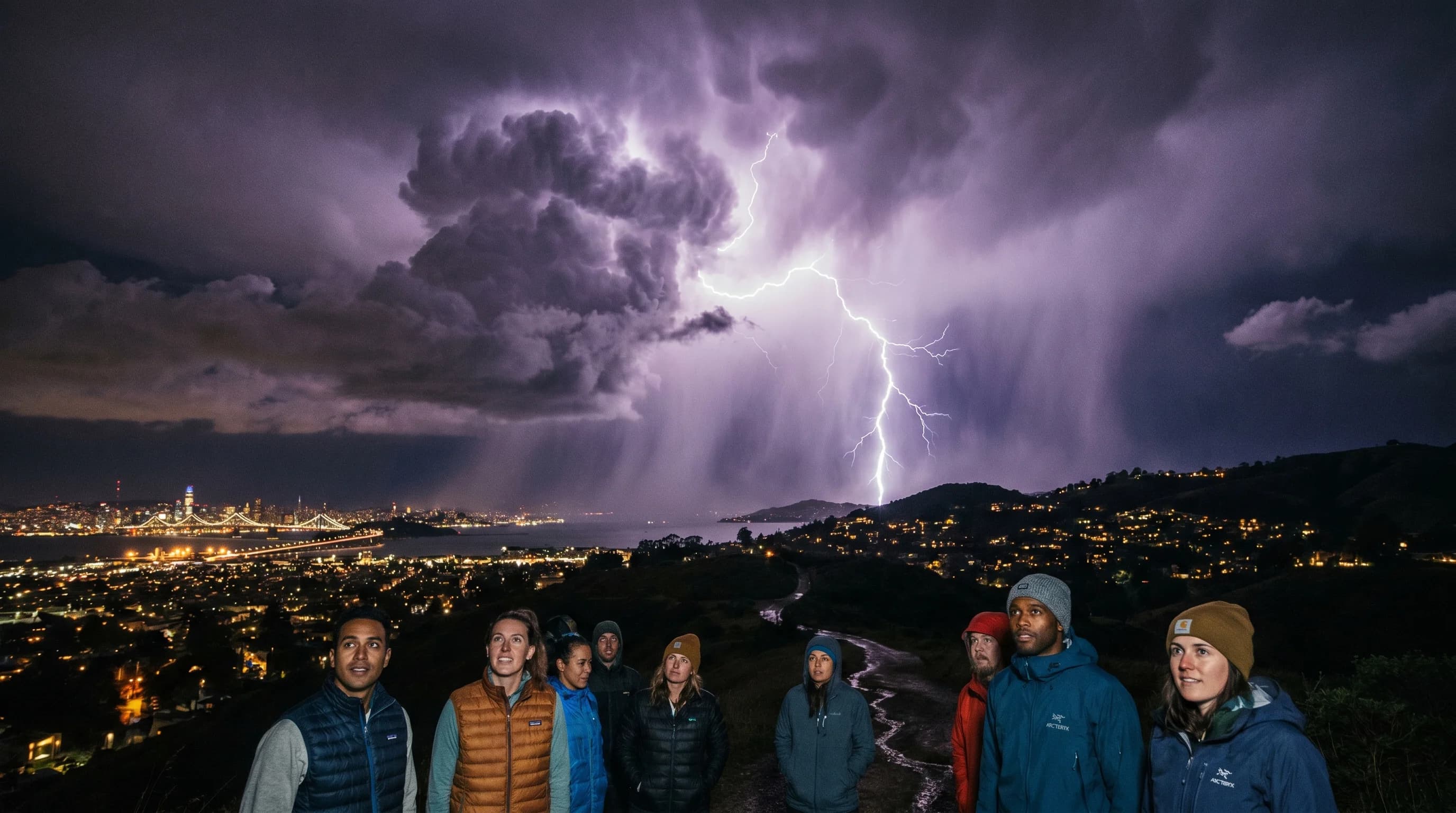
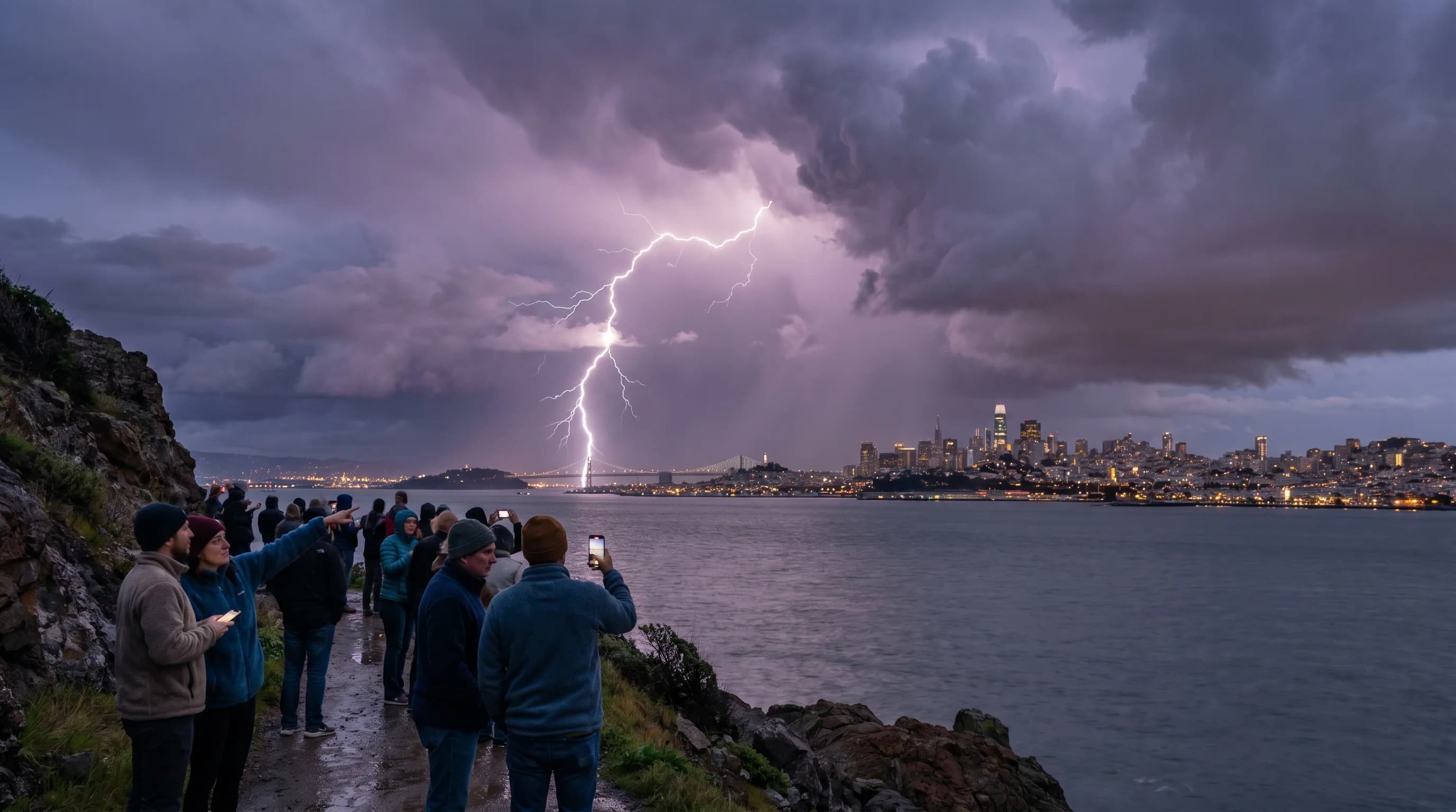
Notable Bay Area Thunderstorm Events
The August 2020 lightning siege was the most significant thunderstorm event in recent Bay Area memory. An unusual subtropical moisture surge combined with a dying tropical cyclone to produce thousands of lightning strikes across Northern California over three days, August 15-19, 2020. The strikes ignited more than 350 wildfires, including the SCU Lightning Complex, LNU Lightning Complex, and CZU Lightning Complex fires that burned hundreds of thousands of acres. This event was extraordinary precisely because summer thunderstorms are so unusual in the Bay Area.
Other notable events include occasional spring hail storms that drop pea-sized hail across East Bay and South Bay communities, and rare winter thunderstorms that produce waterspouts on San Francisco Bay. The waterspouts are weak, non-tornadic vortices that form over warm bay water when cold air moves overhead, and they almost never come ashore. But they are visually dramatic enough to generate significant local attention when they occur.
Thunder and Lightning Safety
Because thunderstorms are so rare, many Bay Area residents are unprepared when they do occur. Lightning safety is straightforward: when thunder is audible, move indoors or into a hard-topped vehicle. Do not shelter under trees, which are frequent lightning strike targets. The "30-30 rule" applies: if the time between seeing lightning and hearing thunder is less than 30 seconds, the storm is close enough to be dangerous, and you should stay indoors for 30 minutes after the last thunder.
The rarity of Bay Area thunderstorms is one of the region's defining climate features. It is directly connected to the same cold ocean and stable atmosphere that produce the fog, the mild temperatures, and the predictable summer weather that draw people to the Bay Area. The trade-off is real: you rarely hear thunder, but you also rarely see a 90-degree day in San Francisco. The Pacific Ocean giveth and the Pacific Ocean taketh away.