The full Half Moon Bay Pumpkin Festival weather guide
When and where
The Half Moon Bay Pumpkin Festival sits at the meeting point of coastal weather and one of the Bay Area’s most weather-sensitive traffic patterns. The event itself is downtown, but many visitors arrive on Highway 1 or cross the coastal hills on Highway 92. Fog, rain, and wind can therefore affect the trip before they affect the festival. Comparing both weekend days is often more valuable than reading one Half Moon Bay daily icon.
Half Moon Bay Art and Pumpkin Festival takes place at Main Street, Half Moon Bay in Half Moon Bay. The official 2026 festival site lists Saturday, October 17 and Sunday, October 18 from 9 a.m. to 5 p.m. on Main Street. It is a two-day outdoor street festival with early arrivals, booths, parades and stage programming, long walking periods, remote parking, and heavy traffic on limited coastal routes. That shape is why this page follows event hours instead of the calendar day: an overnight low says nothing about a daytime festival, and a daily high can land after the gates have already closed.
Dates and hours here follow the current occurrence and link to the official event site. Organizers decide admission, closures, postponements, set times, and cancellations. This page explains the weather; it is not a substitute for an organizer notice.
The venue, the seasonal pattern, and the packing logic hold up year to year. The dates do not, so confirm the current occurrence before you book anything.
Weather profile
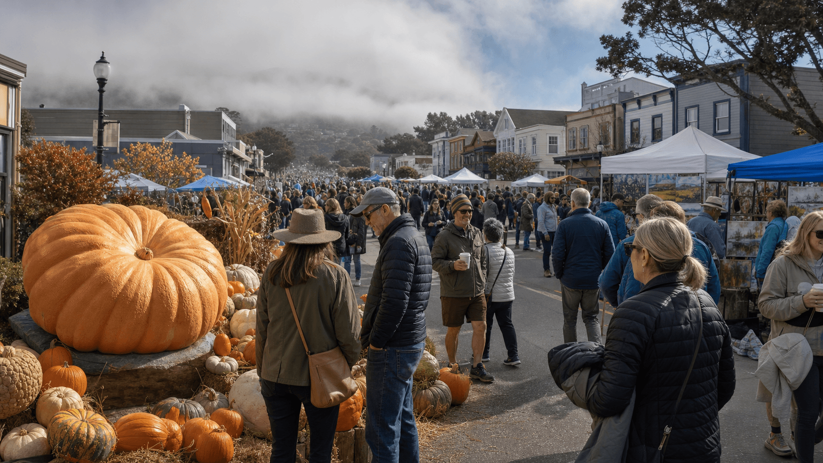
October can deliver beautiful clear afternoons on the coast, yet the marine layer does not disappear on a calendar date. Historical festival-hour conditions average near 65 degrees with about 33 percent cloud cover. Morning fog remains possible, and October is when the dry season begins yielding to Pacific storms. Rain is not the norm, but its odds are meaningfully higher than at August or September festivals.
Those averages are a baseline, not a forecast. They tell you whether to expect a jacket, whether rain belongs in the plan, and which of fog, heat, or wind is this venue's recurring problem. They cannot tell you about a specific date. Use them now, then replace them with the event-week forecast when it opens.
Regional microclimates can be sharp. An exposed park can be colder, cloudier, or windier while a sheltered plaza nearby is mild and calm. Elevation, terrain, water, and the street grid all affect when weather arrives and how it feels. The numbers on this page come from a forecast point chosen for this venue, not a citywide average.
Air temperature is also only part of the story. Sun, shade, and wind change how a number feels over a long day outside. Pavement and crowds make a sunny plaza warmer than the reading; shade and a steady breeze make an inland 70 feel considerably cooler. Read the temperature range alongside wind and cloud cover instead of treating one number as the answer.
Rain probability is the most misread value on any forecast. Forty percent describes the chance of measurable rain, not how long it lasts or how hard it falls. It could be a five-minute shower or the leading edge of a system. What matters is when: during event week, check whether the risk sits before gates, over the main program, or after everyone has gone home.
What weather can change the event
Fog reduces visibility on coastal approaches and keeps the opening hours cool and damp. Rain changes pavement, booth operations, parking areas, and travel time, with the first storm sometimes lifting oils onto roads. Strong wind matters to temporary structures and exposed walks. A sunny afternoon can still follow a foggy morning, so an all-day rain or cloud label often obscures the most useful timing.
Weather sensitivity is not a cancellation threshold. Organizers weigh site conditions, public safety, equipment, and the trend, not one number on a consumer forecast. A rain-or-shine policy still allows pauses for genuinely hazardous weather, and a cloud icon does not mean the day is ruined.
The combinations are what get people. Light rain with no wind is fine in a shell. The same rain with strong gusts defeats umbrellas, rattles signage and sound equipment, and punishes anyone waiting in the open. Moderate heat with shade and water is a different day than the same temperature on bare pavement. Low cloud is a minor comfort note at one event and the entire story at another.
Air quality needs its own check during wildfire season. Smoke arrives under clear skies, and no weather icon communicates it. If regional fires are burning, use official AQI guidance rather than the look of the sky.
Lightning is rare here compared with most of the country, which is exactly why people underestimate it. If you hear thunder or an organizer calls an evacuation, move to the directed shelter. Do not use a forecast page to second-guess a safety instruction. The same goes for flooding, damaging wind, extreme heat, and any emergency alert.
How to read the forecast
Start with the verdict at the top of this page, then look at the four main values and the event-specific conditions under them. Temperature and rain answer a different question than wind, fog, visibility, or smoke do. No single number decides the day.
Confidence builds in stages. More than a week out, the seasonal averages are genuinely more useful than any hourly prediction, which is why this page leads with them. In the last week, day-by-day and hour-by-hour forecasts become worth acting on. On the day itself, live observations, radar, and official messages beat any forecast.
One caveat on the timestamp: it shows when this forecast was generated, and weather models run on their own schedule. Refreshing the page does not conjure a newer model run.
For a multiday event, compare the same hours across days rather than the daily summaries. For a single-day event, treat arrival, program, and departure as three separate questions. An overnight shower is irrelevant to a dry morning race, and an afternoon high tells you nothing about a midnight fireworks show.
Finally, related measurements are not interchangeable. Cloud cover is not cloud ceiling. Visibility is not air quality. A monthly average is not a prediction. Check the one tied to the impact you actually care about.
Timing your day
The 9 a.m. opening is normally the coolest and foggiest part of the program. Midday offers the best chance for clearing and the largest crowds. When a front is possible, compare the actual passage hour: one festival day may be wet while the other is merely cool and breezy. Leave travel margin because weather and event congestion amplify each other on Highways 1 and 92.
At ten to fourteen days out, the useful signal is a pattern: warm, wet, windy. Keep plans flexible and do not read the hourly numbers. Around seven days, comparing event days starts to mean something. At two or three days, arrival hours and program hours are worth planning around. On the day, watch the trend and the official channels.
When this page names a better day, it is ranking weather only. Lineup, crowd size, ticket price, and who can get a ride are not in that calculation, and any of them can outweigh a few degrees. For a single-day event the real decision is usually narrower: when to show up, what to carry, and whether to move an optional outdoor stretch out of a risk window.
Do not chase small changes. Sixty-four degrees becoming sixty-three is not news. A rain window sliding into the headline set, fog holding two hours longer than expected, or gusts crossing from breezy into difficult are news. The verdict at the top of this page is written to surface that kind of change and ignore the rest.
For the Pumpkin Festival, steady rain during public hours, dense travel-time fog, or strong coastal gusts can outweigh a small temperature advantage. Morning low cloud that is forecast to clear is a clothing issue rather than a day-losing event. Official parade, booth, or festival changes come only from the organizer.
Venue microclimates
Main Street is slightly inland from the immediate shoreline and can become milder than the beaches. That does not make the coastal approaches clear. Montara, Pillar Point, downtown Half Moon Bay, and the ridge can all show different fog and wind at the same time. The town forecast point matches the festival; route decisions should also use current highway and coastal observations.
A city forecast is not necessarily a venue forecast. The site may sit closer to the ocean, farther inland, beside open water, inside a sheltered street grid, or on a slope. Those differences influence wind, afternoon temperature, fog penetration, and how quickly conditions change after sunset. The forecast location is chosen to represent the venue as closely as possible.
Conditions can also vary within a large site. An exposed stage, grandstand, route segment, or waterfront edge may feel colder and windier than a crowded sheltered area. Grass can remain wet after rain has ended; pavement can radiate heat after the air begins cooling. A forecast cannot map every few yards, so the guide identifies the recurring contrasts visitors can plan around.
If you are meeting a group, choose a location and communication plan before arrival. Weather can change crowd movement, cell service can be strained at major events, and an unexpected shower sends many people toward the same covered spaces. Saving tickets, maps, transit directions, and the organizer's alert channel offline is a small preparation with a large payoff.
What to wear and bring
Wear layers that handle a cool opening and a milder afternoon, plus comfortable water-resistant shoes. A hooded shell is worthwhile if showers are plausible. Bring sun protection because coastal clouds can break abruptly. Avoid depending on a large umbrella in crowded streets or wind. Check official bag, pet, parking, and shuttle instructions before leaving.
Layers are the regional default because the useful outfit often changes between travel, waiting, the main program, and the trip home. A light wind-resistant outer layer usually adds more flexibility than one bulky item. On a warmer day, choose breathable clothing and retain a compact layer for evening or transit. On a wet day, a hooded waterproof shell works better in crowds and gusts than a large umbrella.
Sun protection belongs in the bag even if the morning is cloudy. Low clouds can clear, thin cloud still transmits ultraviolet radiation, and many event sites offer limited shade. Water, sunscreen, sunglasses, and a secure hat are practical. For cool-season evening events, add an insulating mid-layer, warm socks, and something dry to change into if rain is possible.
Check the official bag and prohibited-item policy before packing. Large umbrellas, hard-sided coolers, outside beverages, chairs, and professional camera equipment may be restricted even when they would otherwise seem weather-smart. The organizer's rules always outrank a general packing recommendation.
People with children, older adults, mobility needs, or health conditions should plan around exposure time as well as the headline forecast. A long security line in sun, rain, cold, or wind may matter more than conditions during the seated portion. Accessibility entrances, medical tents, water stations, and covered rest areas are worth locating in advance.
Travel and contingency plans
The festival is famous for congestion even in good weather. Rain or dense fog lowers road speeds, and remote parking can add exposed waits. Use the official transportation and parking plan, start earlier than a normal map estimate, and avoid improvising on narrow local roads. If the two days are weather-similar, transportation timing may be the more important planning variable.
Major events reshape traffic even in perfect weather. Rain slows boarding and road travel, heat increases demand for rides, and a late program change can send a large crowd toward transit at once. Build margin into the trip and check the organizer, local transit agencies, and city emergency channels before departure.
Use a simple backup ladder. Plan A is the preferred schedule and viewing area. Plan B changes timing, clothing, or a location within the site. Plan C is the organizer-approved alternative or an indoor activity nearby. The point is not to predict every disruption; it is to avoid making the entire day depend on one fragile assumption.
For ticketed events, weather and refund policies are separate. “Rain or shine” usually means ordinary rain does not automatically produce a refund, but official terms vary. Follow the event's ticket provider and organizer for binding admission and refund information.
After the event, expect the local weather to matter on the trip home. Evenings can cool quickly, exposed winds can persist, and rain or snow may intensify after the headline program. Keep a final layer and transportation plan available instead of using everything during the first hour.
Planning as the date approaches
Several weeks ahead, use the seasonal profile to choose likely clothing, identify the venue’s recurring weather issue, and decide whether you need a backup plan. Confirm the current date, location, hours, admission rules, and transportation details with the organizer.
About two weeks ahead, watch for a broad warm, wet, smoky, or windy pattern. Exact hourly timing will still change, but the pattern can tell you whether to keep both days open, reserve flexible transportation, or prepare rain and heat alternatives.
One week ahead, compare the scheduled event hours. At two or three days, focus on arrival time, the headline program, departure, and any weather threshold that can change the experience. On the day itself, check the latest conditions before leaving and again when you reach the venue area.
Plans should become more specific as confidence improves, but always leave room for local variation. If official instructions conflict with weather guidance, follow the organizer and public-safety agencies. This weather service is an independent planning tool, not the event operator.
FAQ
Half Moon Bay Pumpkin Festival weather questions
When is the Half Moon Bay Pumpkin Festival 2026?
The official site lists October 17–18, 2026, from 9 a.m. to 5 p.m. both days.
Is Half Moon Bay foggy during the festival?
Morning coastal fog remains possible in October and may clear unevenly. Downtown can be milder than beaches and Highway 1.
Does it rain at the Pumpkin Festival?
October begins the wet-season transition. Rain is not typical every year, but it is a serious weekend-planning scenario.
Which festival day has better weather?
Beginning one week before the festival, compare the exact 9 a.m.–5 p.m. Saturday and Sunday forecasts.
What should I wear?
Use layers for a cool morning and possible milder afternoon, plus comfortable water-resistant shoes and a compact rain shell if needed.
How does weather affect traffic?
Fog and rain slow Highways 1 and 92 and can compound the event’s normal congestion. Use official parking guidance and allow substantial margin.
Sources and methodology
- Half Moon Bay Pumpkin Festival official site — 2026 dates, public hours, venue, transportation, and organizer updates
- Caltrans QuickMap — Official current state-highway incidents, closures, and travel conditions
- SFBayWeather hourly climate dataset — Half Moon Bay historical temperature, wind, clouds, and fog